Download
3D Flyover
Add to list
More
7.6 km
~1 hrs 31 min
0 m
Loop
“Wander through star-shaped history, wild meadows, and tranquil moats on the unforgettable Bourtange loop.”
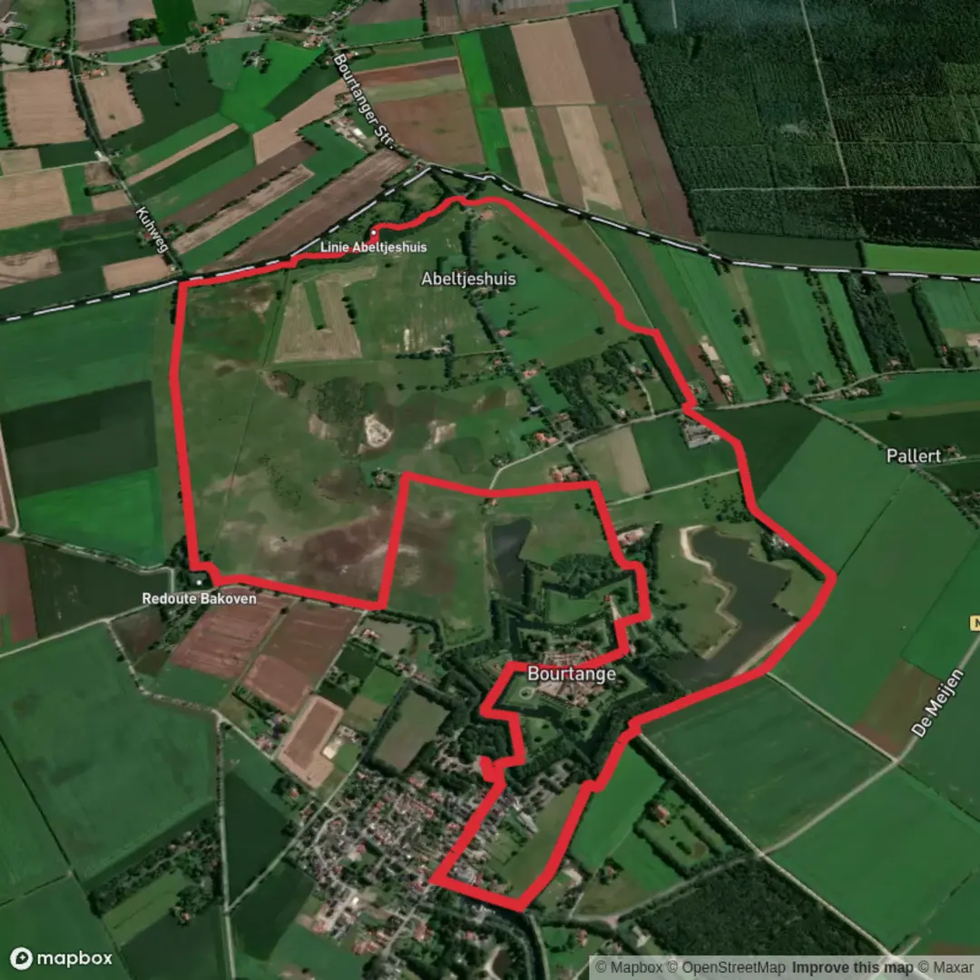
Embarking on the Bourtange hike via Inundatie Weg and Tussen Weg offers a unique journey through the historic and natural landscapes surrounding the star-shaped fortress of Bourtange in the Groningen province of the Netherlands. This approximately 8 km (5 miles) loop trail is predominantly flat, making it accessible for hikers of all levels.
Getting to the Trailhead
To reach the starting point near Fort Bourtange, you have several options:
By Car: From Groningen city, drive southeast for about 60 km (37 miles) to Bourtange. Parking is available near the fortress at Willem Lodewijkstraat 33, 9545 PA Bourtange.
By Public Transport: Take a train from Groningen to Winschoten (approximately 33 minutes), then bus 14 to Vlagtwedde, followed by bus 72 to Bourtange. Note that bus 72 operates primarily before 9 am and after 1 pm, so plan accordingly. (web.mit.edu)
Trail Overview
Starting from the parking area near the fortress, the trail leads you along Inundatie Weg and Tussen Weg, paths historically significant for their roles in the region's defense system. The route encircles the fortress, providing panoramic views of the surrounding moats and earthen ramparts.
Historical Significance
Fort Bourtange, constructed in 1593 under the orders of William the Silent, was strategically positioned to control the only road between Germany and the city of Groningen during the Eighty Years' War. Its unique star-shaped design, complete with moats and bastions, made it a formidable stronghold. The fortress successfully withstood sieges, including one in 1672 by the Prince-Bishop of Münster. After its military significance declined, Bourtange was restored in the 20th century to its 1742 appearance and now serves as a historical museum. (en.wikipedia.org)
Natural Features and Wildlife
As you traverse the trail, you'll pass through diverse landscapes, including open moorlands and grasslands. The area is home to various bird species, making it a delightful spot for birdwatching. Keep an eye out for Konik horses and cattle grazing in the fields, part of the region's ecological management. (groningerlandschap.nl)
Points of Interest Along the Trail
Redoute Bakoven: A small field entrenchment built to secure a strategic sluice, reflecting the area's military history. (visitgroningen.nl)
Soldiers' Dike (Soldatendijk): An earthen dike constructed to manage water levels and enhance the fortress's defenses. (visitgroningen.nl)
Gallows Field (Galgenveld): A historical site on Nieuwerkerksweg, recalling past judicial practices. (visitgroningen.nl)
Trail Conditions and Recommendations
The path consists of both paved and unpaved sections. Some areas may become muddy after rain, so waterproof footwear is advisable. Dogs are welcome but must be kept on a leash due to grazing livestock. (alltrails.com)
Navigation
For detailed maps and navigation assistance, consider using HiiKER, which provides comprehensive trail information and GPS support.
Additional Tips
Facilities: Restrooms and dining options are available within the fortress area.
Seasonal Events: Bourtange hosts various historical reenactments and festivals throughout the year, enhancing the cultural experience of your hike.
This hike offers a blend of history, nature, and culture, providing a comprehensive experience of the Bourtange region.

Surfaces
Unknown
Concrete
Grass
Dirt
Sand
Cobblestone
Asphalt
Wood
Comments and Reviews
User comments, reviews and discussions about the Bourtange via Inundatie Weg and Tussen Weg, Netherlands.
average rating out of 5
0 rating(s)