Download
3D Flyover
Add to list
More
11.5 km
~2 hrs 17 min
0 m
Loop
“Step into a living postcard: fortress walls, wild wetlands, and timeless Dutch countryside unfold on this trail.”
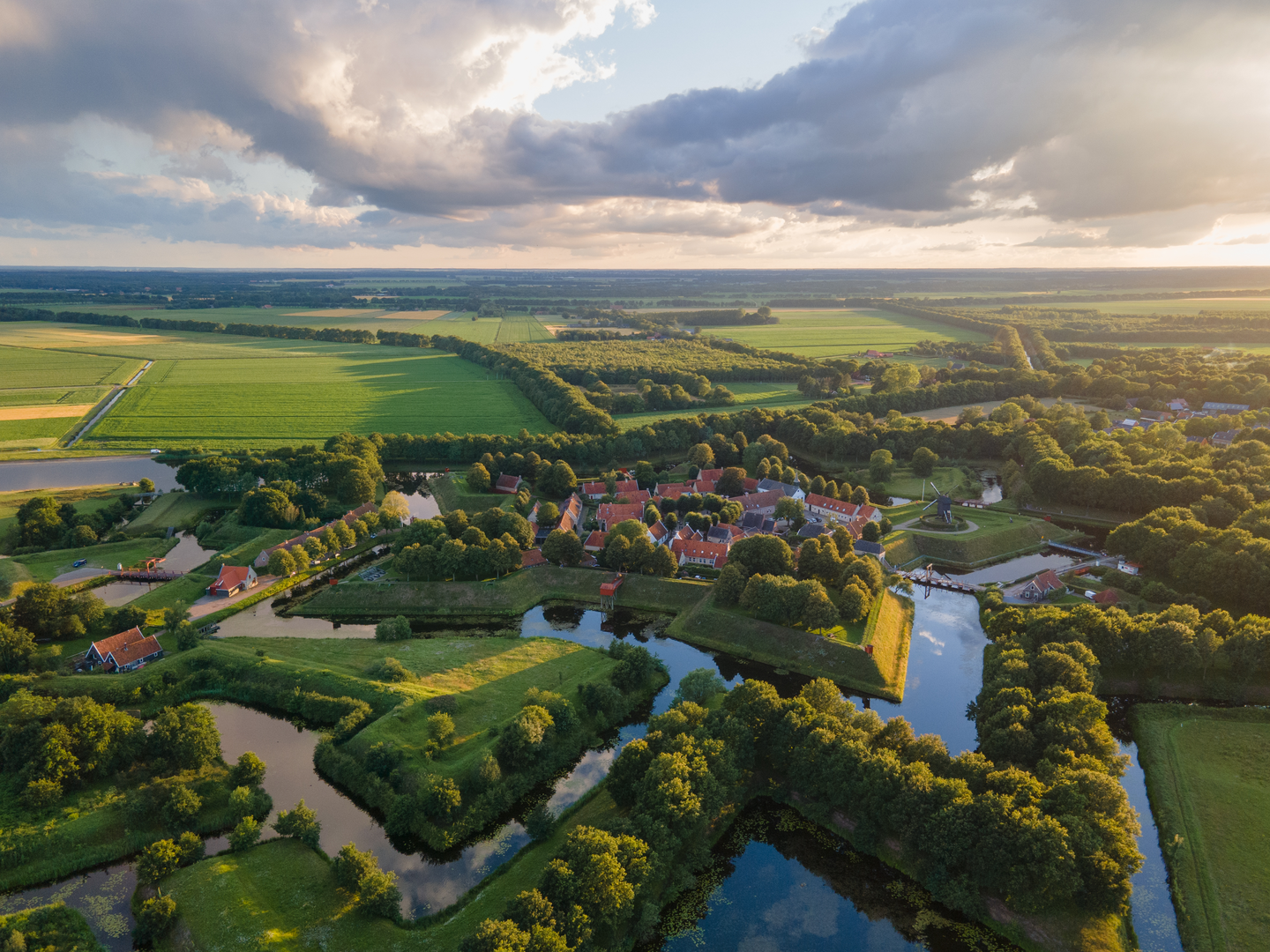
Starting from the historic star-shaped fortress village of Bourtange, this loop hike covers approximately 11 km (about 6.8 miles) with virtually no elevation gain, making it accessible for most walkers and families. The trailhead is easily reached by car, with parking available near the main entrance to Bourtange at Willem Lodewijkstraat, or by public transport via bus connections from Groningen to the Bourtange bus stop, just a short walk from the village center.
Exploring Bourtange’s Fortified Past
The route begins at the heart of Bourtange, a meticulously restored 16th-century fortress that played a crucial role during the Eighty Years’ War. The star-shaped layout, surrounded by moats and earthen ramparts, is a highlight in itself. Before setting off, take time to explore the cobbled streets, wooden drawbridges, and the museum exhibits detailing the area’s military history.
Bourtangerkanaal Noord and Surrounding Wetlands
Heading north from the fortress, the trail follows the Bourtangerkanaal Noord, a historic canal that once served as a defensive barrier and trade route. The path is flat and well-maintained, ideal for a leisurely pace. At around 3 km (1.9 miles), you’ll pass through open meadows and reed beds, where you may spot marsh harriers, herons, and a variety of waterfowl. The canal banks are lined with willows and alder trees, providing shade and shelter for local wildlife.
Landmarks and Points of Interest
At approximately 5 km (3.1 miles), the route skirts the edge of the Westerwolde region’s peat bogs, remnants of the vast Bourtanger Moor that once stretched across the Dutch-German border. Interpretive signs along the way explain the area’s unique ecology and the centuries-old peat-cutting traditions. Keep an eye out for rare plants such as sundew and cotton grass, especially in spring and early summer.
Returning to Bourtange
The loop curves southward, passing through tranquil farmland and small woodland patches. Traditional Dutch farmhouses and grazing sheep dot the landscape, offering a glimpse into rural life in Groningen province. The final stretch brings you back to Bourtange, where you can enjoy local cafes and shops or revisit the fortress walls for panoramic views.
Navigation and Preparation
The entire route is well-marked, but for added confidence, use HiiKER for up-to-date trail maps and navigation. With no significant elevation gain, the hike is suitable for all fitness levels, though waterproof footwear is recommended in wetter months due to occasional muddy sections near the canal and bogs. Bring binoculars for birdwatching and a camera to capture the unique blend of history and nature that defines this region.

Surfaces
Unknown
Asphalt
Gravel
Grass
Concrete
Sand
Cobblestone
Ground
Wood
Comments and Reviews
User comments, reviews and discussions about the Bourtange and Bourtangerkanaal Noord Loop, Netherlands.
average rating out of 5
0 rating(s)