Download
3D Flyover
Add to list
More
54.3 km
~2 days
65 m
Multi-Day
“A long, wind-swept lowland loop of farms, canals, and village edges—rewarding for well-prepared walkers.”
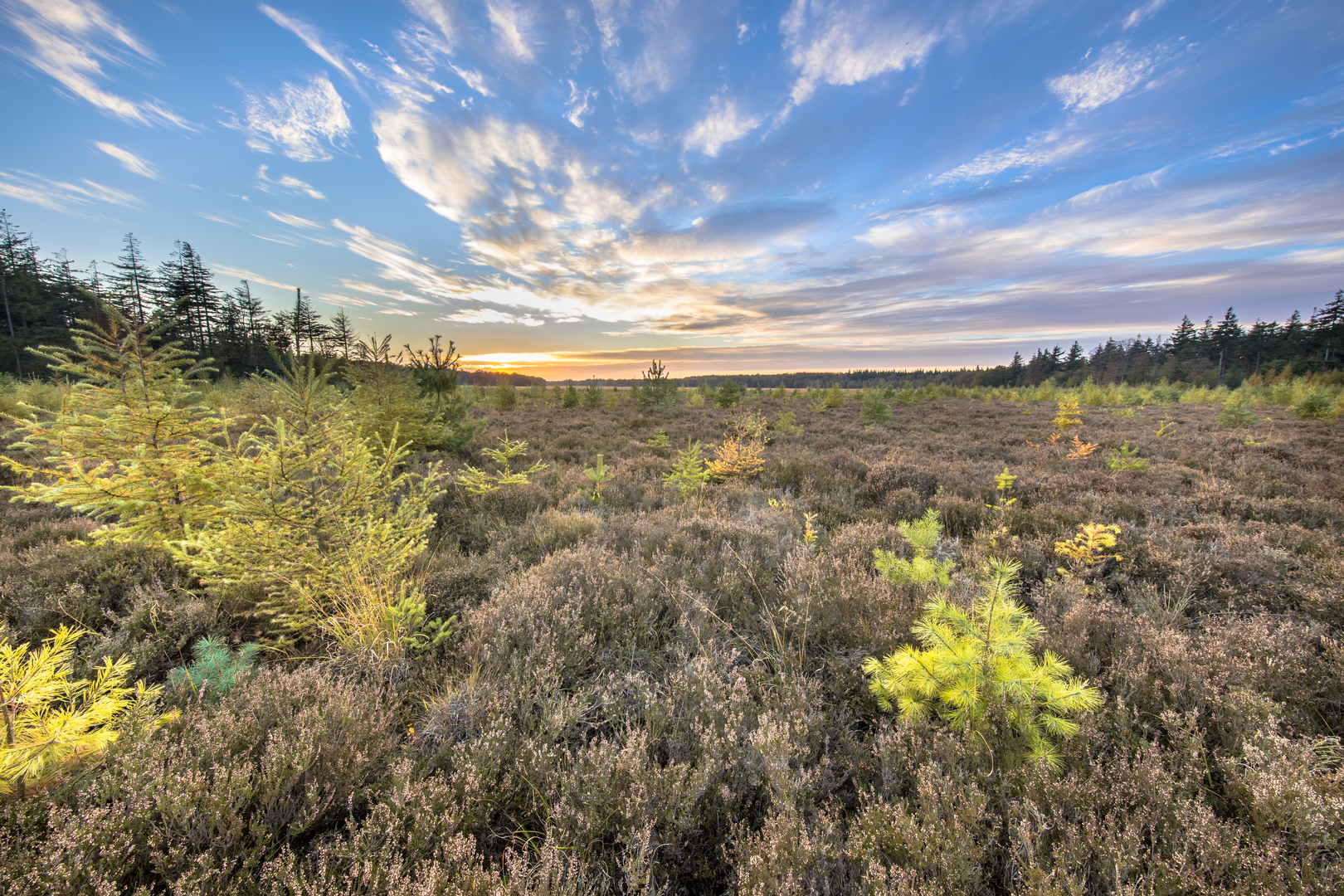
This is a long, low-relief countryside loop of roughly 54 km / 33.6 mi with only about 100 m / 330 ft of total climbing—ideal for strong walkers who want an all-day outing without steep gradients. Expect a mix of farm tracks, quiet lanes, field-edge paths, and short village connectors, with frequent straight sections where distance can feel deceptively “easy” on paper but still demanding on feet and pacing.
Because your start point is listed only as “near” (no coordinates provided), I can’t reliably convert the lon/lat to a nearby address or landmark yet. If you share the start lon/lat (or the nearest village), I’ll pin it to the closest recognizable place (e.g., a church, trailhead parking area, or transit stop) and tailor the access directions precisely.
What the terrain feels like (and why it’s still a big day)
- Underfoot: Mostly firm surfaces—compacted gravel farm roads, paved cycle lanes, and grassy/dirt footpaths along fields. After rain, the field-edge sections can turn slick and the tractor tracks can hold water.
- Gradient: With only ~100 m / 330 ft of gain spread across the whole loop, climbs are more like gentle rises over dikes, bridges, and embankments rather than hills. The effort comes from time-on-feet and wind exposure.
- Exposure: This kind of lowland route is often open and breezy. A headwind can slow your pace dramatically, especially on long straight farm roads.
Navigation and wayfinding
Wayfinding is usually straightforward on Dutch-style rural networks, but long loops can include many similar-looking junctions (parallel farm tracks, repeated canal crossings, and multiple options around field margins). Load the route in HiiKER and: - Keep an eye on junction density near villages and road crossings. - Use HiiKER’s map view to confirm you’re on the correct side of a canal/ditch—being “one track over” can cost time. - Plan bailout points (villages with bus stops) at roughly every 10–15 km / 6–9 mi if possible.
Landmarks, landscape character, and what you’ll see
Even without big elevation, this region tends to be rich in “small-scale” points of interest:
- Agricultural mosaic: Expect alternating blocks of pasture, arable fields, and drainage ditches. You’ll likely pass working farms, barns, and long hedgerows or tree lines used as windbreaks.
- Water management features: Bridges, culverts, canals, and dikes are common. These are part of the broader historical shaping of the Dutch countryside—centuries of drainage, poldering, and controlled waterways that turned wet ground into productive land.
- Village edges and rural lanes: The loop name suggests you’ll link multiple local roads/paths (e.g., “-weg” roads and a named “pad”). These connectors often bring you past church spires, small cemeteries, and traditional farmsteads—good visual checkpoints for confirming position.
If you share the exact area (province/nearest town), I can add the most relevant site-specific history (for example: peat extraction landscapes, former heath commons, WWII-era features, or historic trade routes), because those vary a lot by municipality.
Nature and wildlife to look out for
Lowland farmland and wetland edges can be surprisingly lively:
- Birdlife: Watch for geese, swans, herons, and ducks along canals and flooded fields; lapwings and oystercatchers in open pasture; and raptors (like kestrels) hovering over verges.
- Mammals: You may spot hares, rabbits, and occasionally roe deer near wooded margins or at dawn/dusk.
- Seasonal notes: In spring and early summer, some field-edge paths may pass near ground-nesting birds—stick to the path and keep noise low.
Hazards and practical things to watch for
- Cyclists and farm vehicles: Many “quiet” lanes double as cycle routes and farm access. Stay alert on bends and at farm entrances; tractors can appear quickly and take up the full width.
- Electric fences and livestock: Pasture edges may have temporary fencing. Don’t step over wires—use gates/stiles.
- Dogs: Rural routes often pass homes and farmyards; expect off-lead dogs near properties.
- Road crossings: Even short crossings can be the highest-risk moments of the day. Use reflective elements if visibility is poor.
- Blisters and repetitive strain: The biggest challenge on a flat 54 km is cumulative impact. Foot care matters more than “fitness for hills.”
Pacing, time planning, and food/water
For 54 km / 33.6 mi, most hikers should plan roughly: - 10–13 hours of moving time depending on surface, wind, and breaks (a typical walking pace range is ~4–5.5 km/h / 2.5–3.4 mph on flat ground). - Add 1–2+ hours for stops, photos, navigation checks, and café resupplies.
Carry enough for long gaps between services: - Water: At least 2 L as a baseline; more in warm weather or if you’re unsure about refill points. - Food: Aim for steady intake (snacks every 45–60 minutes). Flat routes can trick you into under-fueling early.
Clothing and gear (flat-country specific)
- Footwear:

Surfaces
Asphalt
Unknown
Concrete
Comments and Reviews
User comments, reviews and discussions about the Borgerveldweg, Berkersweg and Jacob Trippad Loop, Netherlands.
average rating out of 5
0 rating(s)