Download
3D Flyover
Add to list
More
50.6 km
~2 days
0 m
Multi-Day
“Under vast Frisian skies, straight lanes and whispering reedbeds test your patience with wind and time.”
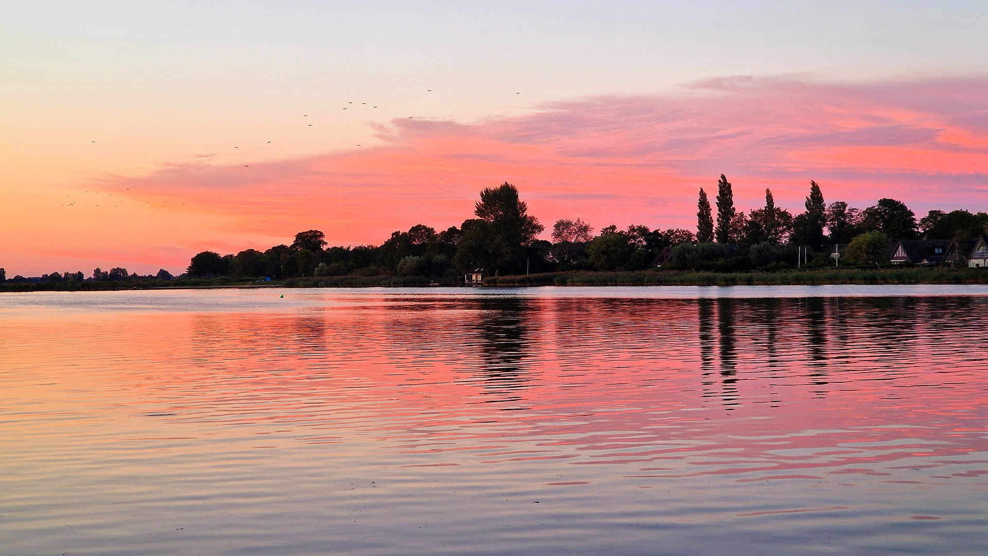
This is a long, very flat day out through classic Dutch lowland scenery: wide skies, ruler-straight lanes, drainage ditches, reedbeds, and open pastureland broken up by small villages and farmsteads. At ~50 km (31 mi) with essentially no climbing (about 0 m / 0 ft of gain), the challenge is less about elevation and more about time-on-feet, wind exposure, and keeping your feet happy on long stretches of hard, level surfaces.
Getting to the start (car + public transport)
Because the start point is listed only as “near” (with no town name or coordinates), the best way to pin down the nearest address/landmark is to share either: - a longitude/latitude pair, or - the nearest village/city name, or - a HiiKER link/GPX.
If you send that, I’ll convert it to the nearest recognizable address or landmark and tailor the directions precisely. Until then, plan like this for a Friesland-style loop: - By car: aim for a village car park (often signed “P” near the church, village hall, or sports fields). In rural areas, parking is usually straightforward, but avoid blocking farm gates and narrow one-lane access roads. - By public transport: the most reliable pattern is train to a larger hub (e.g., Leeuwarden area) and then bus to a smaller village near the loop. Buses can be infrequent on weekends and evenings—check the last return service before committing to a full 50 km (31 mi).
What the route feels like underfoot
Expect a mix of: - Paved farm lanes and village streets (fast, but repetitive and harder on joints over 8–12 hours), - Gravel or compacted paths along ditches and field edges, - Occasional grass verges that can be wet or muddy after rain.
Because the elevation change is negligible, you’ll notice the wind more than anything—headwinds can turn an “easy” flat route into a slow grind. If the loop is truly exposed for long sections, plan your pacing so you’re not fighting wind in the final third when fatigue sets in.
Landmarks and landscape you’ll pass
The names in your loop—Brekkenpad, It Aldsylspaed (Frisian naming), and Remswerderleane (“leane” commonly meaning a lane/road)—strongly suggest a route through Friesland’s rural polder and terp landscape: - Canals, ditches, and pumping infrastructure: you’ll likely cross multiple small bridges and culverts. These are key “handrails” for navigation—confirm each crossing in HiiKER so you don’t drift onto a parallel lane that looks identical. - Farmsteads and pastureland: long views across grazing fields are typical. Cattle and sheep are common; give animals space, especially around gates and narrow bridges. - Village cores: many Frisian villages center on a church and a small cluster of homes. These are your best opportunities for water, snacks, and a restroom—don’t assume services exist in every village.
Nature and wildlife to look out for
Flat wetland-agricultural mosaics can be surprisingly rich: - Birdlife: expect geese, ducks, swans, and waders in wetter sections; raptors (kestrels, buzzards) often hunt over open fields. In spring and early summer, ground-nesting birds may be present—stay on the path edges and keep noise low near reedbeds. - Reed margins and ditch banks: you may see frogs and other amphibians; banks can be undercut and slippery. - Insects: on calm, warm days, midges can be persistent near water. A light head net or repellent can be worth it if you’re sensitive.
Historical context of the region
Friesland’s countryside is shaped by centuries of living with water: - Much of the land is engineered for drainage and flood control, with a dense network of ditches and canals. - Many settlements historically formed on raised ground (terps/wierden) to stay above floodwaters before modern dikes and pumping systems. Even if you don’t explicitly visit a terp, the pattern of slightly “higher” village centers amid flat fields often reflects that history. - Frisian place names (like “It …” and “-leane”) reflect the region’s distinct language and cultural identity, which remains visible in signage and local naming.
Navigation and timing (this is where people get caught out)
A 50 km (31 mi) flat loop is easy to underestimate. - Time estimate: many hikers will take 9–12+ hours depending on breaks, wind, and surface. If you’re not used to ultra-distance walking, build in generous buffer time. - Route-finding: the biggest risk is not “getting lost in wilderness,” but taking the wrong parallel lane—everything can look the same across open fields. Use HiiKER to confirm each junction, bridge crossing, and any point where the route switches from one lane to another. - Bailout options: identify villages along the loop where you can shorten the day or reach a bus stop. Mark these in HiiKER before you start.
Practical prep for a flat 50 km (31 mi)
- Footwear: cushioned shoes or light boots that you already trust for long paved stretches. Consider insoles if you’re prone to foot fatigue on hard surfaces.
- Blister management: tape hot spots early; bring spare socks. Wet grass verges and dew can soak feet even without rain

Surfaces
Unknown
Asphalt
Concrete
Wood
Paved
Comments and Reviews
User comments, reviews and discussions about the Brekkenpad, It Aldsylspaed and Remswerderleane Loop, Netherlands.
average rating out of 5
0 rating(s)