Download
3D Flyover
Add to list
More
22.0 km
~4 hrs 24 min
6 m
Point-to-Point
“Drift from Venlo’s river lowlands through heather-fringed ponds and whispering pines to storybook Arcen—best savoured at an unhurried pace.”
This is a mostly flat, lowland walk through the Maas (Meuse) river landscape and the sandy heath-and-pond nature areas north of Venlo, linking small wetlands and pine–birch woodland before finishing in the historic village of Arcen. At around 22 km (13.7 mi) with roughly 0 m (0 ft) of climbing, it’s well-suited to a steady, relaxed pace—expect 4.5–6 hours depending on stops and how soft the sandy sections feel underfoot.
Getting to the start (Venlo)
Start area (practical landmark): the easiest, most reliable place to begin is Venlo Station (Stationsplein, 5911 AC Venlo, Netherlands)—a major rail/bus hub and a clear navigation anchor.
- By public transport: Venlo is well connected by train and regional buses. From Venlo Station, you can walk a few minutes to pick up paths heading toward the greener northern edge of town.
- By car: Aim for parking near Venlo Station (city garages nearby) or one of the larger public car parks around the center. If you prefer to avoid city driving, consider parking on the north side of Venlo and joining the route from there.
Because this is a point-to-point hike ending in Arcen, it’s simplest to use public transport for the return (bus connections typically link Arcen back toward Venlo) or arrange a two-car shuttle.
What the terrain feels like
You’ll be on a mix of paved cycle paths, compact forest tracks, and sandy nature trails. The “0 m gain” profile is typical for this region, but don’t underestimate how soft sand can slow you down. After rain, some sections near the ven (pond) complexes can be muddy or have standing water.
Footwear: light hiking shoes are fine in dry weather; after wet spells, water-resistant shoes help. Bring a thin layer even in mild seasons—open heath and water edges can feel breezy.
Venlo outskirts to Venkoelen (approx. 0–7 km / 0–4.3 mi)
Leaving the urban edge, the route quickly transitions into the Maas valley lowlands—a landscape shaped by river processes and centuries of land use. You’ll notice the classic Dutch pattern of managed woodland blocks, drainage ditches, and straight path segments that make for easy walking and straightforward pacing.
As you approach Venkoelen, the scenery becomes more “nature-reserve” in character: pine and birch woodland with pockets of wetter ground. The “koelen” name often reflects water features or old peat/wet hollows, and you’ll likely see small water bodies or damp depressions that attract birds.
What to look out for: - Waterfowl and reed-edge birds near any open water (listen for calls from cover). - Frogs and newts in spring around shallow pools. - Ticks in warmer months—especially along grassy edges and heath transitions.
Navigation is generally simple on established tracks, but where multiple narrow paths braid together near wetland edges, check your position with HiiKER to stay on the intended line.
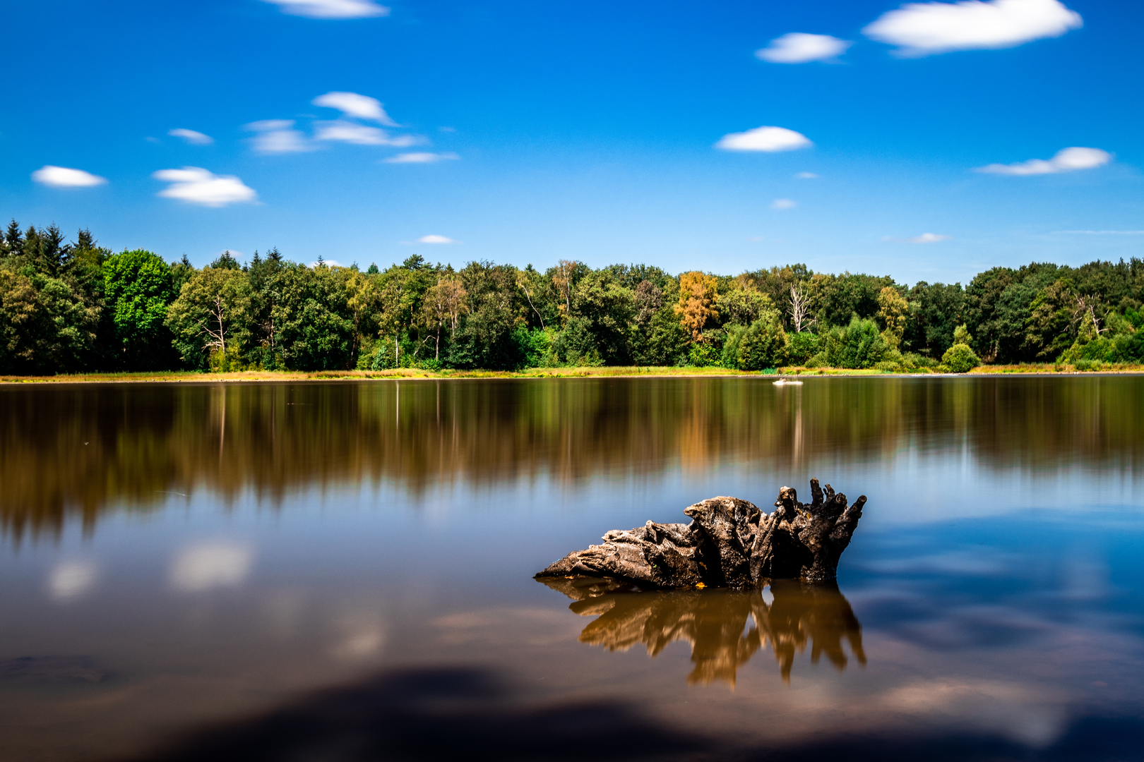
Ravenvennen and Lommerheide (approx. 7–18 km / 4.3–11.2 mi)
This middle portion is the highlight for many hikers: a chain of vennen (heathland ponds) and heath/woodland mosaics. “Ravenvennen” suggests a cluster of ponds; these are typically nutrient-poor, rain-fed waters common on sandy soils, often edged by heather, sedges, and scattered pines.
Expect: - Boardwalk-like firm sections in places, but also soft sand and occasional wet patches where the trail skirts pond margins. - Seasonal color changes: purple heather in late summer, bright greens in spring, and stark, open views in winter.
Wildlife and nature notes: - Dragonflies and damselflies in warmer months around still water. - Deer are possible at dawn/dusk in quieter woodland stretches. - Heathland birds can be present; keep voices low if you’re hoping to spot them.
Lommerheide continues the sandy, open feel—“heide” indicates heathland—often with long, straight forest rides intersecting more natural, winding single-track. This is where it’s easiest to drift onto a parallel path; use HiiKER at junction clusters to confirm you’re taking the correct branch.
Comfort planning: - There may be limited services in the nature sections—carry enough water and snacks for at least 3–4 hours between reliable options. - In hot, sunny weather, heath can feel exposed; in cooler months, damp air near ponds can feel chilly.
Into Arcen (approx. 18–22 km / 11.2–13.7 mi)
The final stretch trends toward the Maas-side settlement pattern again, with more signs of human landscape management—tidier edges, more cycle paths, and a gradual sense of approaching a village destination.
Arcen is known for its long history as a river-area settlement in Limburg, shaped by trade and movement along the Maas corridor. The broader region has seen repeated strategic importance over centuries due to its position near borders and river routes, and many towns here reflect that layered past in their street patterns and older cores.
As you near Arcen, you’ll likely find: - More opportunities to pause for food/drink (depending on opening times and season). - Clearer wayfinding on paved paths, making the

Surfaces
Unknown
Asphalt
Unpaved
Gravel
Grass
Ground
Sand
Dirt
Paved
Comments and Reviews
User comments, reviews and discussions about the Venlo to Arcen via Venkoelen, Ravenvennen and Lommerheide, Netherlands.
average rating out of 5
0 rating(s)