Download
3D Flyover
Add to list
More
24.4 km
~4 hrs 52 min
0 m
Loop
“Wander heath and pine into the “Brabant Sahara,” where wind-sculpted sands turn flat miles into reflection.”
This is a long, low-relief loop of heathland, pine forest, and one of the Netherlands’ most striking inland dune systems. At ~24 km (about 14.9 miles) with roughly 0 m (0 ft) of climbing, the effort comes more from time on feet, sand underfoot, and exposure to wind and sun than from elevation.
Getting to the start (and where “near” usually means for this loop)
This route is typically started from the main access points on the edge of Nationaal Park De Loonse en Drunense Duinen, where parking, trailheads, and clear wayfinding are concentrated. The most common, easy-to-find start landmark is Bosch en Duin / Roestelberg area near Drunen (a well-known gateway to the dunes with large parking areas and signed walking routes). If you share the exact coordinates (lon/lat) or a GPX, I can pin it to the nearest specific address or named trailhead.
By car - Aim for the Roestelberg / Bosch en Duin (Drunen) access area on the south side of the dunes. You’ll find large, established car parks and multiple signed walking routes that make it straightforward to begin a long loop without complicated street navigation.
By public transport - The nearest larger rail hubs are typically ’s‑Hertogenbosch (Den Bosch) and Tilburg. From either, you can usually connect by bus toward Drunen or Udenhout/Biezenmortel (depending on which side you start). From the bus stop, expect a short walk (often 1–3 km / 0.6–1.9 miles) to reach the forest edge and the first dune/heath paths. - Check the last return bus times before you commit to the full loop—24 km (14.9 miles) can easily become a full-day outing if sand slows you down.
What the terrain feels like over 24 km / 14.9 miles
You’ll move through three main “textures,” often repeating in alternating blocks:
- Heath (Kraanvensche Heide): generally firm, springy singletrack or sandy doubletrack with open sightlines. In late summer, heather can color the landscape purple, and the openness makes wind more noticeable.
- Pine and mixed woodland: more sheltered, often on wider forestry tracks. These sections are where you can settle into a steady pace and make up time if the dunes have been slow.
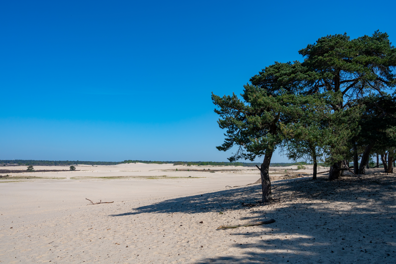
- Inland dunes (De Loonse en Drunense Duinen): the signature feature—broad, pale sand fields with sparse vegetation. Footing ranges from packed sand to deep, energy-sapping drifts. Wind can erase footprints quickly, so don’t rely on “following tracks.”
Even though the elevation gain is near zero, the dunes can feel like “hidden effort.” Plan your pacing as if it were a moderately long hike rather than an easy stroll.
Navigation and wayfinding
This area has many intersecting paths and local route markers, and it’s easy to drift onto a parallel track in the forest or lose a faint line across open sand. Use HiiKER to: - keep an eye on your position when crossing the dune fields, - confirm junction choices in the forest where multiple straight tracks look identical, - identify water/food stops and the nearest exit points if you need to shorten the day.
Landmarks, nature, and what to look out for
The dunes themselves - De Loonse en Drunense Duinen are often called the “Brabant Sahara” because of the scale of the sand. Expect wide horizons, sculpted ripples, and occasional lone trees that look almost stranded. - In bright sun, the sand reflects a lot of light—sunglasses help, and on windy days grit can be irritating.
Heathland character (Kraanvensche Heide) - Heath is a biodiversity hotspot: look for patches of low shrubs, scattered birch and pine, and edges where heath transitions into woodland—these ecotones are often the most wildlife-active. - If you’re hiking in late summer/early autumn, the heather bloom can be the visual highlight of the entire loop.
Wildlife - You’re in classic Dutch sandy-soil habitat: expect plenty of birdlife (songbirds along woodland edges; raptors sometimes overhead in open areas). - Deer are possible, especially at quieter times of day along forest margins. - Ticks can be present in heath and grassy edges—long socks and a quick check after the hike are sensible.
Underfoot conditions, weather exposure, and pacing
- Sand management: Deep sand is the main “difficulty multiplier.” If you hit a long soft stretch, shorten your stride and keep cadence steady rather than pushing hard.
- Wind: Open dunes and heath can be significantly windier than the forest. A light wind layer can make a big comfort difference even on mild days.
- Heat and sun: There’s limited shade on the dunes/heath. Carry more water than you’d normally take for a flat 24 km (14.9 mile) walk, especially in warm months.
Practical planning: time, water, and facilities
- Time estimate: Many hikers will take roughly 5–7 hours moving time for 24 km (14.9 miles), depending on how much deep sand you encounter and how often you stop.
- Water: Don’t assume reliable water sources on the trail. Bring what you need for the full distance.
- Food: Pack enough for a full day; if your loop passes a main access point (like the Roestelberg area), you may have the option of a café stop, but don’t rely on

Surfaces
Unknown
Asphalt
Comments and Reviews
User comments, reviews and discussions about the Kraanvensche Heide and De Loone En Drunense Duinen Loop, Netherlands.
average rating out of 5
0 rating(s)