Download
3D Flyover
Add to list
More
14.7 km
~2 hrs 56 min
0 m
Loop
“Wander sandy forest lanes and whispering reed-fringed vens, ending with breezy tower-wide skies.”
This easy, mostly level loop of about 15 km (9.3 mi) with roughly 0 m (0 ft) of climbing is a classic lowland walk: wide forest tracks, sandy paths, and waterside stretches around a ven (peat lake) system, finishing with a highlight viewpoint from an uitzichttoren (viewing tower). Expect a relaxed pace, minimal elevation change, and a route that’s more about quiet nature, birdlife, and big-sky views than physical challenge.
Getting to the start (car + public transport)
You didn’t include the exact “Hike head” location (it shows as “near …”), so I can’t reliably convert coordinates to the nearest address/landmark yet. If you share a lon/lat pair or the nearest town/parking name, I’ll pin it to the closest recognizable trailhead (e.g., a marked car park, visitor center, or well-known access point) and tailor the directions precisely.
In the meantime, here’s how these Brabant-style ven/forest loops are typically accessed:
- By car: Most starts are from a signed bosparking (forest car park) near the edge of the woodland. Arrive early on weekends—popular tower viewpoints can fill parking quickly. Bring coins/contactless just in case the car park is paid.
- By public transport: The usual pattern is train to the nearest larger town, then a regional bus to a village stop near the forest edge, followed by a 1–3 km (0.6–1.9 mi) walk-in on paved lanes or cycle paths to the trailhead. If you tell me your nearest station or the town you’re coming from, I can outline the most sensible approach.
For navigation, load the loop on HiiKER and download it for offline use—flat, wooded terrain can feel repetitive, and it’s easy to stay on the “wrong but reasonable” forestry track without noticing.
What the route feels like underfoot
Because the elevation gain is essentially negligible, the main “difficulty” factors are surface conditions and exposure to weather:
- Forest tracks & sandy paths: Expect firm, wide tracks mixed with softer sandy stretches. After dry spells, sand can be loose; after rain, some sections can be puddled.
- Boardwalks/edges near water: Around the ven margins, you may encounter narrow paths, short boardwalk-like sections, or damp ground. Waterproof shoes aren’t mandatory in summer, but they’re helpful in wetter months.
- Wind at open water & tower: Even on mild days, the tower and open ven edges can be breezy and feel cooler than the forest interior.
A comfortable planning pace for an easy 15 km (9.3 mi) loop is 3–4 hours of walking time, plus stops for the tower and wildlife watching.
Landmarks and scenery you’ll notice
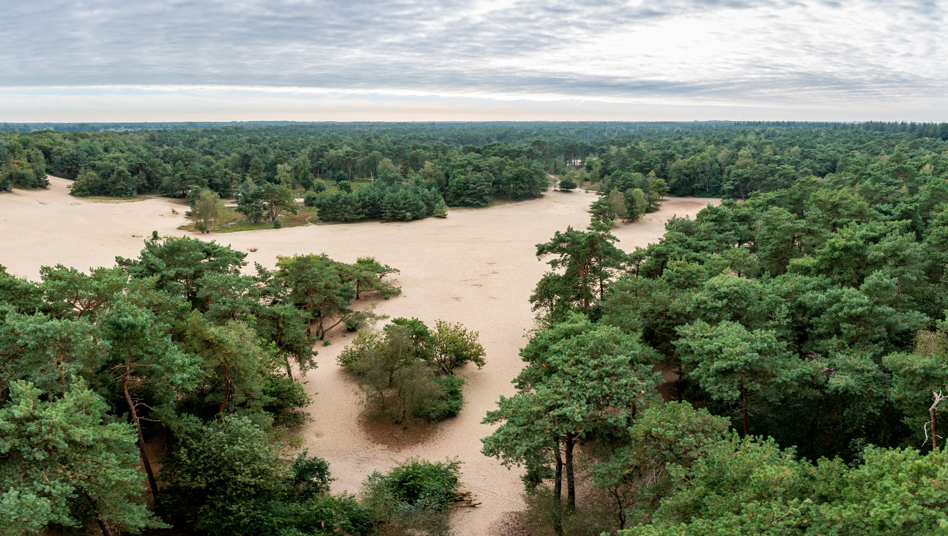
Klompven is the centerpiece: a still, dark-water ven typical of Dutch sandy soils where groundwater and historical peat formation created shallow lakes and wet hollows. The shoreline often alternates between reedy fringes, wet heath, and pine/birch woodland. These transitions are where the wildlife is best.
The uitzichttoren (viewing tower) is the big “moment” of the loop. From the top you’ll usually get: - A clear read of the landscape mosaic—forest blocks, open heath patches, and water bodies - Long views that make the area feel bigger than it does at ground level - Excellent vantage for spotting birds over the ven and heath
If the loop is laid out in the common local style, you’ll likely do something like: - 0–4 km (0–2.5 mi): Settling in on broad forest track, gradually transitioning toward wetter ground - 4–9 km (2.5–5.6 mi): The most scenic section—ven edges, reedbeds, and open views - 9–12 km (5.6–7.5 mi): A return through quieter woodland corridors - 12–15 km (7.5–9.3 mi): The tower approach and final easy run back to the start
(Once you provide the exact start point, I can tighten these segments to match the real junctions and features.)
Nature and wildlife (what to look and listen for)
This kind of ven-and-forest landscape is especially good for birds and wetland-edge species:
- Water and reedbed birds: Look for ducks, coots, grebes, and reedbed songbirds. Early morning is best when the water is calm.
- Heath/edge species: Where heath or open sandy clearings appear, you may see lizards basking in warm months and hear distinctive bird calls from scrubby edges.
- Forest wildlife: Roe deer are possible at dawn/dusk; squirrels and woodland birds are common.
Seasonal notes: - Spring: Bird activity peaks; paths can be wetter. - Summer: Drier underfoot; insects increase near water—bring repellent. - Autumn: Beautiful color in birch and undergrowth; more slippery leaf litter on roots/boardwalks. - Winter: Quiet and stark; watch for icy patches on shaded tracks and tower steps.
Practical planning: what to bring and what to watch out for
- Footwear: Light hiking shoes are fine in dry conditions; choose waterproof footwear if rain is likely or if you prefer not to gamble with muddy ven-edge sections.
- Layers: Even with no climbing, wind at open water and the tower can chill you.
- Food/water: For 15 km (

Surfaces
Unknown
Unpaved
Sand
Paved
Comments and Reviews
User comments, reviews and discussions about the Klompven and Uitzichttoren Loop, Netherlands.
average rating out of 5
0 rating(s)