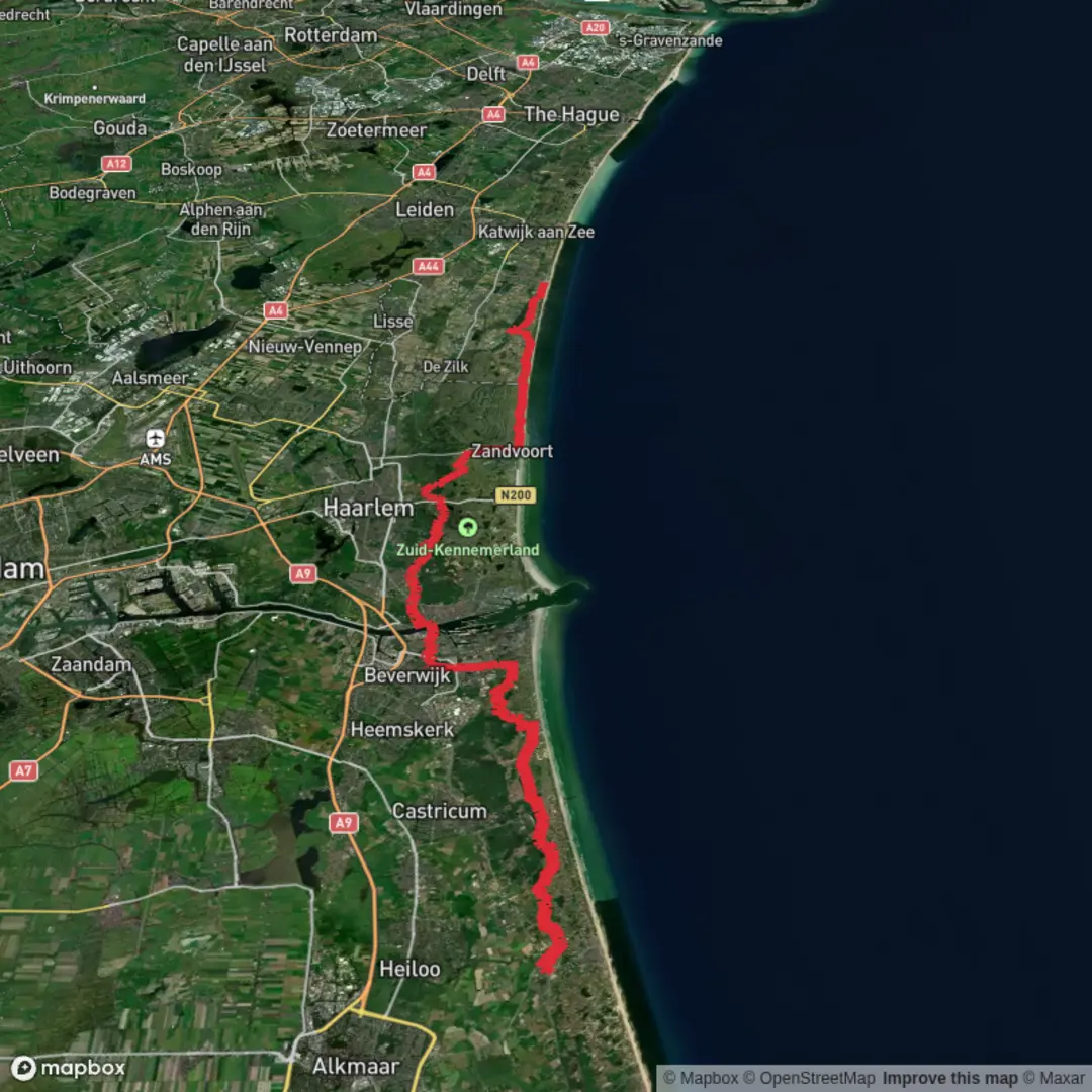
Herenweg to Noordwijk aan zee via Van Oldenborghweg and Rijwielpad Boswachterij Noordwijk
Download
3D Flyover
Add to list
More
61.8 km
~2 days
27 m
Multi-Day
“A wind-shaped, flat ramble from Noordwijk’s old lanes to wild dunes and sea—best savoured steadily.”
This is a long, flat, point-to-point walk of roughly 62 km / 38.5 mi with essentially 0 m / 0 ft of climbing, linking Noordwijk’s inland lanes and older settlement edges to the coastal dunes and beach at Noordwijk aan Zee. Underfoot you’ll get a steady mix of village pavements, quiet roads/paths, and long stretches of sandy or compacted dune tracks—easy on the lungs, but the distance makes it an all-day (or multi-day) undertaking.
Because your start is listed only as “near”, the most practical “anchor” along Herenweg in Noordwijk (Noordwijk Binnen) is around Herenweg, 2201 Noordwijk, Zuid-Holland (central Herenweg corridor). A well-known public landmark on that street is Streekmuseum Veldzicht (Herenweg 114, Noordwijk), which is commonly used as a start/finish for local walking routes and is a useful navigation target in HiiKER. (visitduinenbollenstreek.nl)
Getting to the start (Herenweg, Noordwijk Binnen area)
- By public transport: Aim for Noordwijk Binnen bus stops (the inland “old town” side of Noordwijk). From major rail hubs like Leiden Centraal, frequent regional buses typically connect toward Noordwijk; from there it’s a short walk to the Herenweg corridor. (Check same-day routing/times in your preferred transit app; schedules can change seasonally.)
- By car: Set navigation to Herenweg (2201), Noordwijk or Streekmuseum Veldzicht, Herenweg 114. Street parking rules vary by zone; in Noordwijk, paid parking is common closer to the coast, usually easier inland.
What the route feels like (surface, pacing, and wind)
Expect a very “Dutch” profile: flat, exposed in places, and wind-shaped. Even with negligible elevation gain, the day can feel harder than the rating suggests because: - Headwinds along open lanes and especially near the coast can slow you down dramatically. - Sandy dune paths (common once you’re on/near Boswachterij Noordwijk) can be energy-sapping compared with pavement. - Distance management matters: at a typical walking pace, 62 km is often 12–15+ hours moving time depending on surface and breaks.
Plan water and food as if you’re doing an ultra-distance walk: reliable resupply is easiest in built-up areas; once you’re in the dune forest and dune valleys, services thin out.
Key sections and landmarks you’ll notice
0–15 km / 0–9 mi: Noordwijk Binnen and the Herenweg corridor
The opening portion is about settling into rhythm on quiet residential streets and local lanes. Noordwijk Binnen is the older, inland part of Noordwijk, and the Herenweg area is where you’ll feel the transition from town edges into greener corridors. If you start near Streekmuseum Veldzicht, it’s a worthwhile quick stop for local landscape context—this region sits in the Duin- en Bollenstreek (dune-and-bulb area), where centuries of dune dynamics, drainage, and cultivation shaped today’s patchwork of settlement, fields, and managed nature. (visitduinenbollenstreek.nl)
Navigation is generally straightforward here; use HiiKER to keep you on the intended connectors as you angle toward Van Oldenborghweg.
15–35 km / 9–22 mi: Van Oldenborghweg and the inland-to-dunes transition
This middle stretch tends to be fast underfoot if you’re on firmer paths/roads, and it’s where you’ll want to bank efficient kilometers before the sandier dune sections. You’ll pass through a landscape that’s strongly influenced by the Netherlands’ long history of coastal defense and land management—straightened routes, drainage lines, and carefully managed green buffers are common features even when you’re not consciously looking for them.
Keep an eye out for: - Cycling infrastructure crossings (the Netherlands’ cycle network is dense; some paths are shared-use, others are bike-priority). - Farm access traffic and faster cyclists on straighter connectors.
35–55 km / 22–34 mi: Rijwielpad Boswachterij Noordwijk (dune forest, dune valleys, and open sand)
This is the signature nature section: Boswachterij Noordwijk, part of the broader Hollands Duin / Hollandse Duinen dune system. The area is known for a striking mosaic—open, shifting dunes, wetter dune slacks/valleys, and dune woodland—all in a relatively compact zone. (noordwijk.org)
What to expect on the ground: - Surface: alternating firm cycle-path-style segments and looser sandy tracks.

Surfaces
Unknown
Asphalt
Paved
Sand
Unpaved
Gravel
Comments and Reviews
User comments, reviews and discussions about the Herenweg to Noordwijk aan zee via Van Oldenborghweg and Rijwielpad Boswachterij Noordwijk, Netherlands.
average rating out of 5
0 rating(s)