Download
3D Flyover
Add to list
More
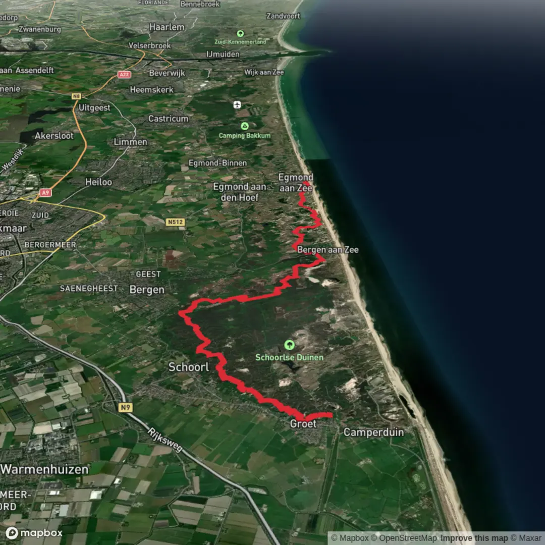
20.1 km
~4 hrs 6 min
57 m
Point-to-Point
“From Hargen’s surf to Russengat’s hush and wide achterveld skies, a wind-kissed, mostly-flat dune ramble.”
This is a low-stress, mostly flat coastal-and-dune walk in the Schoorlse Duinen area, linking the beach access at Hargen aan Zee with quieter dune corridors around Russengat and the open, low-lying “achterveld” landscape before finishing near the seafront (Boulevard Zuid). At roughly 20 km / 12.4 mi with about 100 m / 330 ft of total ascent, it’s an Easy day for most hikers—more about steady time on your feet and wind exposure than steep climbing.
Getting to the start (Hargen aan Zee)
Nearest clear start landmark/address: the most practical trailhead is the main beach access at Strandpaviljoen Hargen, Strand Hargen aan Zee 2, 1871 GX (often listed as 1871 GZ) Schoorl/Hargen aan Zee, Netherlands. (strandpaviljoenhargen.nl)
This sits at Strandslag 20 (Hargen aan Zee), the primary beach entrance for this section of coast. (ontdek-schoorl.nl)
By car
- Navigate to Hargen aan Zee parking via Hargerstrandweg 1 (parking area in the dunes), then walk a few hundred meters to the beach access and pavilion area. The lot is large (about 1,600 spaces) and is the standard staging point for hikes here. (ontdek-schoorl.nl)
- Expect paid parking much of the year; some sources note free parking Nov–Mar and a day rate outside that period (figures can change). (ontdek-schoorl.nl)
By public transport
- The most reliable approach is: train to Alkmaar, then a regional bus toward Schoorl/Camperduin, and from there onward to the Hargen beach area (final leg can be a walk depending on the exact bus stop and season). For exact connections and walking links on the day, plan the door-to-door route in HiiKER (and cross-check with local transit planners if you like).
(Seasonal coastal services can vary year to year, so treat timetables as changeable.)
What the route feels like underfoot
You’ll be moving through three distinct surfaces: 1. Beach access and coastal paths: firm sand near the waterline can be fast; dry upper beach is slower and more tiring. 2. Dune tracks and sandy forest paths: typically the “crux” for effort—soft sand can add fatigue even when elevation is minimal. 3. Polder-edge/achterveld paths: flatter, often firmer, with long sightlines and more shelter if you’re behind the dunes.
Because the dunes here are among the widest and highest in the Netherlands (the broader Schoorl area is known for dunes reaching roughly 54 m / 177 ft above sea level), the landscape can feel surprisingly “big” for such a low-elevation hike. (en.wikipedia.org)
Route breakdown with approximate distances
Distances are approximate and will vary slightly depending on the exact line your GPX takes through Russengat/Zuiderachterveld and where “Boulevard Zuid” is defined as the finish.
0.0–2.0 km (0.0–1.2 mi): Hargen aan Zee beach access → into the dunes
Start near the pavilion and beach entrance at Strandslag 20. The first stretch is ideal for a quick systems check: adjust layers for wind, confirm water, and open your route in HiiKER before you disappear into the dune corridors. Coastal wind can be strong even on mild days, and it’s common to feel cooler here than inland.
2.0–8.0 km (1.2–5.0 mi): Dune corridors toward Russengat (gentle rollers, sandy footing)
This is where most of your ~100 m / 330 ft of ascent accumulates in small increments—short rises over dune shoulders rather than any sustained climb. Expect:
- Soft sand patches that slow pace
- Wind-pruned vegetation and alternating open dune bowls and more sheltered pine/birch pockets
- Occasional junction density: multiple parallel tracks can look similar, so keep an eye on HiiKER at intersections rather than assuming the “main” path is always correct.
8.0–13.5 km (5.0–8.4 mi): Russengat area → transition toward Zuiderachterveld (quieter, more open)
Around Russengat you’ll notice a shift: less

Surfaces
Unknown
Sand
Unpaved
Concrete
Ground
Paved
Asphalt
Comments and Reviews
User comments, reviews and discussions about the Hargen to Boulevard Zuid via Russengat and Zuiderachterveld, Netherlands.
average rating out of 5
0 rating(s)