
Download
3D Flyover
Add to list
More
413.7 km
22 days
5476 m
Multi Day
“From North Sea canals to Ardennes woodlands, this varied crossing rewards steady walkers with shifting moods.”
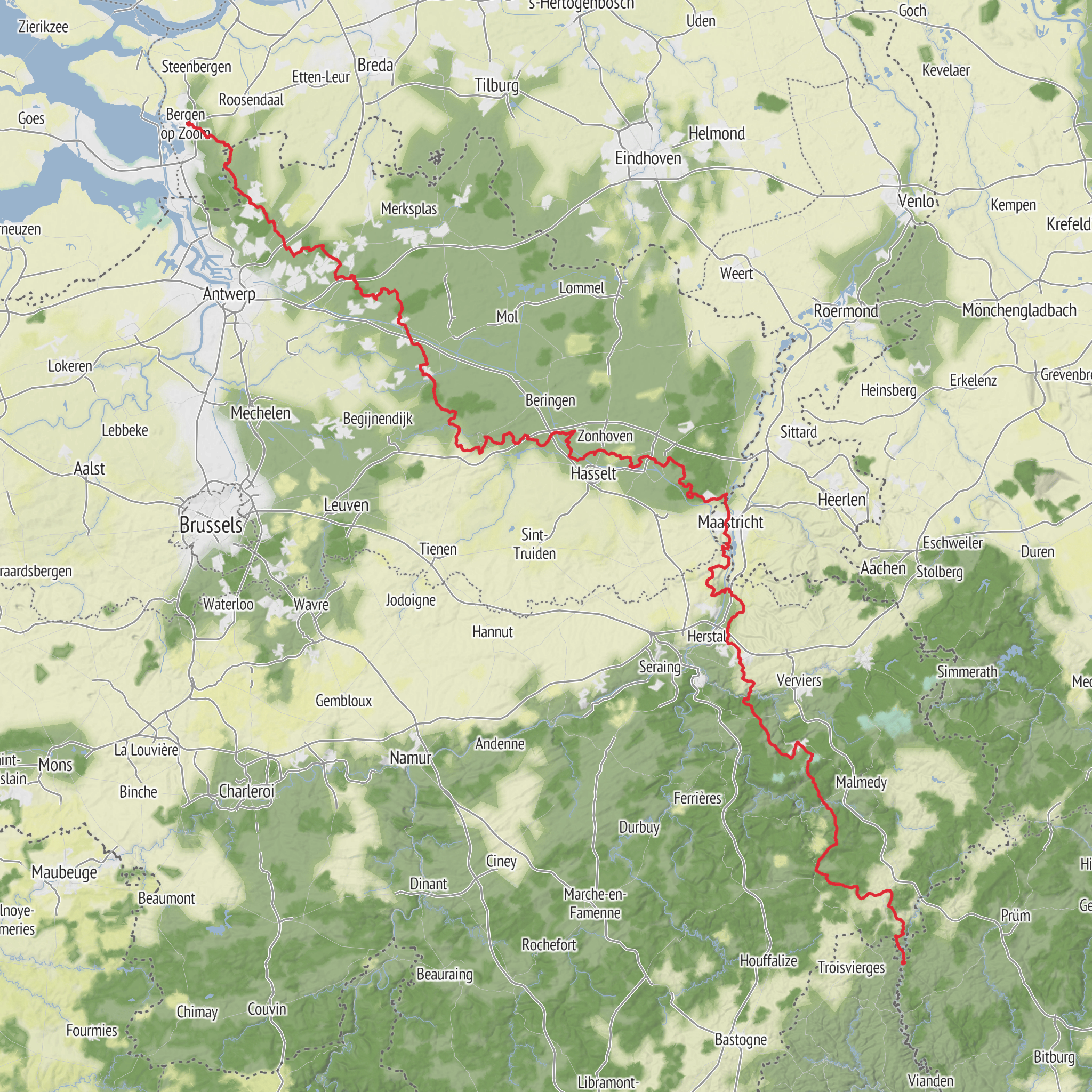
This Belgian section of the E2 follows the GR 5 corridor for roughly 413 km / 257 miles with about 5,500 m / 18,045 ft of total ascent, linking the low, canal-laced landscapes of northern Belgium with the more wooded, hillier country toward the Ardennes and the Luxembourg border. Although the overall rating is on the easier side by long-distance standards, that mostly reflects the absence of sustained mountain terrain rather than a lack of challenge: the route is long, often exposed to wind and rain, and asks for steady day-after-day endurance rather than technical skill. The walking is typically on a mix of towpaths, farm tracks, forest roads, village lanes, and signed footpaths, with gradients that are usually gentle until the southern half. The E2 in Belgium is part of the wider European long-distance path network, and in Belgium and France it uses the GR 5 alignment. (grsentiers.be)
The northern end is generally associated with Ostend / Oostende, the North Sea port city, and the Belgian route then heads inland via Bruges, Antwerp, and onward through Limburg and Wallonia before continuing toward Luxembourg on the GR 5 line. If you need a practical landmark for the start, Oostende railway station and the seafront near the port are the most useful planning reference points. That makes the route straightforward to access without a car, since Ostend is a major rail destination with direct Belgian train connections and onward local transit. By car, Ostend is reached via the coastal motorway network, with city parking better used for a short drop-off than for long-term storage. (kaweah.freedombox.rocks)
What the walk feels like
Expect a route of changing character rather than one single wilderness experience. In the north and northwest, the trail moves through lowland Flanders where canals, polders, dikes, and agricultural country shape the walking. Distances can feel deceptively easy here because the terrain is flatter, but long exposed stretches can become tiring in wet or windy weather. Around Bruges and Antwerp, the route becomes more urban-fringe and cultural, with green corridors, river landscapes, and parkland helping stitch together the long-distance line. South and east of Antwerp, the trail gradually becomes quieter and more natural, especially through the Campine/Kempen and Limburg areas, where heath, pine woodland, ponds, and sandy tracks become more common. (kaweah.freedombox.rocks)
Farther on, the route gains a more undulating profile as it approaches the higher ground of eastern and southern Belgium. The climbs are rarely alpine in scale, but they come more frequently, and the cumulative ascent begins to matter. A day that looks modest on paper can feel longer when it includes repeated wooded rises, muddy descents, and rougher underfoot conditions. Hikers planning 20 to 30 km / 12 to 19 miles per day in the north may want to scale back slightly in the more rolling southern sections.
Landmarks, landscapes, and historical setting
One of the strengths of this route is the way it crosses several of Belgium’s defining landscapes and cultural regions. Bruges is one of the standout historic cities on or near the line, known for its medieval core, canals, and mercantile history. Antwerp adds a very different atmosphere: a major Scheldt city shaped by trade, port activity, and centuries of urban growth. These are not remote-trail landmarks but major cultural anchors that can be used for resupply, rest days, or transport breaks. (kaweah.freedombox.rocks)
In Limburg, the route is closely associated with greener, more open natural terrain. The GR 5 passes through areas such as Bokrijk, Genk, Zutendaal, and the wider landscape connected with De Maten and the Hoge Kempen region, where ponds, heathland, conifer stands, and sandy soils create a very different feel from the canal country farther north. This is often some of the most pleasant sustained nature walking on the Belgian section. (groteroutepaden.be)
Historically, the route also crosses regions deeply marked by medieval trade, early modern state formation, industrialization, and the wars that shaped modern Belgium. Flanders’ towns grew rich through cloth trade and maritime links; Antwerp became one of Europe’s great commercial cities; and farther east and south, the landscape reflects old frontier zones and forested uplands that long formed cultural and political boundaries. Even where the trail itself is quiet, many villages, churches, chapels, old farmsteads, and war memorials sit within that larger historical fabric. The GR network in Belgium is also part of a long-established walking culture, with extensive waymarking and thousands of kilometers of long-distance paths across the country. (european-mountaineers.eu)
Nature and wildlife
Wild
AI Planner
Days planned around your pace, with somewhere to stay each night.
Comments and Reviews
User comments, reviews and discussions about the E2 - Belgium, Netherlands.
average rating out of 5
0 rating(s)



_Vielsalm,_BE.jpg)