Download
3D Flyover
Add to list
More
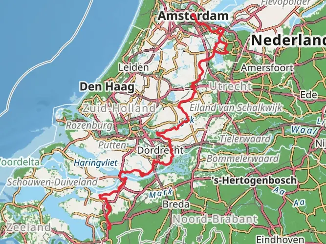
113.1 km
~4 days
352 m
Multi-Day
“Embark on the serene Brabantse Walpad, a scenic hike through Dutch history, nature, and diverse landscapes.”
Spanning approximately 113 kilometers (70 miles) with a modest elevation gain of around 300 meters (984 feet), the Brabantse Walpad offers hikers an easy yet rewarding trek through the southwestern part of the Netherlands. The trail begins near the historic city of Bergen op Zoom, which is easily accessible by public transport or car. For those arriving by train, the Bergen op Zoom station is the closest stop, from which the trailhead is just a short walk or taxi ride away. If driving, there are parking facilities in the vicinity of the starting point.
Navigating the Trail
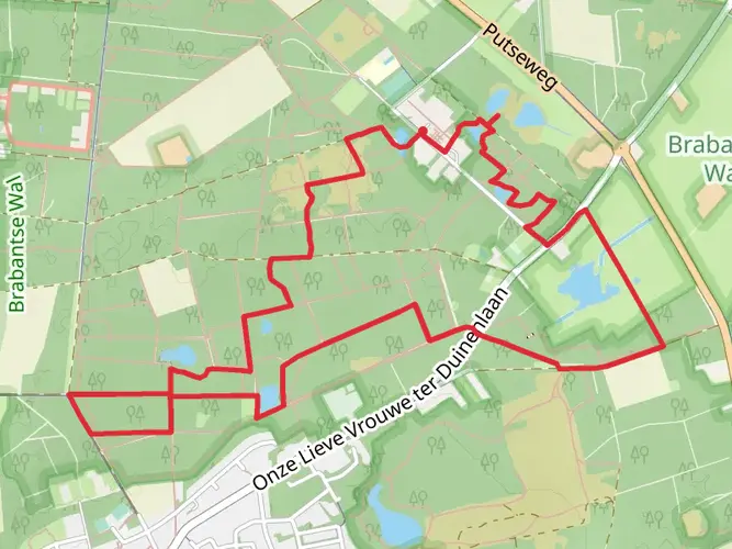
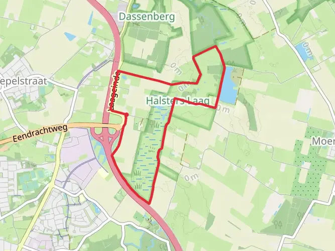
The Brabantse Walpad is a point-to-point trail, meaning it starts and ends at different locations. Hikers can rely on the HiiKER app for detailed maps and navigation assistance throughout their journey. The trail is well-marked, guiding adventurers through a variety of landscapes including forests, heathlands, and picturesque countryside.
Landmarks and Scenery
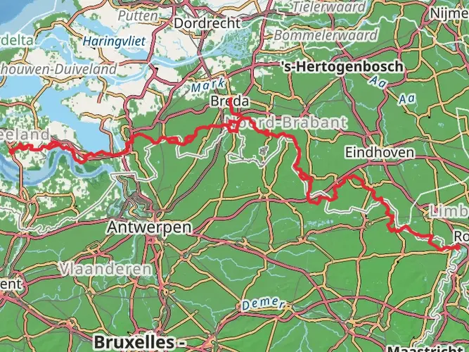
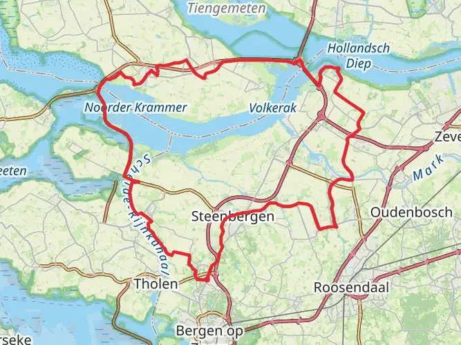
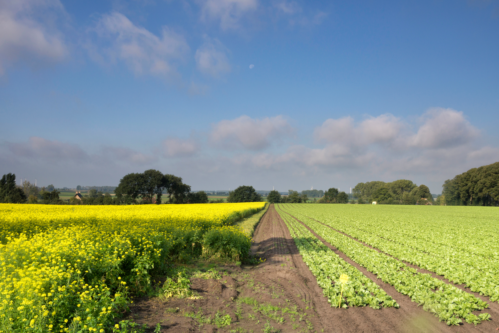
As you set out from the trailhead near Bergen op Zoom, you'll soon find yourself immersed in the natural beauty of the Brabantse Wal, an area where sandy soils transition into peat and clay, creating a unique ecological gradient. The trail meanders through the Zoomland, a forested area with a mix of coniferous and deciduous trees, before leading to the expansive heathlands of Kalmthoutse Heide, shared with neighboring Belgium.
Wildlife and Nature
The diverse habitats along the Brabantse Walpad support a rich array of wildlife. Birdwatchers may spot species such as the European green woodpecker and the nightjar. The heathlands are home to various reptiles and insects, including the rare heathland blue butterfly.
Historical Significance
The region is steeped in history, with the trail passing close to several sites of interest. Fortifications and remnants from the Eighty Years' War can be found near the town of Steenbergen, roughly 20 kilometers (12 miles) from the start. Further along, the trail skirts the impressive estate of Mattemburgh, showcasing a well-preserved 19th-century manor house and landscaped gardens.
Practical Information
The trail's gentle elevation gain and well-maintained paths make it suitable for hikers of all skill levels. It's advisable to carry sufficient water and snacks, as there are stretches without amenities. For overnight stays, there are various accommodations along the route, including bed and breakfasts, campsites, and hotels.
Seasonal Considerations
The Brabantse Walpad can be hiked year-round, but each season offers a different experience. Spring brings blossoming flora and active wildlife, summer provides long, warm days perfect for leisurely walks, autumn features a stunning display of fall colors, and winter presents a quiet, stark landscape often dusted with snow.
Access and Departure
Upon completing the trail, hikers can find public transport options in the town at the end of the route to return to Bergen op Zoom or continue to other destinations. It's recommended to check local transport schedules in advance to ensure a smooth departure.

Frequently asked questions
What is the Brabantse Walpad Loop near Bergen op Zoom?
The Brabantse Walpad Loop is a multi-day hiking route of 113.07 km based around Bergen op Zoom in the southwest Netherlands. It is rated easy, with 352 m of total elevation gain, and follows the Brabantse Wal landscape where higher sandy ground drops toward the surrounding polders.
How long does it take to hike the Brabantse Walpad Loop?
Most hikers split the Brabantse Walpad Loop into several days rather than walking all 113.07 km at once. With easy overall difficulty and 352 m of climbing spread across the route, a practical pace is usually around 20 to 30 km per day, which puts the full loop at roughly 4 to 6 days.
Where does the Brabantse Walpad Loop start, and can it be reached by train?
The Brabantse Walpad Loop is based in Bergen op Zoom, making the city the logical access point for the route. Bergen op Zoom has an NS railway station, and the station sits within walking distance of the city center, so the hike can be reached by public transport without needing a car.
Where can you park for the Brabantse Walpad Loop in Bergen op Zoom?
Parking for the Brabantse Walpad Loop is available in Bergen op Zoom, where the municipality manages more than 1,700 parking spaces across the city. For hikers starting near the center or station, Bergen op Zoom also has official parking areas and garages, making it straightforward to leave a car before setting out on the loop.
What kind of scenery does the Brabantse Walpad Loop pass through?
The Brabantse Walpad Loop covers the distinctive Brabantse Wal ridge landscape near Bergen op Zoom, where sandy higher ground meets lower clay and polder country. Along the way, the route is associated with wooded sections around the Bergen op Zoom area and the wider Brabantse Wal region, which is known for its noticeable natural height difference by Dutch standards.
Is the Brabantse Walpad Loop difficult?
The Brabantse Walpad Loop is classed as easy. That rating fits the numbers: 113.07 km is a substantial distance for a multi-day walk, but the total ascent is only 352 m, so the challenge comes more from time on foot than from steep climbing.
Comments and Reviews
User comments, reviews and discussions about the Brabantse Walpad Loop, Netherlands.
4.43
average rating out of 5
7 rating(s)