Download
3D Flyover
Add to list
More
24.5 km
~4 hrs 55 min
7 m
Point-to-Point
“A flat Kempen wander from whispering pines to peat-dark moorland—windy, wild, and sometimes soggy.”
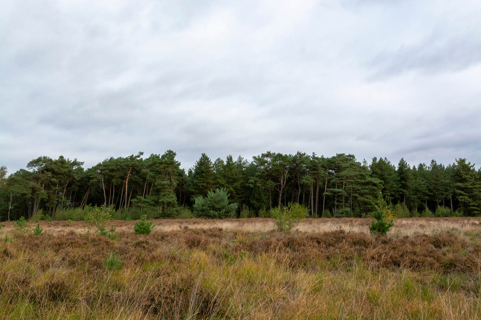
You’ll be walking a very flat slice of the Brabantse Kempen: sandy tracks through pine and birch woodland, long straight farm lanes, and then the big change of character—wet heath, peat remnants, and open moorland at the Reuselse Moeren—before finishing near the village of Reusel. At ~25 km (15.5 mi) with roughly ~0 m / ~0 ft of climbing, the effort is mostly about time on feet, wind exposure in open sections, and keeping your feet dry where the ground turns boggy.
Getting to the start (Witrijt area)
Nearest known place to aim for: the hamlet of Witrijt (near Bergeijk, North Brabant), around 51.314°N, 5.265°E, ~36 m above sea level. (portal2europe.com)
- By car: Use Witrijt, 5571 XH Bergeijk as a reliable navigation target; a commonly referenced address point is Witrijt 10, 5571 XH Bergeijk. Park considerately on the verge or in any obvious pull-ins without blocking farm access. (waze.com)
- By public transport: This is rural—expect a bus + walk/taxi combination from larger hubs (Eindhoven/Tilburg area). If you’re coming by train, you’ll typically connect onward by regional bus toward Bergeijk/Eersel and then finish with a longer walk to Witrijt. (Check current timetables close to your date.)
What the trail feels like underfoot
For most of the day you’ll be on hard-packed sand, forest tracks, and quiet paved farm lanes—easy walking, but repetitive. After rain, the sandy sections can turn soft and energy-sapping, while the moorland edges can become waterlogged. Even with “no elevation,” you’ll notice subtle rises and dips in the sandy soils, but nothing that registers as real climbing.
Plan on 5.5–7 hours of moving time for 25 km (15.5 mi), depending on pace and how much time you spend watching wildlife in the Moeren.
Early kilometres: Witrijt’s quiet lanes and Kempen woodland
Leaving the Witrijt area, you’re in a landscape shaped by heathland reclamation and forestry—straight lines, planted conifers, and sandy soils typical of the Kempen. Expect: - Pine forest blocks with occasional birch and scrubby edges - Long, ruler-straight tracks where wind can be more noticeable than you’d expect in “flat” country - Drainage ditches and small crossings that hint at how close the water table can be here
Because the terrain is uniform, it’s easy to drift off-route at junctions where multiple sandy tracks look identical. Keep your route loaded in HiiKER and confirm direction at every major crossing rather than “following the nicest-looking track.”
Mid-route: Zwarte Weijer and the transition to wetter ground
As you swing toward Zwarte Weijer, the walk typically starts to feel more varied: woodland breaks open, the ground can darken and hold moisture longer, and you’ll see more edge habitat—good for birds and small mammals.
What to look out for here: - Seasonal mud and standing water in shaded track hollows - Ticks in rough grass/heath margins (especially spring through autumn): long socks and a quick check at breaks helps - Forestry operations: occasional machinery ruts can appear suddenly; detour around deep sand/mud rather than fighting through it
Reuselse Moeren: peat remnants, wet heath, and birdlife
This is the signature section. The Reuselse Moeren is one of the last remaining high moor (hoogveen) areas in southern North Brabant, with a mix of wet heath, dry conifer forest, birch woodland, and peat remnants. (birdingplaces.eu) The area is known for being rich in birdlife and includes a birdwatching hide. (birdingplaces.eu)
You’re likely to notice: - Open, spongey-looking vegetation and wetter hollows where the path may narrow - Gagel (sweet gale) scrub and nutrient-poor “schraal” grassland patches (a classic sign of these moorland systems) (ivn.nl) - A real sense of “borderland” nature: the Moeren sits right by the Netherlands–Belgium border (birdingplaces.eu)
Wildlife expectations (season-dependent): - A strong chance of seeing/hearing a variety of moorland and wetland birds; the site is specifically noted for species such as Bluethroat, Eurasian Nightjar, Reed Bunting, Common Teal, and others. (birdingplaces.eu)

Surfaces
Unknown
Unpaved
Asphalt
Dirt
Ground
Sand
Paved
Concrete
Comments and Reviews
User comments, reviews and discussions about the Witrijt to Reusel via Zwarte Weijer and Reuselse Moeren, Netherlands.
average rating out of 5
0 rating(s)