Download
3D Flyover
Add to list
More
25.1 km
~5 hrs 8 min
76 m
Loop
“A gentle loop through Drenthe’s shifting chapters—sunlit sand, whispering wet heath, and hushed woodland edges.”
This easy, mostly flat loop links three classic Drenthe landscapes—open sand, wet heath/peat, and quiet woodland edges—so the walking feels varied even though the elevation gain is modest (about 25 km / 15.5 mi with roughly 100 m / 330 ft of ascent spread gently across the day). Expect wide, well-surfaced forest tracks mixed with narrower sandy paths and boardwalk-like sections near wetter ground, plus long, open stretches where wind and weather are more noticeable.
Getting to the start (car + public transport)
Because the start point is only listed as “near,” the most practical way to plan is to aim for the main access points that serve the Ter Horsterzand / Wittenveen / Groote Veen area in southwest Drenthe (near the villages of Havelte, Uffelte, and Darp)—these are the nearest well-known hubs with parking areas and bus connections.
- By car: Look for signed parking areas at major nature access points around Havelte/Uffelte (common trailhead-style lots near the forest edge and heath entrances). In this region, parking is typically at designated “P” lots at the edge of the reserve rather than at a single street address. If you share the route line (or the lon/lat points), I can convert them to the nearest specific parking lot or landmark.
- By public transport: The usual approach is:
1) Train to Meppel or Steenwijk (both are major rail stations for this part of Drenthe/Overijssel), then
2) Bus toward Havelte and walk from the village edge to the reserve access points.
Bus timetables and stop locations can vary by season/day, so check the current schedule before committing to a tight start time.
If you provide the lon/lat for “Hike head,” I’ll pin it to the nearest named parking area, bus stop, or landmark so you can navigate cleanly.
You’ll want to carry a light windproof layer even on mild days: the open sand and peat/heath sections can feel cooler than the forest. Footwear-wise, trail runners or light boots work well in dry spells; after rain, the peat/heath edges can hold water and turn soft, so waterproof footwear (or at least quick-drying shoes) is helpful.
What the route feels like underfoot
The loop’s character typically alternates in three “chapters”:
- Forest approach and transition tracks (first ~6–9 km / 3.5–5.5 mi): Broad, easy-going paths with gentle undulations. This is where you’ll likely make your best time. The surface is usually compacted sand or fine gravel, with occasional roots where narrower paths cut through.
- Open sand and heath/peat mosaics (middle ~10–12 km / 6–7.5 mi): The most distinctive section. You’ll move between pale, open sandy ground and darker, wetter heath/peat margins. This is also where exposure to sun and wind is highest, and where navigation can feel less “corridor-like” because the landscape opens up.
- Return via quieter edges (final ~5–8 km / 3–5 mi): Often a calmer finish on straighter tracks, with more shelter and fewer wet patches, though you can still encounter soft sand in places.
Even with only ~100 m / 330 ft of gain total, you may notice short rises where paths crest low sandy ridges or old drift-sand formations. None are sustained climbs; the effort is more about distance than elevation.
Landmarks, scenery, and what to look for
Ter Horsterzand (drift-sand landscape):
This is the “big sky” portion—open, sandy ground shaped by wind. Drift-sand areas in the Netherlands are culturally significant because many were historically created or expanded by centuries of grazing, sod-cutting, and woodland removal, after which wind took over and formed mobile dunes. Modern management often aims to keep some sand active (to preserve rare habitats) while preventing it from overwhelming surrounding forest.
What to notice: - Subtle dune-like ripples and low ridges - Sharp transitions where sand gives way to heather or pine - Lichen and pioneer plants that stabilize patches of sand
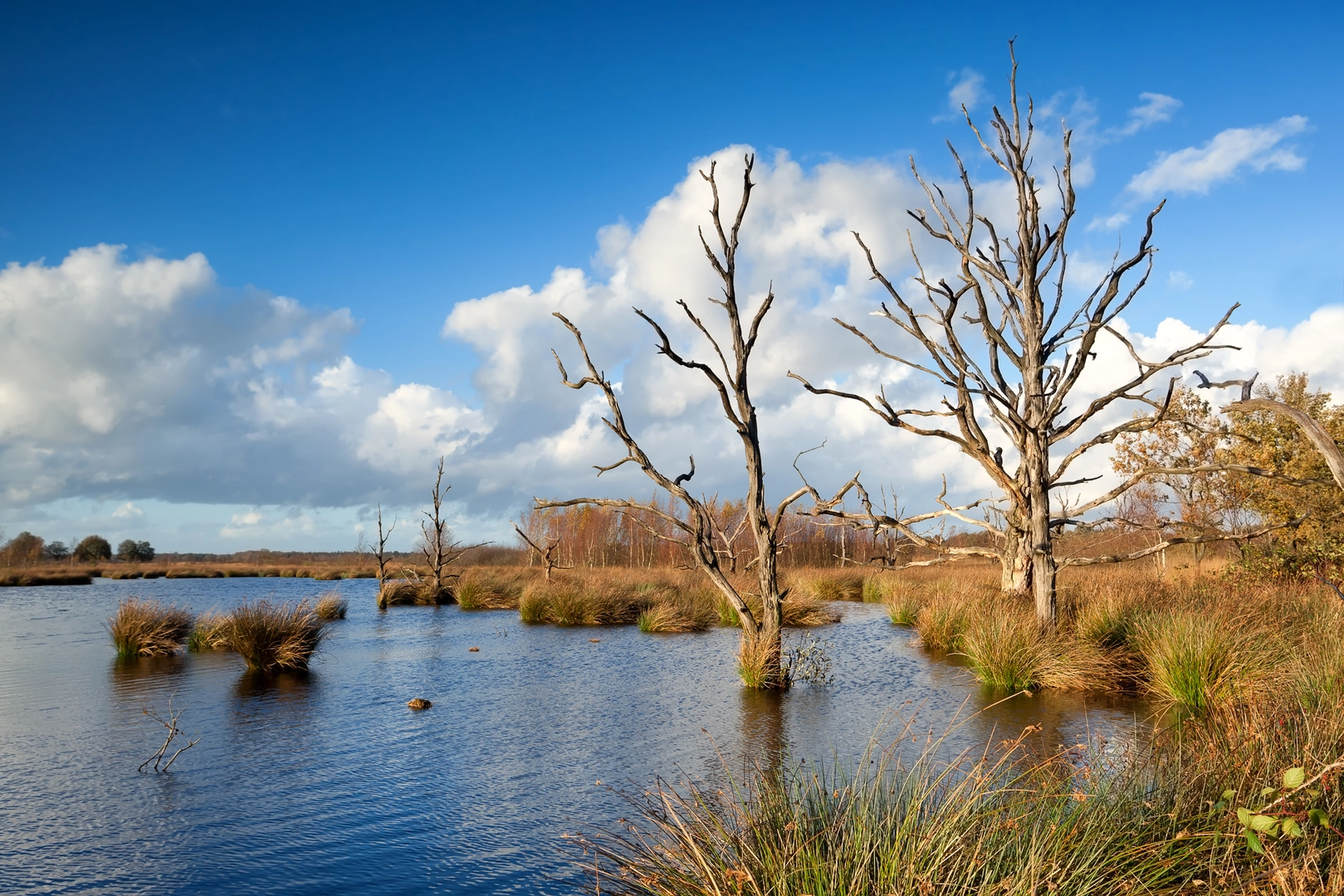
Wittenveen and Groote Veen (wet heath/peat influence):
These names point to “veen” landscapes—areas shaped by wet soils and peat-forming conditions. Even when you’re not walking on obvious bog, you’ll often see the signs: darker soils, wetter hollows, and vegetation that prefers damp ground.
What to notice: - Heather and grasses shifting with moisture levels - Drainage ditches or old water-management lines (common in peat-adjacent landscapes) - Occasional plank/boardwalk-style crossings or reinforced path sections where the ground stays soft
Wildlife and seasonal highlights
This region’s mix of sand, heath, and woodland edge supports a good variety of birds and mammals.
- Birdlife: Heath and open areas can host raptors overhead (buzzards are common), while woodland edges bring songbirds. In spring and early summer, dawn and late afternoon are the most active times.
- Mammals: Roe deer are a realistic possibility at forest-heath transitions, especially in quieter hours. Foxes are present but usually elusive.
- Insects: In warm months, expect mosquitoes and biting flies near wetter sections—pack repellent. Ticks are also a consideration in heath/rough grass; long socks and a tick check afterward are sensible.
Dogs are often allowed in many Dutch nature areas but may need to be leashed in sensitive zones (especially around

Surfaces
Unknown
Sand
Asphalt
Dirt
Unpaved
Concrete
Paved
Ground
Grass
Comments and Reviews
User comments, reviews and discussions about the Ter Horsterzand, Witten veen and Groote Veen Loop, Netherlands.
average rating out of 5
0 rating(s)