Download
3D Flyover
Add to list
More
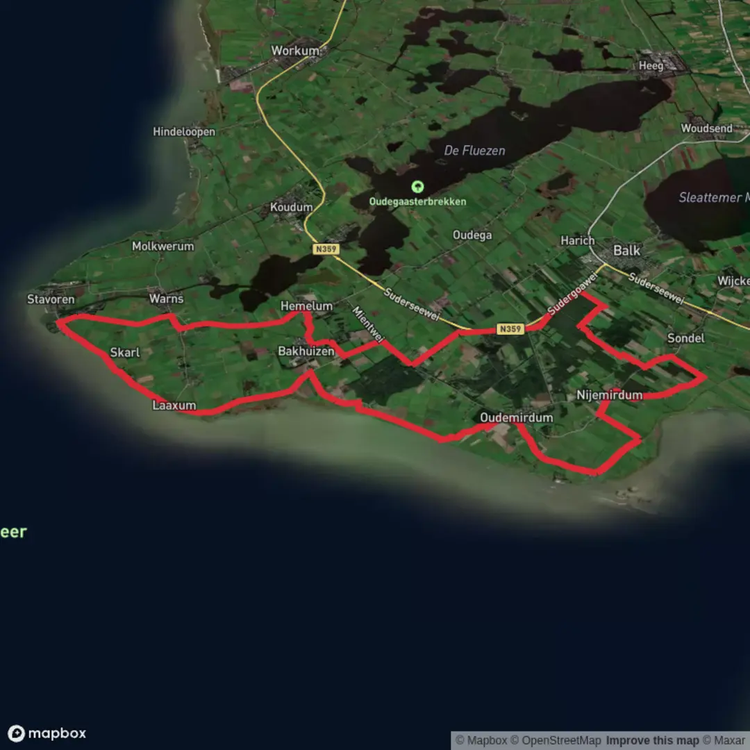
44.4 km
~2 days
0 m
Point-to-Point
“A Frisian forest loop awaits—share a start point, and the route’s story can unfold.”
I’m missing a few key pieces of information needed to write this accurately (especially the start location). “Rysterbosk / Wyldermerkbosk / Starnumanbosk” look like Frisian place-names, and there are multiple “-bosk” woods in Friesland—without coordinates or a map/GPX, I can’t reliably convert the start point to a nearest address/landmark or give correct access/public transport guidance.
Send any one of the following and I’ll produce the full, detailed hike description exactly in the style you requested:
- Start point coordinates (lon/lat) for the trailhead (and ideally the loop line), or
- a HiiKER link, or
- a GPX/KML, or
- a static map image showing the loop and start.
Also, please confirm these two fields (they’re blank): - Hike head: near (town/village/parking area name, even approximate) - Hike type: (loop is implied, but confirm: loop, figure-8, lollipop loop, etc.)
Once you share that, I’ll include: - segment-by-segment expectations with approx distances in km + miles (44 km ≈ 27.3 mi) and elevation gain in m + ft (0 m ≈ 0 ft, if correct), - terrain/seasonal conditions (mud, drainage ditches, boardwalks, farm tracks, forest lanes), - notable landmarks and any regional history relevant to the exact area, - wildlife/nature notes, - and how to reach the start by car and public transport, using the nearest real-world address/landmark derived from your coordinates.

Surfaces
Asphalt
Grass
Concrete
Unknown
Ground
Paved
Gravel
Comments and Reviews
User comments, reviews and discussions about the Rysterbosk, Wyldermerkbosk and Starnumanbosk Loop, Netherlands.
average rating out of 5
0 rating(s)