Download
3D Flyover
Add to list
More
19.2 km
~3 hrs 50 min
6 m
Loop
“Wander through vibrant meadows, windmills, and woodlands on a gentle journey steeped in Dutch charm.”
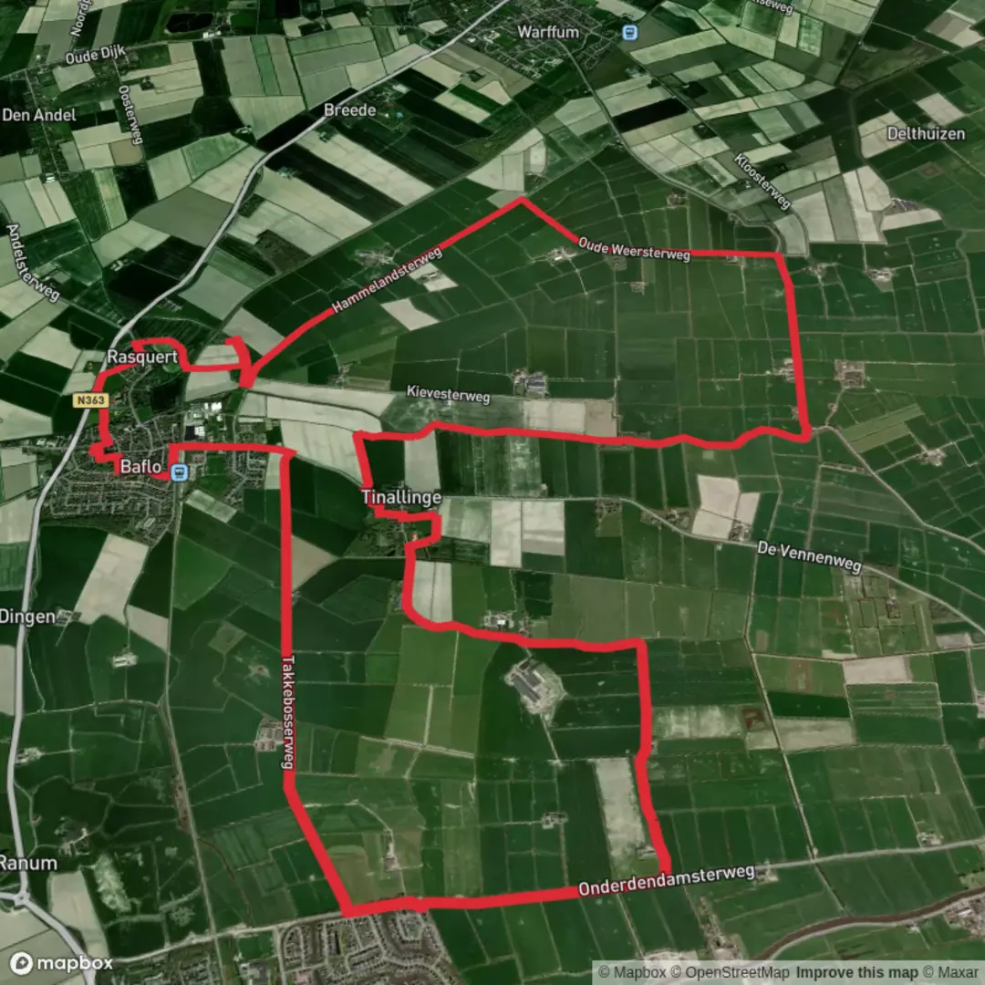
Embarking on the Oosterhuiser Loop via Hammelandster Weg and Molen Weg offers a serene 19-kilometer (approximately 11.8 miles) journey through the picturesque Dutch countryside, characterized by flat terrain and an estimated elevation gain of zero meters. This easy loop trail is ideal for hikers of all levels, providing a delightful exploration of the region's natural beauty and historical landmarks.
Trailhead and Access
The hike commences near the village of Oosterhuizen, situated in the province of Gelderland, Netherlands. For those traveling by car, Oosterhuizen is accessible via the A1 motorway, taking the exit toward Beekbergen and following local roads to the village. Parking is available in the village center or at designated areas near the trailhead. Public transportation options include trains to Apeldoorn, followed by a bus ride to Oosterhuizen. It's advisable to check the latest schedules and routes to plan your journey accordingly.
Trail Overview
Starting from Oosterhuizen, the loop follows Hammelandster Weg, a charming country road that meanders through lush meadows and agricultural fields. Approximately 5 kilometers (3.1 miles) into the hike, you'll encounter the first significant landmark, the Hammelandster Windmill. This traditional Dutch windmill, dating back to the 19th century, stands as a testament to the region's rich milling history. While the windmill is not open to the public, its exterior provides a picturesque backdrop for photos.
Natural Highlights
Continuing along the route, the trail transitions onto Molen Weg, leading you through a diverse landscape of woodlands and wetlands. This section is particularly rich in biodiversity, offering opportunities to observe various bird species, including herons and storks, especially during the spring and summer months. The flat terrain and well-maintained paths make this portion of the hike both accessible and enjoyable.
Historical Significance
Around the 12-kilometer (7.5 miles) mark, the trail passes near the historic village of Loenen. This area is known for its connection to the Veluwe region's paper industry, which flourished in the 17th and 18th centuries. The nearby Loenense Waterfall, the highest waterfall in the Netherlands, is a short detour from the main trail and offers a glimpse into the area's industrial past.
Navigation and Safety
The Oosterhuiser Loop is well-marked with clear signage at key junctions. For enhanced navigation, consider using the HiiKER app, which provides detailed maps and real-time updates. Given the flat nature of the trail, it's suitable for hikers of all ages and fitness levels. However, it's recommended to wear comfortable walking shoes and carry sufficient water, especially during warmer months.
Additional Information
Restrooms and refreshment facilities are limited along the trail, so plan accordingly. The best times to embark on this hike are during the spring and autumn seasons when the weather is mild, and the natural scenery is at its most vibrant.
By preparing adequately and respecting the natural environment, hikers can fully enjoy the tranquil beauty and historical richness of the Oosterhuiser Loop via Hammelandster Weg and Molen Weg.

Surfaces
Asphalt
Concrete
Unknown
Grass
Paved
Comments and Reviews
User comments, reviews and discussions about the Oosterhuiser Loop via Hammelandster Weg and Molen Weg, Netherlands.
average rating out of 5
0 rating(s)