Download
3D Flyover
Add to list
More
29.3 km
~5 hrs 59 min
73 m
Loop
“A long, gentle Veluwe loop through whispering pines, purple heath, and wind-sculpted sands—unhurried.”
This is a long, low-relief loop of heathland, drifting sand, and quiet pine forest on the Veluwe—built for steady, all-day walking rather than steep climbing. At roughly 29 km (18.0 mi) with about 100 m (330 ft) of total ascent, it’s physically “easy” in terms of elevation, but it’s still a full-day distance: plan for 6–8 hours of moving time depending on pace and how often you stop.
Getting to the start (and what “near” usually means here)
You didn’t include the exact start coordinates, but this loop name strongly points to the Otterlo / Deelen / Hoenderloo side of Nationaal Park De Hoge Veluwe and the surrounding Veluwe nature areas. The most common, practical start points for a loop that links De Pollen, Otterlose Zand, and Deelense Veld are near Otterlo village—often around the Otterlo entrance area of De Hoge Veluwe National Park (a well-known landmark with parking and clear wayfinding).
- By car: Aim for Otterlo (Gelderland, Netherlands) and park near the De Hoge Veluwe – Entrance Otterlo area (large, signed parking typical for the park access points). If your route begins outside the paid park boundary, you may instead use village parking in Otterlo and walk to the trail network.
- By public transport: The usual approach is train to Ede-Wageningen (major rail station), then a regional bus toward Otterlo. From Otterlo, you typically have a short walk to reach the trail network. (Exact bus lines/timetables change—check current schedules before you go.)
If you share the start lon/lat, I can pin it to the nearest named entrance, car park, or bus stop and describe the first kilometer precisely.
What the terrain feels like (and why it’s “easy” but not effortless)
Expect mostly flat to gently rolling ground: sandy paths, compacted forest tracks, and occasional softer sections through drift sand where footing can feel loose. The elevation gain is modest—think short rises and shallow dips rather than sustained climbs—so your main challenges are: - Distance management: 29 km (18 mi) is the real effort. - Footing in sand: some stretches can slow you down and work calves/ankles more than expected. - Exposure on open heath/sand: wind and sun can be more noticeable than in the forest.
Route flow and key landscapes (approximate breakdown)
Because loops in this area often weave through a dense path network, distances can vary slightly depending on the exact line taken, but a typical rhythm looks like this:
0–6 km (0–3.7 mi): Forest approach and quiet tracks
You’ll likely start on wide, well-used forest paths—pine and mixed woodland with straight, sandy lanes typical of managed Veluwe forests. This is a good section to settle into pace and check your navigation on HiiKER, because intersections can come quickly and many tracks look similar.
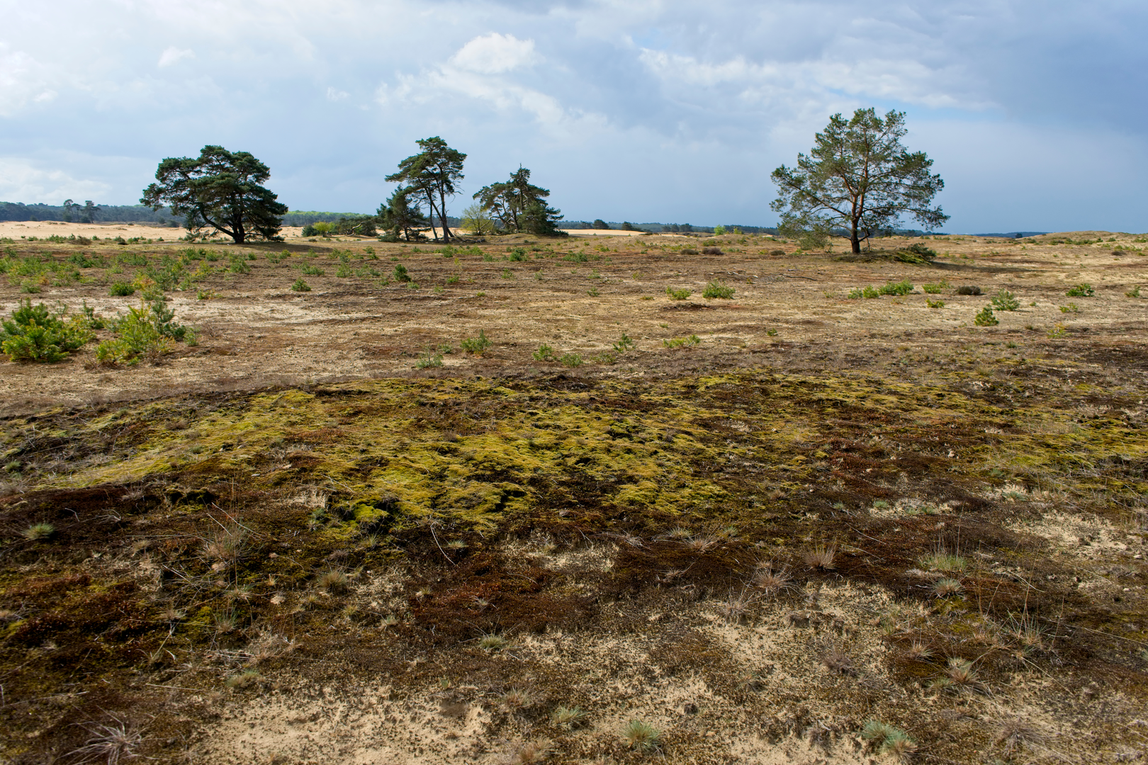
6–14 km (3.7–8.7 mi): Otterlose Zand—open drift sand and big skies
The Otterlose Zand is one of the signature features: a broad, pale sandscape with sparse vegetation and a distinctly “dune-like” feel. In dry spells, sand can be soft; after rain, it firms up but can be patchy.
What to look for:
- Wind-shaped sand ripples and scattered pioneer plants (grasses, mosses, hardy shrubs).
- Sharp edge transitions where forest abruptly gives way to open sand—great for orientation.
- Wildlife signs: tracks in sand are often easier to spot than in forest soil.
14–22 km (8.7–13.7 mi): De Pollen and heathland mosaics
“De Pollen” in this region is associated with low-lying, often slightly wetter heath/grass mosaics and open patches among woodland. You may notice subtle changes underfoot—more compact soil, occasional dampness depending on season, and a shift in vegetation structure.
Seasonal highlights:
- Late summer can bring heather bloom (where present), turning sections purple.
- Cooler months open up longer sightlines through leafless edges and thinner understory.
22–29 km (13.7–18.0 mi): Deelense Veld—broad heath, quiet edges, and long finishes
The Deelense Veld is known for expansive heath and a sense of space. Paths here can be narrower and feel more remote, even though you’re never far from the Veluwe’s managed landscape. This is where fatigue from distance can creep in—keep an eye on pace and hydration, and use HiiKER to stay on the intended line through the web of sandy tracks.
Landmarks and points of interest
- Drift-sand systems (Otterlose Zand): These are culturally and ecologically significant landscapes shaped by historical land use (grazing, sod-cutting, and deforestation in past centuries) that allowed sand to mobilize. Modern conservation often works to keep parts open by controlling tree encroachment.
- Heathland (Deelense Veld): Heath is a semi-natural habitat maintained historically by grazing and management; without it, much would revert to woodland. The open character is part of the Veluwe’s identity.
- Forest management patterns: The Veluwe includes large areas of planted pine and managed woodland—straight lanes

Surfaces
Asphalt
Unknown
Concrete
Wood
Comments and Reviews
User comments, reviews and discussions about the De Pollen, Otterlose Zand and Deelense Veld Loop, Netherlands.
average rating out of 5
0 rating(s)