Download
3D Flyover
Add to list
More
20.2 km
~4 hrs 8 min
67 m
Loop
“A gentle Veluwe loop through Bruggelen’s clearings and Engelanderholt’s sandy pine lanes, rich with birdsong.”
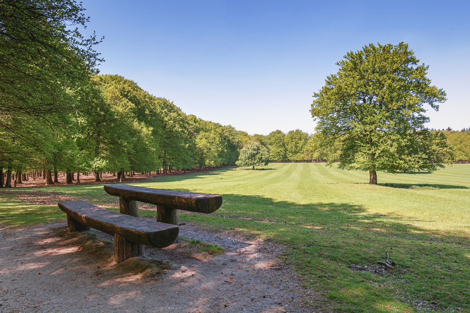
This easy loop is a low-relief walk of roughly 20 km (12.4 mi) with about 100 m (330 ft) of total climbing, linking two classic Veluwe landscapes: Bruggelen (a patchwork of woodland edges and estate-like clearings) and Engelanderholt (quiet mixed forest with long, straight sandy tracks). Expect mostly flat terrain, frequent junctions, and a route that’s more about atmosphere—pines, heather remnants, and birdsong—than big viewpoints.
Getting to the start (car + public transport)
Because the start point is listed only as “near” (no coordinates provided), the most practical approach is to aim for the Bruggelen / Engelanderholt area on the Veluwe, near Apeldoorn (Gelderland, Netherlands) and then choose the closest signed trailhead/parking once you have the exact pin.
- By car: Set your destination to the Apeldoorn–Hoenderloo edge of the Veluwe and look for official forest car parks (often signed as P with “Veluwe”/forest names). In this region, trailheads are commonly at marked parking areas beside wide forest roads.
- By public transport: The nearest major hub is typically Apeldoorn (rail connections), then a bus toward Hoenderloo / Veluwe entrances plus a short walk to a forest access point. If you share the exact start coordinates (lon/lat), I can translate them to the nearest trailhead/landmark and tighten this into a step-by-step plan.
For navigation, load the loop on HiiKER and download the offline map—this area has many similar-looking tracks and frequent intersections.
What the trail is like underfoot
You’ll mostly be on wide forest roads and sandy/gravel tracks, with occasional narrower paths where the loop cuts between straighter lanes. The ~100 m (330 ft) of ascent is typically spread out in tiny rises—old dunes and subtle ridgelines—so you rarely feel like you’re “climbing,” but you do get gentle undulation.
- Typical time: 4–5.5 hours for most hikers at an easy pace with stops.
- Waymarking: Often decent in Veluwe forests, but junction density is high; it’s easy to take a parallel track and not notice for a while.
- Seasonal footing:
- Wet months: sandy sections can turn soft; puddles linger in low spots.
- Dry months: sand can be loose and energy-sapping in places, especially if bikes have churned it up.
- Wet months: sandy sections can turn soft; puddles linger in low spots.
Landmarks, landscape, and the “feel” of Bruggelen & Engelanderholt
The Veluwe is one of the Netherlands’ largest continuous natural areas, shaped by Ice Age sands and later managed as a mosaic of production forest, heath, and protected habitat. On this loop you’ll likely notice:
- Mixed woodland structure: Scots pine stands, patches of oak and birch, and occasional darker conifer blocks. Edges and clearings are where you’ll see the most activity—birds, deer sign, and seasonal wildflowers.
- Long straight forest lanes: A hallmark of managed Veluwe forestry—great for easy walking, but they can feel repetitive. The loop format helps by changing direction and habitat frequently.
- Heath and open pockets (where present): Even small open areas can be surprisingly scenic, especially in late summer when heather blooms (where it still occurs).
Wildlife you may encounter (and what to look out for)
This region is known for large mammals and rich birdlife. You may see or at least find signs of: - Red deer and roe deer: Most active at dawn/dusk; look for hoofprints in sand and browsing on young shoots. - Wild boar: Often shy, but you’ll notice rooted-up ground along softer verges. Give them space, keep dogs leashed, and avoid surprising animals in dense cover. - Birds: Woodpeckers, jays, and raptors over clearings; listen for drumming and sharp alarm calls.
Ticks can be present in woodland and grassy edges in warmer months—long socks and a post-hike check are sensible.
Route breakdown with approximate distances (20 km / 12.4 mi total)
Because the exact trailhead isn’t specified, treat these as a planning framework; the character of each segment is consistent across the Bruggelen–Engelanderholt area.
0–4 km (0–2.5 mi): Settling into the forest Gentle, flat tracks through mixed woodland. Expect early junctions—confirm direction on HiiKER at each major crossing.
4–9 km (2.5–5.6 mi): Bruggelen sector—clearings and edges Slightly more variation: woodland margins, occasional open patches, and subtle rises (the kind that add up to the day’s modest ~100 m / 330 ft gain). Good place for a short break where the trees thin.
9–15 km (5.6–9.3 mi): Engelanderholt—quiet interior lanes Typically the calmest-feeling stretch: long, straight sandy roads and deeper forest. This is where it’s easiest to drift onto a parallel track—keep an eye on distance-to-next-turn rather than just compass direction.
15–20 km (9.3–12.4 mi): Return leg—more mixed habitat The loop usually finishes with a blend of straighter lanes and smaller connectors. If you’re hiking later in the day, this is also when deer are more likely to appear near edges and crossings.
Historical context of the

Surfaces
Unknown
Asphalt
Unpaved
Gravel
Sand
Ground
Dirt
Grass
Concrete
Comments and Reviews
User comments, reviews and discussions about the Bruggelen and Engelanderholt Loop, Netherlands.
average rating out of 5
0 rating(s)