Download
Preview
Add to list
More
12.0 km
~2 hrs 24 min
0 m
Loop
“Stroll through Amsterdam’s vibrant west, where industry, waterways, and modern life weave a vivid urban tapestry.”
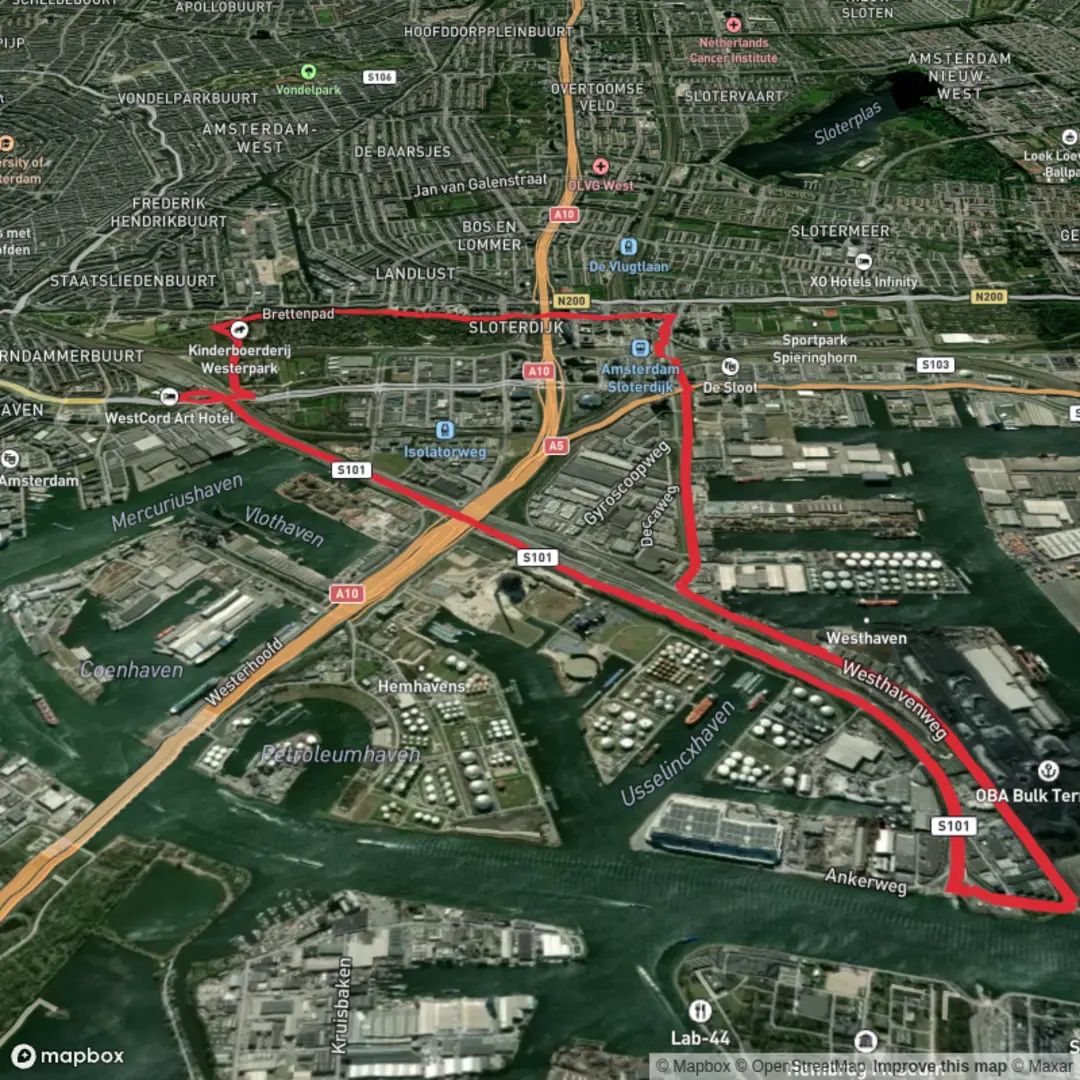
Embarking on the Radarweg and Nieuwe Hemweg trail offers a unique urban hiking experience through the western part of Amsterdam, Netherlands. This approximately 12-kilometer (7.5-mile) route is predominantly flat, making it accessible for hikers of all levels.
Getting There
The trailhead is conveniently located near the Sloterdijk Station, a major transportation hub in Amsterdam. Sloterdijk Station is well-served by trains, trams, and buses, providing easy access from various parts of the city and surrounding regions. For those driving, parking facilities are available near the station, though spaces can be limited during peak hours.
Trail Overview
Starting near Sloterdijk Station, the trail follows Radarweg, a significant thoroughfare in the area. As you proceed, you'll transition onto Nieuwe Hemweg, which runs parallel to the North Sea Canal. This route offers a blend of urban landscapes and industrial vistas, reflecting Amsterdam's dynamic character.
Landmarks and Points of Interest
- Westpoort Industrial Area: As you traverse Nieuwe Hemweg, you'll pass through Westpoort, Amsterdam's primary industrial zone. This area showcases the city's economic backbone, with numerous warehouses, factories, and shipping facilities.
- North Sea Canal: Running alongside Nieuwe Hemweg, the canal is a vital waterway connecting Amsterdam to the North Sea. Observing the maritime traffic, including cargo ships and barges, provides insight into the city's longstanding relationship with trade and transportation.
- Houthavens District: Near the end of the trail, you'll encounter the Houthavens, a former timber harbor now transformed into a modern residential and commercial area. The district features contemporary architecture and offers picturesque views of the IJ River.
Flora and Fauna
Despite its urban setting, the trail offers pockets of greenery. Along the canal, you might spot waterfowl such as ducks and swans. Green spaces interspersed throughout the route provide habitats for various bird species and small mammals.
Historical Significance
- Industrial Heritage: The areas surrounding Radarweg and Nieuwe Hemweg have played a crucial role in Amsterdam's industrial development. The proximity to the North Sea Canal facilitated trade and industry, contributing significantly to the city's economic growth.
- Urban Transformation: The Houthavens district exemplifies Amsterdam's ability to repurpose industrial areas into vibrant urban spaces, reflecting the city's commitment to sustainable development and innovation.
Navigation and Safety
The trail is straightforward, following main roads with pedestrian pathways. For enhanced navigation, consider using the HiiKER app, which provides detailed maps and real-time updates. Be mindful of traffic when crossing streets, and adhere to pedestrian signals.
Practical Tips
- Footwear and Gear: Comfortable walking shoes are suitable for this flat, urban trail.
- Amenities: Numerous cafes and restrooms are available along the route, particularly near Sloterdijk Station and in the Houthavens district.
- Weather Considerations: Amsterdam's weather can be unpredictable. It's advisable to carry a light rain jacket and check the forecast before setting out.
This hike offers a unique perspective on Amsterdam's industrial heritage and urban development, making it a worthwhile exploration for those interested in the city's multifaceted character.

Surfaces
Asphalt
Concrete
Unknown
Comments and Reviews
User comments, reviews and discussions about the Radar Weg and Nieuwe Hem Weg, Netherlands.
average rating out of 5
0 rating(s)