Download
3D Flyover
Add to list
More
25.6 km
~5 hrs 12 min
55 m
Loop
“A gentle, all-day greenbelt loop from Soest Zuid—woods, sandy edges, and bike-buzzing junctions.”
This is a long, low-relief loop of about 26 km / 16.2 mi with roughly 100 m / 330 ft of total climbing—more of a steady, all-day ramble than a “workout” hike. Expect a mix of wide multi-use paths, woodland tracks, and quiet edges of residential/parkland, with frequent junctions where paying attention matters more than fitness. Underfoot is typically firm (paved or compacted) with occasional sandy or muddy patches after rain.
Because “Heezerspoor Oostzijde” and “Monnikenboschpad” are also used as names for well-known cycle corridors in the Soest–Amersfoort area (Province of Utrecht), this loop is most consistent with starting near Soest / Soestduinen and linking toward Amersfoort via the Monnikenbosch area. The most practical, easy-to-find start for hikers is near Soest Zuid railway station (Station Soest Zuid), which sits close to the corridors these names refer to. (en.wikipedia.org)
Getting to the start (public transport + car)
- By train: Take Dutch Railways to Soest Zuid (on the Den Dolder–Baarn line). From the platforms, you can walk a few minutes to pick up the green corridors and path network that feed into the Heezerspoor/Monnikenbosch connections. (en.wikipedia.org)
- By car: Aim for parking near Station Soest Zuid (station-area parking and nearby streets are the simplest “anchor” for navigation). If you prefer a quieter start, you can also look for parking near the Soestduinen edge and join the corridor from there, but station access is usually the most straightforward for first-timers.
What the route feels like (surface, rhythm, and pacing)
Over 26 km / 16.2 mi, the walking is consistently easy: no steep climbs, no technical descents—just gentle rises and dips that add up to ~100 m / 330 ft. The main challenge is flow: - You’ll cross multiple junctions where cycle routes, local access paths, and woodland tracks braid together. - Several stretches are shared-use (walkers + cyclists). On weekends and commuting hours, expect faster traffic—walk single-file when needed and be ready for bikes approaching quietly from behind.
A typical pace for most hikers (including short stops) lands around 5.5–7 hours depending on how often you pause for photos, wildlife watching, or navigation checks.
Navigation (use HiiKER)
This is the kind of loop where you’ll want HiiKER open, not because it’s hard terrain, but because the path network is dense and signage can prioritize cyclists. Use HiiKER to: - Confirm you’re on the correct side of long straight corridors (it’s easy to parallel the intended line on a nearby path). - Catch small “connector” turns that keep the loop shape rather than sending you straight toward town.
Landmarks, landscape, and wildlife to watch for
You’ll spend much of the day moving through the green belt between Soest and Amersfoort, where woodland patches, park edges, and transport corridors create a surprisingly natural feel close to urban areas.
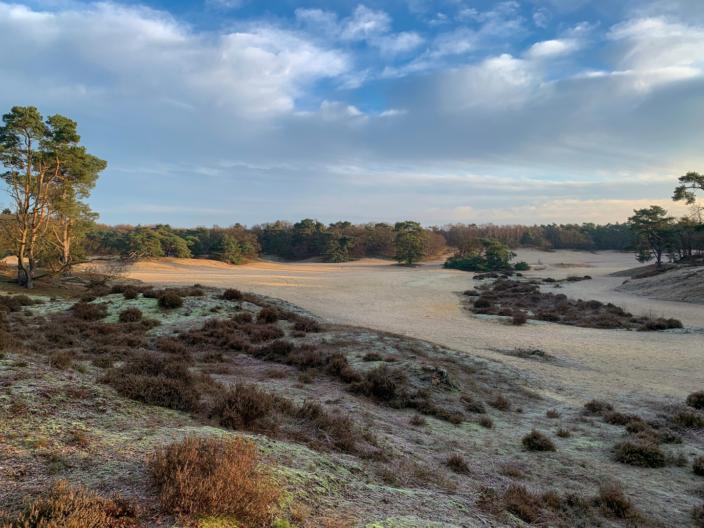
Woodland and heath-edge character - Expect mixed woodland (oak/beech patches and planted conifers in places), with occasional open sandy clearings and heath-edge vegetation depending on the exact connectors used. - In drier sections, sandy soils can make the surface feel softer and slightly slower; after rain, low spots can hold water and become slick.
Wildlife - Common sightings in these woods and edges include songbirds, woodpeckers, and small mammals; at dawn/dusk you may spot roe deer in quieter clearings. - Ticks can be present in grassy/heathy margins in warm months—long socks and a post-hike check are sensible.
Historical context you’re walking through
This area sits in the broader historical landscape of Utrecht province, where transport lines and old routeways have long shaped settlement patterns. The nearby rail infrastructure is part of the Den Dolder–Baarn railway, which runs through Soest and has been a defining corridor for local movement and development. (en.wikipedia.org)
You’ll also be paralleling or intersecting parts of the modern Utrecht–Amersfoort fast cycle route network, where the

Surfaces
Unknown
Concrete
Sand
Asphalt
Ground
Dirt
Unpaved
Gravel
Cobblestone
Paved
Wood
Comments and Reviews
User comments, reviews and discussions about the Heezerspoor Oostzijde and Monnikenboschpad Loop, Netherlands.
average rating out of 5
0 rating(s)