Download
3D Flyover
Add to list
More
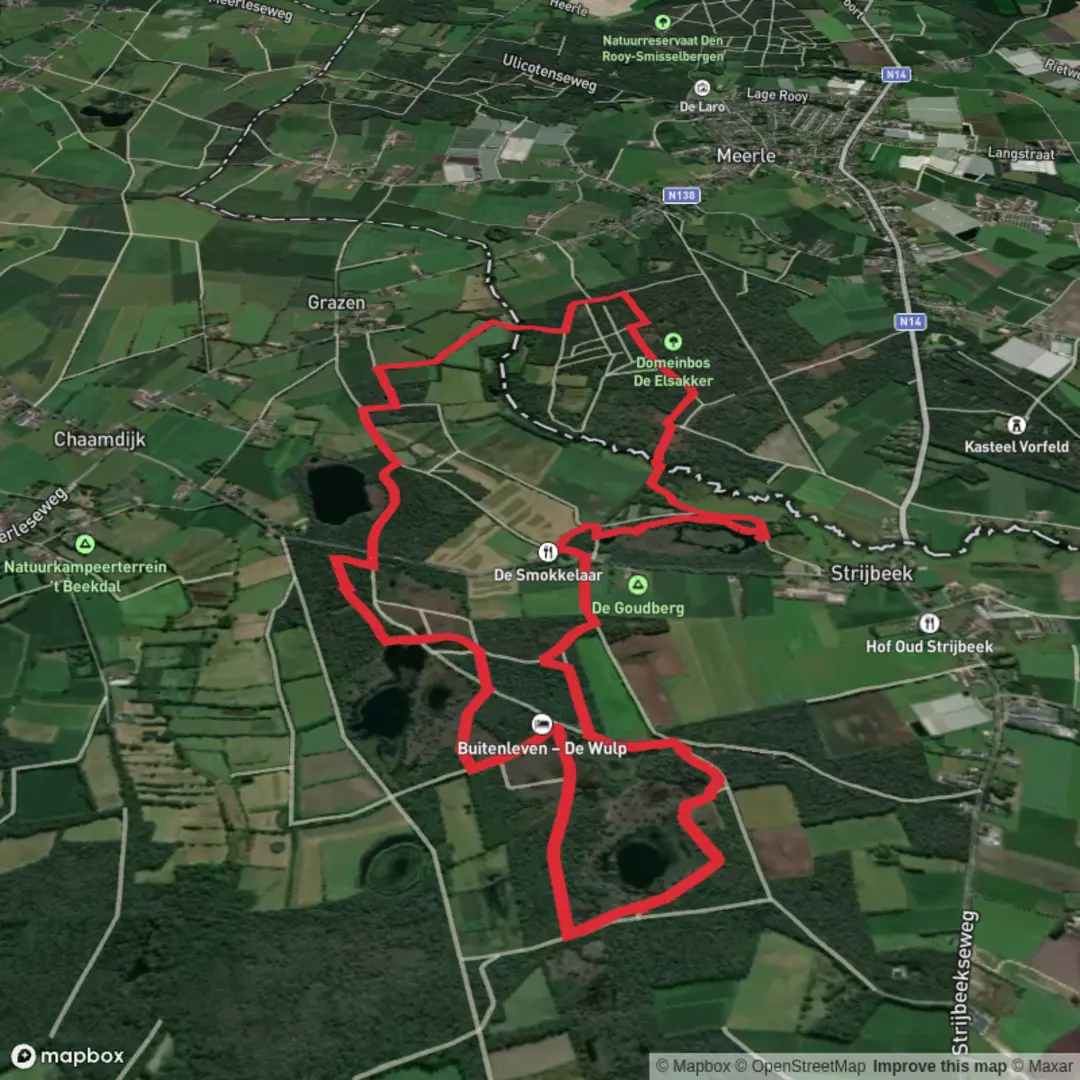
10.5 km
~2 hrs 5 min
0 m
Loop
“A gentle loop near Pelt drifts through heath, whispering reeds, and boardwalked fens alive with birdsong.”
This easy, almost perfectly flat loop (about 10 km / 6.2 mi with roughly 0 m / 0 ft of climbing) wanders through the Hageven–De Plateaux cross-border nature reserve on the edge of Pelt (Belgium)—a landscape of heath, pine-and-birch woodland, fens (vennen), wet meadows, and boardwalk-style “knuppelpaden” over marshy ground. Expect wide skies, lots of birdlife, and long stretches where the only “soundtrack” is wind in the reeds and the occasional call of waterfowl.
The most practical start point is the nature gateway and visitor center:
- Toegangspoort / Bezoekerscentrum De Wulp, Tussenstraat 10, 3910 Pelt, Belgium (a well-known trail hub for the area). (degrooteheide.eu)
This is also a useful landmark to plug into HiiKER for route-finding and to confirm any short detours or seasonal closures.
Getting to the start (car + public transport)
By car - Navigate to Tussenstraat 10, 3910 Pelt (Bezoekerscentrum/Toegangspoort De Wulp). There are established access points and parking associated with the nature gateway/visitor center area. (degrooteheide.eu)
By public transport - The nearest major rail access is typically via Neerpelt (Pelt) station area, then a short taxi/bus connection or bike/walk to the De Wulp gateway depending on schedules. If you’re planning to arrive fully by transit, check the day’s connections in advance and then use HiiKER to map the last-mile approach from your stop to Tussenstraat 10.
What the walk feels like, kilometre by kilometre
From the De Wulp gateway, you’ll quickly leave the built edge behind and step into a mosaic of habitats. The first couple of kilometres are usually on firm, sandy paths and forest tracks, with the terrain staying level. In damp periods, puddling can linger in low spots—waterproof shoes aren’t mandatory in dry weather, but they’re a comfort upgrade if rain has been recent.
Around 2–4 km (1.2–2.5 mi), the character shifts toward open nature: heathland clearings and the first hints of vennen (shallow fen-lakes). These waters are often edged with reeds and sedges; the paths may narrow and become softer underfoot. If your loop specifically strings together De Wulp – Rondven – Petersmoer, this is where you start encountering the “wetland spine” of the route: reflective pools, peatier ground, and occasional boardwalk/knuppelpad sections that keep you above the soggiest patches.
By roughly 4–7 km (2.5–4.3 mi), you’re in the most wildlife-rich portion of the loop. Move quietly and you’ll often spot:
- Water birds (ducks, geese, herons, and seasonal migrants)
- Dragonflies in warmer months
- Amphibians near the marshy margins in spring
This area is valued specifically for its wetland and bird habitat, so stay on the marked line even when the “tempting” dry-looking edge paths appear.
From about 7–10 km (4.3–6.2 mi), the loop typically bends back through a mix of woodland and meadow edges, returning you to the De Wulp access point without any meaningful climbing—just gentle undulations that barely register on an elevation profile.
Underfoot conditions, signage, and navigation
- Surface: mostly natural paths (sand, compacted soil), with wet/soft sections near fens and marsh.
- Seasonal wetness: after rain, expect mud and standing water in low areas; in winter, some stretches can feel saturated for days.
- Wayfinding: this is a well-used walking landscape with local waymarking in places, but intersections can be frequent. Use HiiKER to keep the loop clean and avoid accidentally “upgrading” your 10 km into 14 km.
Nature highlights and what to look out for
Fens (vennen), marsh, and boardwalk stretches
The Rondven and Petersmoer portions are the kind of terrain where the scenery changes with water level and season: glassy pools on calm days, reedbeds that rustle constantly

Surfaces
Dirt
Unknown
Ground
Sand
Grass
Unpaved
Asphalt
Wood
Comments and Reviews
User comments, reviews and discussions about the De Wulp, Rondven and Petersmoer Loop, Netherlands.
average rating out of 5
0 rating(s)