Download
3D Flyover
Add to list
More
13.5 km
~2 hrs 42 min
0 m
Loop
“Stroll ruler-straight dikes beneath big skies, where wind, reeds, and birds shape the day.”
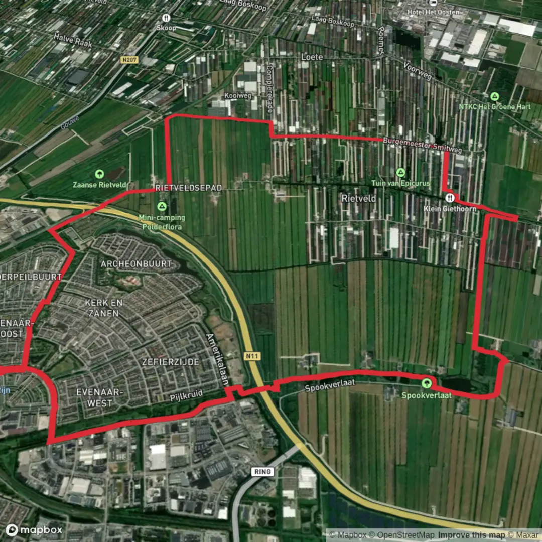
This is a flat, water-shaped walk through classic Dutch polder country: long, ruler-straight dikes, reed-fringed drainage canals, open pasture, and big skies. At around 14 km (8.7 mi) with roughly 0 m (0 ft) of climbing, it’s ideal when you want an easy day that still feels distinctly “out there”—especially in wind, wide-open views, and birdlife.
Getting to the start (car + public transport)
Because “near” and the hike type weren’t filled in, the most practical way to plan this loop is to anchor it to the nearest obvious access point: Riethoornse Polder is associated with the village area around Giethoorn / Wanneperveen in Overijssel (a well-known canal-and-wetland region). A common, convenient landmark to aim for is Giethoorn village center (near the main canal area and visitor parking), then you can step out onto the surrounding dikes and field tracks that form the polder loop.
- By car: Navigate (with HiiKER for the walking portion) to a major local landmark such as Giethoorn Centrum / Dorpsgracht area or one of the signed public car parks serving the village. From there, you can link onto the polder paths within a short warm-up walk. Expect busy parking on weekends and in peak season; arrive early if you want a quieter start.
- By public transport: The usual approach is train to Steenwijk (regional rail hub), then bus toward Giethoorn. From the bus stop in/near the village, you can walk to the dike network and begin the loop. Check same-day bus frequency before committing—rural services can be limited outside commuter hours.
If you share the exact start coordinates (lon/lat) you’re using, I can convert them to the nearest named place/landmark and tailor the directions precisely.
What the terrain is like (and why it feels “flat but not effortless”)
Underfoot is typically a mix of:
- Paved farm lanes and quiet access roads on top of dikes
- Gravel or compacted dirt field tracks
- Occasional grassy levee sections that can be slick when wet
Even with negligible elevation gain, the walk can feel harder if: - Wind is strong (there’s little shelter in open polder) - Tracks are muddy after rain - You’re sharing narrow lanes with bikes, farm vehicles, and e-bikes
Plan on 3–4 hours of walking time for most hikers at an easy pace, plus stops for photos and birdwatching.
Route flow and key moments along the loop
0–3 km (0–1.9 mi): Settling into the polder grid
You’ll quickly leave the denser village edges and enter the polder’s geometry: straight canals, rectangular fields, and long sightlines. This early section is great for getting your bearings—pick a steady pace and let the landscape open up. Use HiiKER to stay on the correct side of canals; in polder country, a “short line on the map” can be a dead end if there’s no bridge.
3–8 km (1.9–5.0 mi): Water management landscape up close
This is where the region’s defining feature becomes obvious: the land is engineered. Expect to pass:
- Drainage ditches and larger canals (often reed-lined)
- Sluices, culverts, and small pumping infrastructure (sometimes subtle, sometimes clearly marked)
- Dike-top paths with panoramic views across pasture and wet ground
Historically, polders are the result of centuries of Dutch water management—draining, controlling, and defending low-lying land to make it usable for agriculture and settlement. The straightness you see isn’t accidental; it reflects surveying, drainage planning, and the constant need to move water efficiently.
8–12 km (5.0–7.5 mi): The quiet middle—birds, reeds, and big skies
This portion often feels the most remote, even though you’re never far from farms or villages. Look and listen for:
- Marsh and canal birds: herons, egrets, coots, moorhens, and a variety of ducks
- Raptors hunting over fields (kestrels are common in open farmland)
- Seasonal movement: spring and autumn can bring noticeably higher bird activity
Stay alert on narrow dikes: edges can drop straight into water, and the grass can hide soft ground. If you’re hiking with kids, keep them on the inside of the path when passing cyclists.
12–14 km (7.5–8.7 mi): Returning toward the start
The final stretch typically reconnects with more traveled lanes and the outskirts of the village area. If you started near a busier access point, you’ll notice the shift from quiet farm tracks back to more foot and bike traffic.
Landmarks, nature, and wildlife to look out for
- Reed beds and wet margins: These are prime habitat zones—expect rustling reeds, bird calls, and occasional sudden movement as waterfowl lift off.
- Canal crossings and small bridges: These become natural “checkpoints” for navigation; confirm each crossing in HiiKER so you don’t end up committed to the wrong bank for several kilometers.
- Pastureland: You may pass grazing cattle or sheep. Give animals space, close any gates if you encounter them, and keep dogs leashed where required.
Practical planning: what to bring and what to

Surfaces
Asphalt
Unknown
Paved
Grass
Dirt
Gravel
Concrete
Ground
Comments and Reviews
User comments, reviews and discussions about the Riethoornse Polder Loop, Netherlands.
average rating out of 5
0 rating(s)