Download
3D Flyover
Add to list
More
14.1 km
~2 hrs 49 min
0 m
Loop
“A gentle loop from orderly young woods to wide, wind-swept dike horizons above the Gooimeer.”
This easy, mostly level loop of about 14 km (8.7 miles) is a great choice when you want a relaxed day on wide forest tracks, dike-top walking, and big open water views with almost no climbing—expect roughly 0–20 m (0–65 ft) of total elevation change depending on small dike undulations and how your device records it. The route links three distinct landscapes: Schapenbos and Cirkelbos (managed Dutch woodland with straight rides and softer, leafier sections) and the Gooimeerdijk (a long, exposed dike beside the Gooimeer).
Getting to the start (car + public transport)
Because the start point is listed only as “near” (no coordinates provided), the most practical way to plan is to aim for a well-known access point that reliably puts you on the same network of paths:
- By car: Navigate to Cirkelbos / Schapenbos parking areas near Almere Haven (Almere, Flevoland)—look for signed recreation parking for Cirkelbos or Schapenbos on the south/east side of Almere. These lots typically sit right on the forest edge and connect directly to the straight forest lanes that make up the first part of the loop.
- By public transport: Take the train to Almere Centrum or Almere Buiten, then bus toward Almere Haven. From Almere Haven, it’s usually a short walk or quick local bus/taxi hop to the forest edge at Cirkelbos/Schapenbos. When you build the route in HiiKER, use the nearest trailhead/parking pin it suggests for Cirkelbos/Schapenbos and match it to the bus stop closest to that pin.
If you share the lon/lat for “near …”, I can convert it to the nearest recognizable address/landmark and tailor the exact start logistics.
What to expect underfoot and on the ground
- Surface: Predominantly compacted gravel/firm dirt forest roads, some narrower woodland paths, and a long stretch of paved or hard-packed dike path along the Gooimeer.
- Steepness: Essentially flat; the only “ups and downs” are gentle dike rises and small drainage crossings.
- Exposure: Sheltered in the woods; very exposed and windy on the dike.
- Wayfinding: The forest has many similar-looking junctions and straight rides—easy to drift onto the wrong parallel track. Keep HiiKER open at intersections and confirm you’re on the correct line before committing.
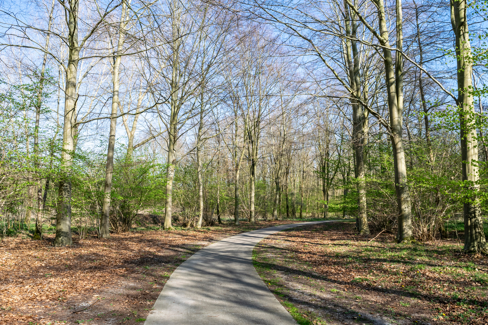
Early kilometres: Schapenbos into Cirkelbos (about 0–6 km / 0–3.7 mi) You’ll start in a classic Flevoland woodland pattern: straight, engineered lines broken by occasional curving footpaths. These forests are relatively young by European standards—Flevoland itself is reclaimed land—so you’ll see orderly planting, drainage ditches, and long sightlines. In calmer pockets, the understory can feel surprisingly lush in spring and early summer.
- Landmarks & nature: Expect mixed stands of deciduous trees and conifers, with open glades and ditch-side vegetation. The ditches are part of the polder water-management system—watch for steep, slippery banks if you step off-trail for a photo.
- Wildlife: Common sightings in this region include waterfowl near wetter edges, songbirds in the canopy, and small mammals. In quieter hours you may spot roe deer at forest margins.
- Hazards: After rain, shaded tracks can hold mud; in dry spells, sandy patches can be loose. Cyclists may use the wider forest roads—listen behind you on straightaways.
Middle section: Transition to the Gooimeerdijk (about 6–10 km / 3.7–6.2 mi) As you work toward the water, the landscape opens and the air changes—more wind, more sky, and the first broad views across the Gooimeer. This is where the loop’s character shifts from woodland wandering to big-horizon walking.
- Navigation note: This transition often includes several junctions where multiple tracks funnel toward the dike. Use HiiKER to pick the correct connector path; it’s easy to end up one access point north or south and add distance unintentionally.
- Historical context: The dike and surrounding infrastructure reflect the Netherlands’ long relationship with water control and land reclamation. Flevoland is a modern province built from reclaimed seabed, and the dike paths you’re walking are part of the broader system that makes settlement and forestry here possible.
Dike walking along Gooimeer: big views, big wind (about 10–13 km / 6.2–8.1 mi) The Gooimeerdijk section is the visual highlight: open water on one side, polder land and woodland edges on the other. On clear days, you’ll get long-distance views across the lake and a strong sense of how flat the region truly is.
- Conditions: This stretch can feel easy on the legs but demanding in weather. Wind off the water can be persistent; in colder months it cuts through quickly. In summer, there’s little shade—sun protection matters.
- Wildlife: Look for geese, swans, ducks, and other waterbirds. Birds of prey sometimes patrol the open edges, using the wind and thermals above the dike.
- Etiquette & safety: The dike path may be shared with cyclists. Keep right, be predictable, and manage dogs carefully—

Surfaces
Asphalt
Unknown
Concrete
Grass
Paved
Ground
Wood
Gravel
Comments and Reviews
User comments, reviews and discussions about the Schapenbos, Cirkelbos and Gooimeerdijk Loop, Netherlands.
average rating out of 5
0 rating(s)