Almere Buiten to Centrum via Noorderleedeweg, Michelinpad and Gooimeerdijk West
Download
3D Flyover
Add to list
More
26.5 km
~5 hrs 17 min
0 m
Point-to-Point
“From planned Almere streets to airy Gooimeer dikes, this flat polder walk invites wind-and-water reflection.”
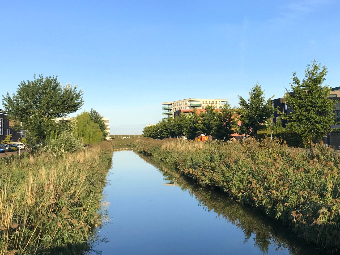
This is a long, flat, low-stress walk across Flevoland’s newest landscapes—starting in Almere Buiten’s planned neighborhoods, slipping quickly into open polder edges and canal roads, then tracking the broad waterline of the Gooimeer before delivering you into Almere Centrum. At around 26 km (16.2 mi) with roughly 0 m (0 ft) of climbing, it’s more about steady pacing, wind management, and choosing good break points than it is about fitness or navigation complexity.
Getting to the start (public transport + car)
- Public transport: The most practical rail start is Almere Buiten station (major NS stop). From the station area you can walk a few minutes to pick up the first streets/paths that lead you toward Noorderleedeweg. If you’re coming from Amsterdam, Utrecht, or Lelystad, trains to Almere are frequent; plan your exact station-to-trail link in HiiKER so you begin on the correct side of the tracks/canals.
- By car: Aim for parking near Almere Buiten station or a nearby neighborhood shopping area (Almere Buiten has multiple small centers). Street parking rules vary by block; check signage. Starting near the station is convenient if you want an easy finish in Almere Centrum without needing to loop back.
What the route feels like, section by section
0–6 km (0–3.7 mi): Almere Buiten to the polder edge via Noorderleedeweg
You’ll begin on urban foot/cycle paths typical of Almere: wide, smooth surfaces, frequent crossings, and lots of separated cycling infrastructure. Within the first few kilometers the built environment thins and you start to feel the “polder geometry”—straight lines, long sightlines, and drainage channels that run like rulers across the landscape.
- Underfoot: Mostly paved paths and compacted surfaces; very little mud unless it has been raining hard and you step off onto verges.
- What to watch for: Fast cyclists at junctions and on shared paths; keep right and be predictable when crossing cycle lanes.
- Landmarks: Drainage canals and pumping infrastructure are common; they’re not “tourist landmarks,” but they’re the defining features of Flevoland’s engineered landscape.
6–14 km (3.7–8.7 mi): Michelinpad and quiet linear walking
This middle stretch is where the walk becomes meditative: long, straight segments with open fields, reed fringes, and water management corridors. The lack of elevation is real—your effort comes from distance and exposure rather than hills.
- Wind exposure: Expect headwinds or crosswinds to be the main “difficulty multiplier,” especially in cooler months. A light shell can matter more than you’d think on a flat route.
- Wildlife:
- Along ditches and reed edges: mallard, coot, moorhen, grey heron, and in migration seasons a variety of geese.
- Over open fields: common kestrel and other raptors hunting; you’ll often see them hovering into the wind.
- Near wetter margins: frogs and small fish activity is common in warmer months, drawing birds.
- Practical planning: There may be long gaps without shops or cafés once you leave the denser parts of Almere. Carry enough water and snacks for at least 3–5 hours of steady walking depending on your pace.
Along the water: Gooimeerdijk West
14–22 km (8.7–13.7 mi): Gooimeerdijk West and the Gooimeer shoreline
When you reach the dike line, the character changes again: you’re now walking a boundary between reclaimed land and open water. The Gooimeer is part of the chain of lakes created and reshaped by Dutch water engineering, and the dike paths here often feel airy and expansive.
- Views: Broad water panoramas with sailboats in season; on clear days you’ll get big skies and long horizons.
- Birdlife: This is typically the richest section for birdwatching—look for cormorants, gulls, and seasonal concentrations of waterfowl.
- Surface: Usually firm and fast (paved or well-compacted dike path).
- Hazards:
- Gusts can be strong on the exposed dike—secure hats and keep an eye on balance if you’re close to the water edge.
- Shared-use traffic (cyclists, runners) can be busy on pleasant weekends.
Into Almere Centrum
22–26 km (13.7–16.2 mi): Urban approach and finish
The final kilometers transition back into city infrastructure—bridges, underpasses, and well-signed paths. Fatigue tends to show up here because the terrain never forces a change of muscle use; consider a short break before the last push.
- Navigation: Almere’s path network can be dense with parallel cycleways and pedestrian routes; keep HiiKER handy to avoid small detours that add distance.
- Food and water: As you near Centrum, options increase quickly—ideal if you’re finishing with a meal or need a reliable water refill.
Historical and landscape context (why it looks the way it does)
This hike is a tour through one of Europe’s most striking examples of modern land-making. Flevoland is largely reclaimed from the former Zuiderzee through 20th-century Dutch engineering—dikes, pumping stations, and carefully planned drainage that turned seabed into farmland and new towns

Surfaces
Unknown
Asphalt
Grass
Concrete
Gravel
Ground
Paved
Wood
Comments and Reviews
User comments, reviews and discussions about the Almere Buiten to Centrum via Noorderleedeweg, Michelinpad and Gooimeerdijk West, Netherlands.
average rating out of 5
0 rating(s)