Download
3D Flyover
Add to list
More
9.3 km
~1 hrs 51 min
0 m
Loop
“Wander through Amsterdam’s storied bridges and blooming canals on a vibrant stroll through living history.”
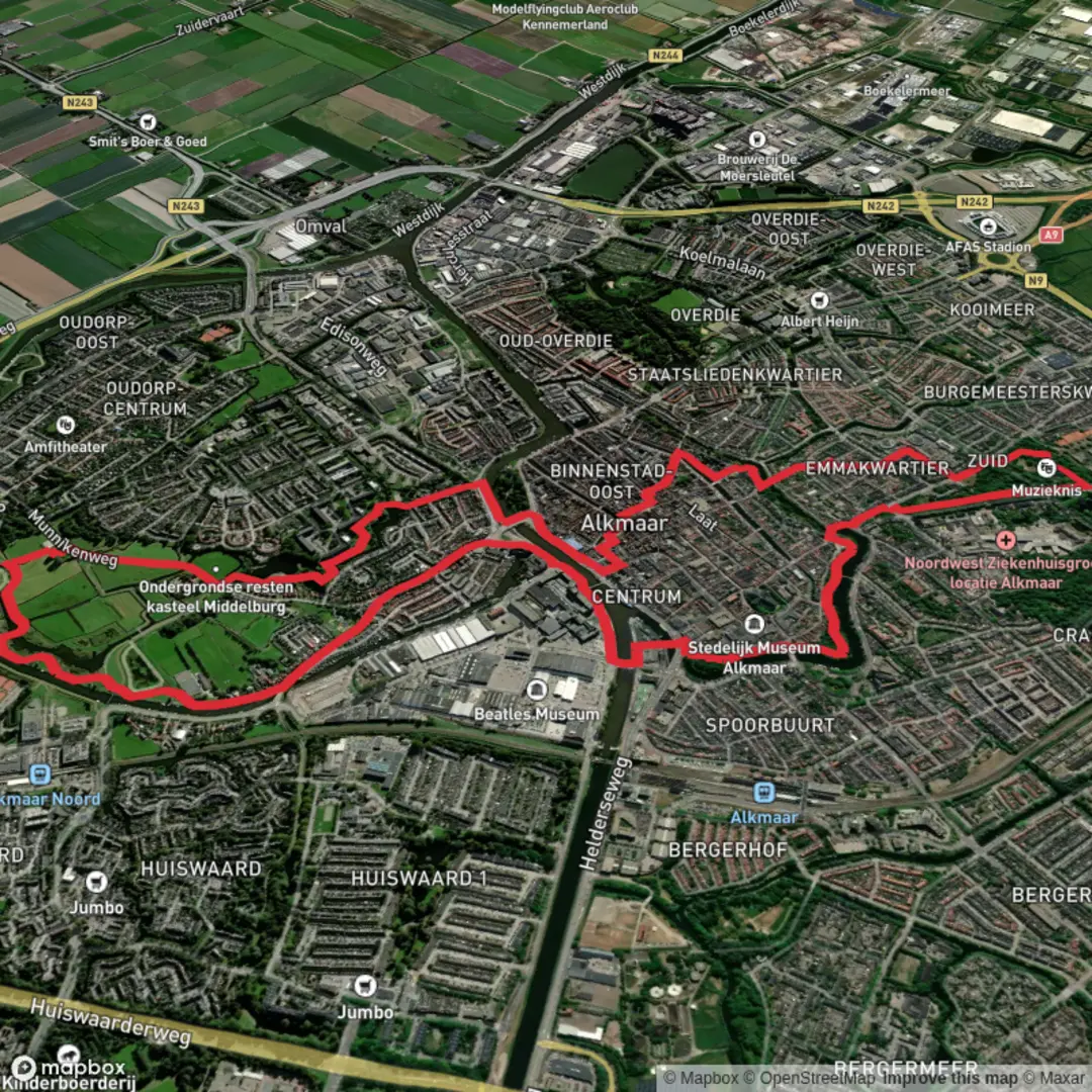
Embarking on the Halvemaansbrug, Friese Brug, and Emma Kwartier Loop offers a delightful exploration of Amsterdam's historic heart, covering approximately 9 kilometers (5.6 miles) with negligible elevation gain, making it accessible for hikers of all levels.
Starting Point and Access
The journey begins at the Halvemaansbrug, a fixed bridge located in Amsterdam-Centrum. This bridge connects the Kloveniersburgwal and the 's-Gravelandseveer over the Amstel River. To reach the starting point, travelers can utilize Amsterdam's efficient public transportation system. Tram lines 4 and 14 stop nearby at Rembrandtplein, just a short walk from the Halvemaansbrug. For those arriving by car, parking facilities are available in the vicinity, though spaces may be limited due to the central location.
Trail Overview
From the Halvemaansbrug, the route proceeds along the Amstel River, offering picturesque views of the city's iconic canals and historic architecture. The path is predominantly flat and paved, ensuring a comfortable walk throughout.
Key Landmarks Along the Route
Halvemaansbrug: This bridge, also known as Bridge 221, is a notable structure in Amsterdam, providing a connection over the Amstel River. (mapcarta.com)
Friese Brug: Continuing along the route, hikers will encounter the Friese Brug. This bridge is situated in the northeast of Friesland, near the Munnekezijlstermolen windmill. (mapcarta.com)
Emma Kwartier: The loop also encompasses the Emma Kwartier area, adding to the diverse experiences along the trail.
Historical Significance
The Halvemaansbrug and Friese Brug are integral parts of Amsterdam's extensive network of over 1,500 bridges, each contributing to the city's rich maritime heritage. The Halvemaansbrug, in particular, offers views of the Munttoren ("Mint Tower"), a historic tower that was originally part of the city wall and rebuilt in 1620. (flickr.com)
Nature and Wildlife
While the route traverses urban landscapes, it provides opportunities to observe local bird species along the canals. The Amstel River and surrounding waterways are home to swans, ducks, and herons. Seasonal flora, including tulips in spring, add vibrant colors to the scenery.
Navigation and Safety
The trail is well-marked, but it's advisable to use a reliable navigation tool like HiiKER to stay on course. Given the urban setting, be mindful of cyclists and adhere to pedestrian pathways. Cross streets at designated crossings and remain aware of tram lines intersecting the route.
Amenities and Facilities
Numerous cafes and restrooms are available along the route, particularly around Rembrandtplein and the Emma Kwartier area. These spots offer opportunities to rest and enjoy local Dutch cuisine.
Preparation Tips
Footwear: Comfortable walking shoes are recommended due to the paved surfaces.
Weather: Check the forecast and dress appropriately, as Amsterdam's weather can be unpredictable.
Timing: Starting the hike in the morning allows ample time to explore landmarks and enjoy breaks.
This loop provides a comprehensive experience of Amsterdam's historical and cultural highlights, making it a rewarding endeavor for both novice and seasoned hikers.

Surfaces
Unknown
Asphalt
Cobblestone
Grass
Concrete
Wood
Comments and Reviews
User comments, reviews and discussions about the Halvemaansbrug and Friese Brug and Emma Kwartier Loop, Netherlands.
average rating out of 5
0 rating(s)