Download
3D Flyover
Add to list
More
16.8 km
~3 hrs 21 min
0 m
Loop
“Wander from city edge to tranquil lakes, where history, wildlife, and Dutch landscapes unfold in harmony.”
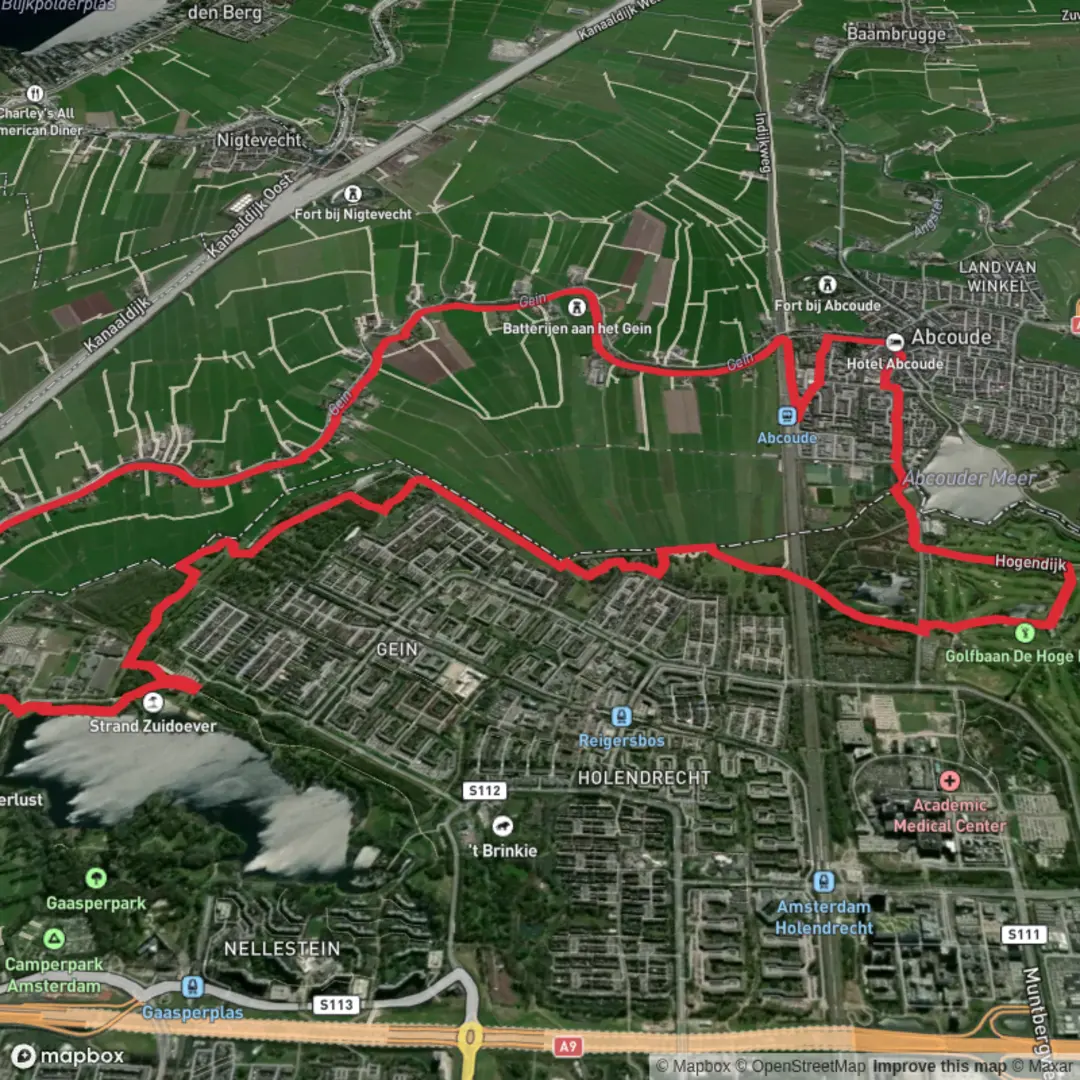
Embarking on the Gaasperplas and Abcouder Meer hike via the Liniepad and Gaasperplas Route offers a serene journey through the southeastern outskirts of Amsterdam, blending urban landscapes with natural beauty. This approximately 17-kilometer (10.5-mile) trail is predominantly flat, making it accessible for hikers of all levels.
Starting Point and Access
The hike commences near the Gaasperplas Metro Station, the terminus of Metro Line 53. From Amsterdam Centraal Station, board Metro 53 towards Gaasperplas; the journey takes about 25 minutes. Upon arrival, exit the station and head towards the Gaasperpark entrance, located adjacent to the station. For those driving, parking is available near the metro station or at designated areas around Gaasperpark.
Gaasperplas and Gaasperpark
Gaasperplas, an artificial lake created during the construction of the Bijlmermeer neighborhood, reaches depths of up to 35 meters (115 feet). Surrounding the lake is Gaasperpark, developed for the 1982 Floriade garden exhibition. Today, the park features diverse flora, open meadows, and wooded areas, providing a habitat for various bird species and small mammals. The park's well-maintained paths are ideal for walking, cycling, and horseback riding. (iamsterdam.com)
Liniepad and Historical Significance
As you proceed, the route incorporates the Liniepad, a path that traces part of the historic Dutch Waterline defense system. This network of fortifications and waterworks was designed to protect the Netherlands by intentional flooding. Along this section, remnants of old fortifications and water management structures are visible, offering insights into the region's military history.
Abcouder Meer and Surroundings
Continuing southward, the trail leads to Abcouder Meer, a picturesque lake near the town of Abcoude. The area is characterized by traditional Dutch polder landscapes, with expansive fields, canals, and dikes. The nearby town of Abcoude, with its historic center, adds a cultural dimension to the hike. (alltrails.com)
Wildlife and Natural Features
Throughout the hike, expect to encounter a variety of wildlife. Gaasperplas and its environs are home to waterfowl such as swans, ducks, and coots. The surrounding woodlands and meadows support songbirds, rabbits, and occasionally deer. The diverse ecosystems along the route provide ample opportunities for nature observation and photography.
Trail Conditions and Navigation
The trail consists of paved and unpaved paths, with some sections potentially muddy after rain. It's advisable to wear sturdy, waterproof footwear. While the route is generally well-marked, carrying a detailed map or using a navigation app like HiiKER can enhance your hiking experience.
Amenities and Considerations
Facilities along the route are limited. Gaasperpark offers rest areas and a few cafes, but it's recommended to carry sufficient water and snacks. Public restrooms are available near Gaasperplas Metro Station and within Gaasperpark. Always adhere to local guidelines, respect private property, and be mindful of wildlife habitats.
This hike offers a harmonious blend of natural beauty, historical intrigue, and cultural exploration, making it a rewarding experience for those seeking to discover the lesser-known landscapes surrounding Amsterdam.

Surfaces
Unknown
Asphalt
Gravel
Grass
Dirt
Wood
Comments and Reviews
User comments, reviews and discussions about the Gaasperplas and Abcouder Meer via Liniepad and Gaasperplas Route, Netherlands.
average rating out of 5
0 rating(s)