Download
3D Flyover
Add to list
More
31.5 km
~6 hrs 26 min
84 m
Multi-Day
“A gentle, all-day ramble through Kloosterbos shade and big-sky farmland, junctions demanding focus.”
This is a long, low-relief loop of roughly 31 km (19.3 mi) with about 100 m (330 ft) of total climbing—more of an endurance walk than a “hike for views.” Expect a mix of quiet woodland, open agricultural edges, and small rural lanes/paths, with frequent junctions where staying on the intended line matters more than dealing with steep terrain. The easy rating fits the gradients, but the distance makes it a full-day outing for most people.
Getting to the start (car + public transport)
Because the start is only given as “near …”, the most reliable way to pinpoint the trailhead is to open the route in HiiKER and use the “start point” to identify the nearest village/parking pull-in. Once you have that pin:
- By car: Aim for the nearest signed forest access/parking area at the edge of Kloosterbos (often a small gravel lot or roadside lay-by near a forest gate). In this region, parking is typically informal—arrive early to avoid blocking farm access or forestry tracks.
- By public transport: The practical approach is usually train to the nearest larger town, then a local bus toward the closest village on the loop, finishing with a short walk to the start. Rural bus frequency can be limited (especially weekends), so check the last return service before committing. If the start pin is more than a couple of kilometers from a bus stop, plan for a longer road-walk at the beginning/end.
If you share the lon/lat for the start (or a HiiKER link), I can convert it to the nearest known address or landmark precisely.
What the terrain feels like over 31 km (19.3 mi)
Most of the day is flat to gently rolling, with small rises that add up to about 100 m (330 ft) total. Underfoot is typically: - Forest tracks (firm, sometimes sandy or needle-covered) - Field-edge paths (can be grassy, narrow, and overgrown in summer) - Short road connectors (quiet lanes, but stay alert for fast-moving local traffic)
Because the elevation gain is low, the main physical challenge is time on feet. A steady pace with short breaks is usually more effective than long stops, especially in cooler months.
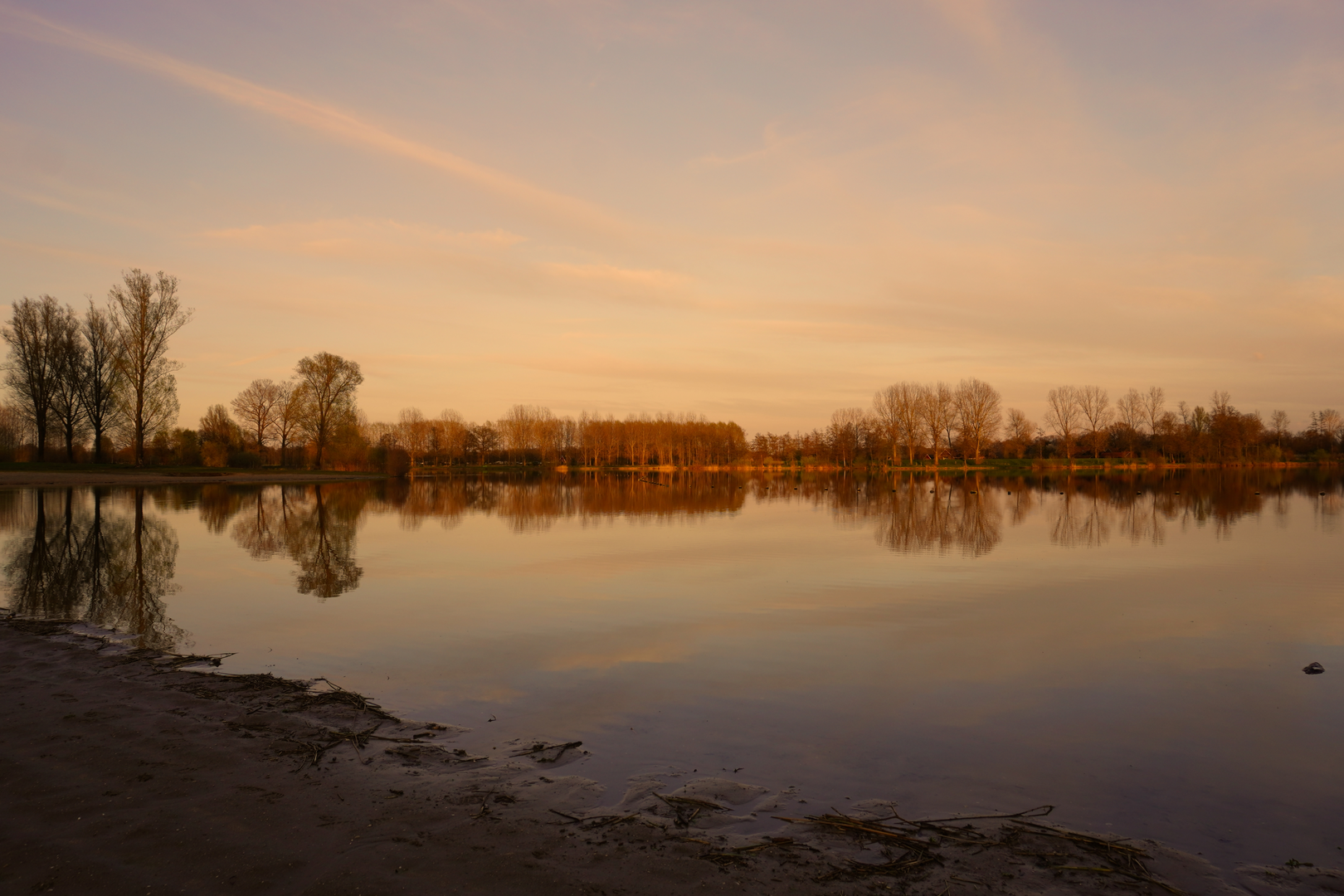
Kloosterbos: shaded woodland and quiet tracks
The Kloosterbos section is where you’ll likely get the most consistent footing and shelter. Expect: - Dense canopy in places (cooler, damper ground; slower drying after rain) - Straight forestry lines mixed with older, more meandering woodland paths - Occasional ditches/drainage channels—easy to step over when dry, messy after wet spells
Wildlife is often subtle rather than dramatic: woodland birds, small mammals, and signs like tracks and scat. In quieter hours you may spot roe deer at the forest edge. Ticks can be a concern in grassy margins and leaf litter—long socks and a quick check during breaks help.
Rommelgebergte & Beestman: open edges, farmland, and big-sky walking
As the loop leaves deeper woodland, it tends to alternate between open agricultural landscapes and smaller copses/hedgerows. This is where conditions can change quickly: - Wind exposure increases—bring a light shell even on mild days. - Sun exposure can be significant in open stretches—cap, sunglasses, and enough water matter more than the elevation profile suggests. - Paths may run along field boundaries; in growing season they can be narrowed by crops or vegetation.
You’ll likely pass a mix of working farmland and rural residences. Keep gates as you find them, give livestock space, and expect occasional muddy tractor ruts after rain.
Landmarks, nature, and what to look out for
- Woodland character: Look for transitions between planted forestry blocks and older mixed woodland—these often show up as changes in tree species, understory density, and the feel of the trail surface.
- Hedgerows and field margins: These can be surprisingly rich for birds and pollinators in spring/summer.
- Drainage features: Lowland routes often cross small culverts and ditches; after heavy rain, the “easy” route can become a slow route if water sits on the track.
Historical context of the area
Place names like “Kloosterbos” commonly point to historical ties with a monastic estate or cloister lands—woodland that was managed for timber, fuel, and hunting, often with long-standing boundary lines and trackways that later became public paths. Even when no monastery buildings remain nearby, the naming often preserves that land-use history. In many parts of this region, today’s patchwork of forest blocks, lanes, and field edges reflects centuries of agricultural management, drainage, and woodland stewardship.
Navigation and timing
This is the kind of loop where you can feel like you’re “always on the right track” until a junction quietly splits into two similar-looking options. Use HiiKER to: - confirm you’re on the correct branch at forestry intersections, - anticipate road crossings and turns before you reach them, - keep an eye on distance remaining (helpful late in the day when the terrain feels repetitive).
For timing, many hikers plan 6–8 hours moving time for 31 km (19.3 mi) depending on pace and stops, with extra buffer if conditions are muddy or if you expect to pause for photos/birdwatching.
Practical prep for an easy-but-long day
- Footwear: Comfortable walking shoes or light boots with decent tread;

Surfaces
Unknown
Asphalt
Ground
Grass
Dirt
Sand
Gravel
Cobblestone
Concrete
Wood
Comments and Reviews
User comments, reviews and discussions about the Kloosterbos, Rommelgebergte and Beestman Loop, Netherlands.
average rating out of 5
0 rating(s)