Download
Preview
Add to list
More
10.1 km
~3 hrs 13 min
721 m
Loop
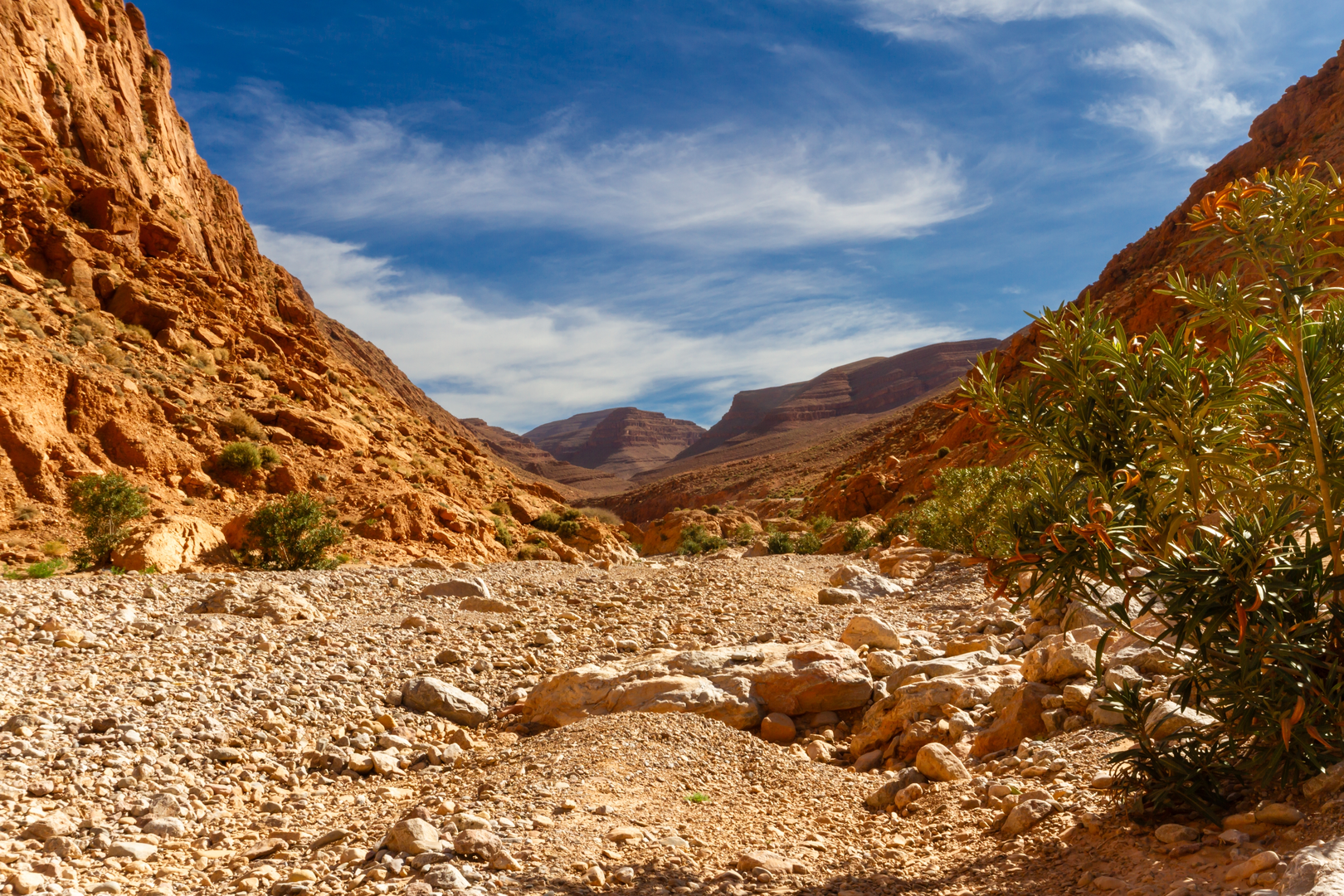
“Thread Todra’s towering gorge, climb into sunbaked silence, then pick your way back down.”
This is a short, steep loop that packs a lot into ~10 km (6.2 mi): a dramatic canyon walk through the Todra Gorge, a sustained climb onto the arid plateau above the cliffs, and a rugged descent back toward the river corridor. With roughly 700 m (2,300 ft) of total ascent, it feels “Difficult” less because of technical terrain and more because the climbing is continuous, the sun exposure can be intense, and footing varies from smooth riverside track to loose rock on the upper slopes.
Getting to the start (and where “near” usually means here)
Most hikers begin from the main gorge access area at Todra Gorge (Gorges du Todra), near the village of Tinghir (Tinerhir), Morocco, where the road narrows between the canyon walls and you’ll see cafés, small hotels, and climbing activity. A practical “nearest landmark” to aim for is the Todra Gorge road pinch-point and riverside promenade area (often simply signed as Gorges du Todra), a few kilometers north of Tinghir.
- By car: From Tinghir, drive north up the paved road following the Todra River into the gorge. Parking is typically informal along the roadside near the busiest canyon section—arrive early if you want an easier spot and a quieter start.
- By public transport: Tinghir is the transport hub. From larger towns (commonly Ouarzazate or Errachidia), travelers usually reach Tinghir by intercity bus or shared taxi, then continue to the gorge by grand taxi/shared taxi or a local arrangement. Service frequency can vary by season and day; plan extra buffer time for the return.
Before you set off, open the route in HiiKER and download it for offline use—signal can be inconsistent once you’re above the gorge.
What to expect underfoot and on the clock - Distance: ~10 km (6.2 mi) - Elevation gain: ~700 m (2,300 ft) - Typical time: Many parties take 4–6 hours depending on heat, stops, and comfort on loose descents. - Surface: Riverside track/road, rocky footpaths, scree-like sections on the upper slopes, and occasional rough steps or ledges where the trail cuts across gullies. - Exposure: High. Shade is common only in the narrowest part of the gorge and near the river corridor.
Route flow and key landmarks You’ll usually start by threading into the gorge along the river, with towering limestone walls rising abruptly on both sides. The canyon is famous for its vertical faces—one reason it’s a major rock-climbing destination—and the scale is immediate: the walls tighten, the light narrows, and the sound of water and voices carries.
After the initial gorge section, the loop typically turns away from the main corridor and begins the real work: a climb up a side path that gains the rim. Expect the grade to bite quickly. The trail often zigzags or traverses across broken slopes where small stones roll underfoot—trekking poles help with rhythm on the ascent and stability on the descent.
Once you top out, the character changes completely. The rim and plateau feel open and stark: wide views back into the gorge, across the Tinghir oasis ribbon, and out toward the broader High Atlas/anti-Atlas landscapes depending on your exact line. This is where navigation matters most—multiple faint tracks can braid across the plateau. Use HiiKER to confirm you’re staying on the intended loop rather than drifting onto a parallel shepherd path.
The climb to the rim: heat, footing, and pacing
The climb accounts for most of the 700 m (2,300 ft) gain, and it’s where hikers most often underestimate the effort.
- Heat management: In warm months, the slope can feel like an oven. Start early, keep a steady pace, and plan short, frequent pauses rather than long stops that cool you down too much and make restarting harder.
- Footing: Watch for ball-bearing gravel on hardpack. Step deliberately, especially when the trail crosses shallow gullies where erosion leaves loose rubble.
- Rockfall awareness: In narrow gullies and below cliff bands, don’t linger directly under other hikers. Natural rockfall is also possible after rain or freeze-thaw periods.
Nature, wildlife, and what you might see This is a classic semi-arid mountain gorge ecosystem: hardy shrubs, sparse grasses, and tough, drought-adapted plants on the upper slopes, with greener growth concentrated along the river and irrigated plots nearer settlements.
- Birdlife: Small raptors and cliff-nesting birds are common sights around the gorge walls and thermals above the rim. Early morning is best for activity.
- Reptiles and insects: In warm weather, lizards are frequently seen sunning on rocks. Check hand placements if you steady yourself on boulders.
- Grazing animals: Goats and sheep are common on the plateau and slopes; you may pass herders and should give animals space, especially on narrow traverses.
Water and resupply Along the main gorge you’ll often find places to buy drinks/snacks, but once you climb out, you should assume no reliable resupply until you return.
- Carry at least 2–3 liters per person in moderate conditions; more in hot weather.
- Treat any natural water sources with caution—runoff and livestock can affect quality.
Historical and cultural context The Todra Valley and the Tinghir oasis area have long been shaped by river-fed agriculture and caravan-era movement through the Atlas fringes. The gorge itself functions as a natural corridor and a dramatic boundary between cultivated valley bottoms

Surfaces
Unknown
Asphalt
Ground
Dirt
Concrete
Comments and Reviews
User comments, reviews and discussions about the Todra Gorges Loop, Morocco.
average rating out of 5
0 rating(s)