Download
3D Flyover
Add to list
More
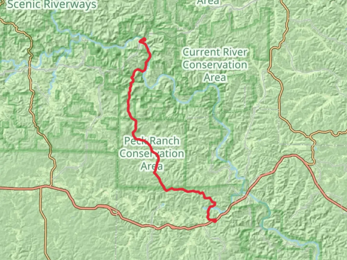
48.1 km
~2 days
932 m
Point-to-Point
“Explore Missouri's Ozarks through breathtaking landscapes, rich wildlife, and historical echoes at Peck Ranch.”
Nestled in the heart of the Ozarks, the Peck Ranch Conservation Area offers a captivating hiking experience through Missouri's diverse landscapes. Spanning approximately 48 kilometers (about 30 miles) with an elevation gain of around 900 meters (approximately 2,950 feet), this point-to-point trail is a moderately challenging adventure for hikers seeking to immerse themselves in nature and history.
Getting There
The trailhead is conveniently located near Shannon County, Missouri. For those traveling by car, the nearest significant landmark is the town of Eminence, Missouri. From Eminence, head east on Highway 106 for about 15 miles until you reach the entrance to Peck Ranch Conservation Area. Public transport options are limited in this rural region, so driving is the most practical way to reach the trailhead.
Trail Highlights
Scenic Landscapes
As you embark on this journey, you'll traverse a variety of terrains, from dense forests to open glades. The trail meanders through the rugged hills of the Ozarks, offering breathtaking vistas of the surrounding countryside. Keep your camera ready for panoramic views, especially during the fall when the foliage bursts into vibrant colors.
Wildlife Encounters
Peck Ranch is renowned for its wildlife, particularly the reintroduced elk population. As you hike, you might catch a glimpse of these majestic creatures grazing in the meadows. The area is also home to white-tailed deer, wild turkeys, and a plethora of bird species, making it a haven for wildlife enthusiasts and photographers alike.
Historical Significance
The region holds historical significance, with remnants of early 20th-century logging operations scattered throughout the area. These remnants offer a glimpse into the past, when the timber industry played a crucial role in the local economy. As you hike, you'll encounter old logging roads and possibly some abandoned equipment, serving as silent witnesses to the area's rich history.
Trail Navigation
Navigating the Peck Ranch Conservation Area trail requires careful planning. The trail is well-marked, but it's advisable to use the HiiKER app for real-time navigation and updates. The app provides detailed maps and can help you stay on track, especially in areas where the trail might be less defined.
Trail Sections
Initial Ascent
The trail begins with a gradual ascent, gaining approximately 300 meters (about 985 feet) over the first 10 kilometers (6.2 miles). This section winds through dense oak and hickory forests, providing ample shade and a serene atmosphere.
Mid-Trail Meadows
Around the halfway point, the trail opens up into expansive meadows. This section is relatively flat, allowing for a more leisurely pace. It's an ideal spot for a picnic or a rest, with plenty of opportunities to observe the local flora and fauna.
Final Descent
The last segment of the trail involves a descent of about 600 meters (approximately 1,965 feet) over the remaining 15 kilometers (9.3 miles). This part of the hike offers stunning views of the surrounding valleys and is a rewarding conclusion to your journey.
Preparation Tips
Given the trail's moderate difficulty, it's essential to come prepared. Ensure you have sturdy hiking boots, sufficient water, and snacks. Weather in the Ozarks can be unpredictable, so pack layers and rain gear. Cell service may be spotty, so downloading maps and trail information on HiiKER before you set out is recommended.
Embarking on the Peck Ranch Conservation Area trail is a journey through both natural beauty and historical intrigue, offering a memorable experience for those who venture into this captivating part of Missouri.

What to expect?
Activity types
Comments and Reviews
User comments, reviews and discussions about the Peck Ranch Conservation Area, Missouri.
average rating out of 5
0 rating(s)