Download
3D Flyover
Add to list
More
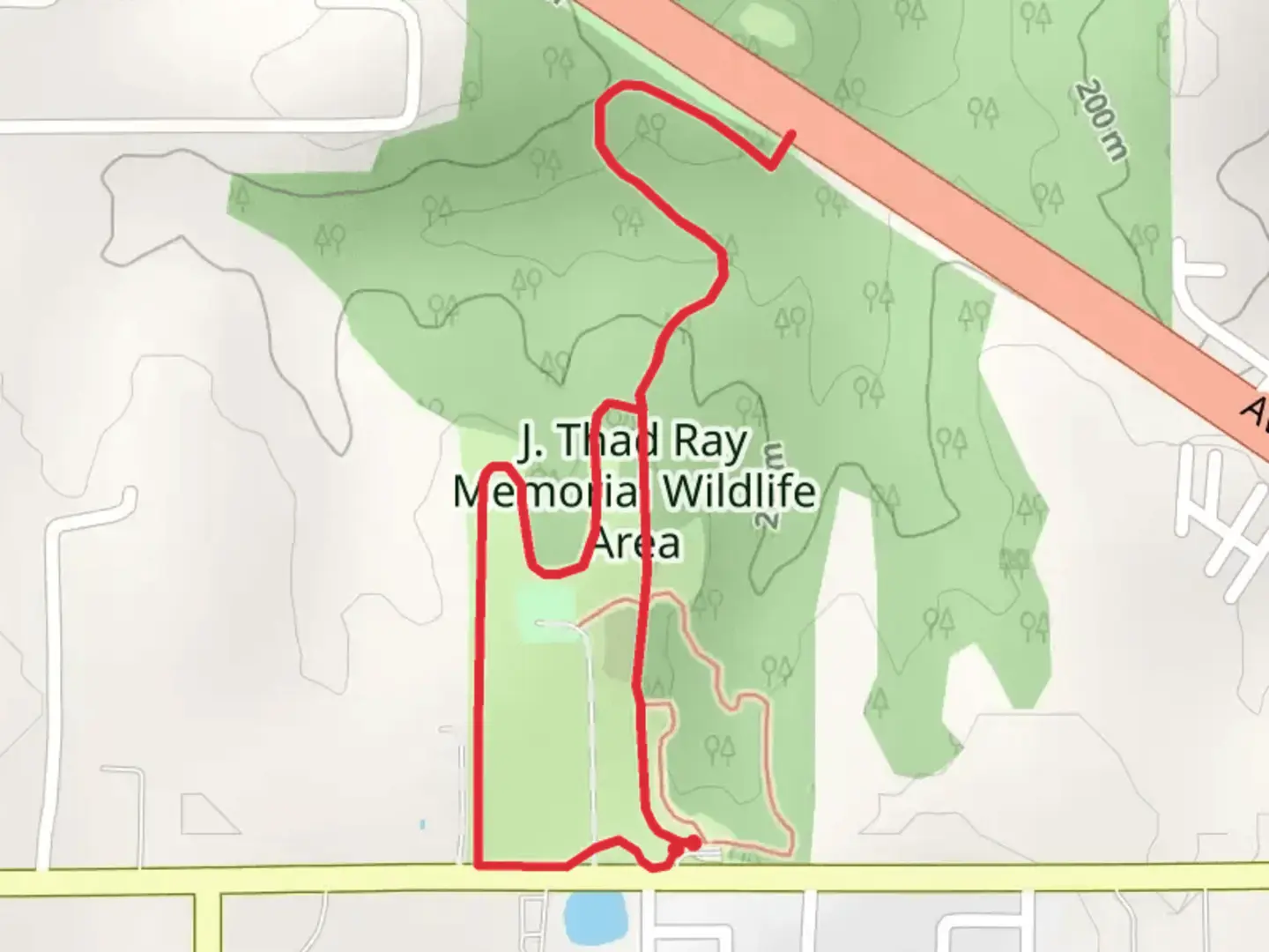
3.2 km
~46 min
80 m
Loop
“Explore the diverse landscapes and historical landmarks of the accessible Thad Ray and Hiking Loop in Missouri.”
Starting near Marion County, Missouri, the Thad Ray and Hiking Loop is a delightful 3 km (approximately 1.86 miles) loop trail with no significant elevation gain, making it accessible for a wide range of hikers. This trail is rated as medium difficulty, primarily due to its varied terrain and the need for some basic navigation skills.
Getting There
To reach the trailhead, you can drive or use public transport. If driving, head towards Marion County, Missouri, and look for parking near the nearest known address or significant landmark, such as the Marion County Courthouse. For those using public transport, the nearest bus stop is located at the Marion County Courthouse, from where you can walk to the trailhead.
Trail Navigation
For navigation, it is highly recommended to use the HiiKER app, which provides detailed maps and real-time updates. The trail is well-marked, but having a reliable navigation tool will ensure you stay on track.
Trail Highlights
As you embark on the Thad Ray and Hiking Loop, you will traverse a variety of landscapes, including dense woodlands, open meadows, and serene streams. The trail is particularly beautiful in the spring and fall when the foliage is at its most vibrant.
Flora and Fauna
The area is rich in biodiversity. Keep an eye out for native Missouri wildflowers such as the Missouri Primrose and the Purple Coneflower. Birdwatchers will be delighted by the presence of species like the Eastern Bluebird and the Red-tailed Hawk. Small mammals such as squirrels and rabbits are also commonly spotted along the trail.
Historical Significance
Marion County has a rich history dating back to the early 19th century. The trail itself passes near several historical landmarks, including remnants of old homesteads and farming equipment, offering a glimpse into the region's agricultural past. Be sure to take a moment to appreciate these historical artifacts, which add a unique dimension to your hiking experience.
Points of Interest
- Woodland Section (0.5 km / 0.31 miles): The initial part of the trail takes you through a dense forest, where the canopy provides ample shade. This section is relatively flat and easy to navigate.
- Meadow (1.5 km / 0.93 miles): As you exit the woodland, you will enter an open meadow. This is a great spot to take a break and enjoy a picnic. The meadow is also an excellent place for spotting butterflies and other insects.
- Stream Crossing (2 km / 1.24 miles): Approximately two-thirds into the hike, you will encounter a small stream. There are stepping stones to help you cross, but be cautious as they can be slippery.
- Historical Homestead (2.5 km / 1.55 miles): Near the end of the loop, you will come across the remnants of an old homestead. This area is perfect for a brief rest and some exploration.
Preparation Tips
- Footwear: Wear sturdy hiking boots as the terrain can be uneven, especially near the stream crossing.
- Water and Snacks: Bring enough water and some light snacks, particularly if you plan to picnic in the meadow.
- Weather: Check the weather forecast before heading out. The trail can become muddy after rain, making it more challenging to navigate.
- Wildlife: While the wildlife is generally harmless, it's always a good idea to keep a safe distance and avoid feeding any animals.
By following these guidelines and using the HiiKER app for navigation, you can ensure a safe and enjoyable hike on the Thad Ray and Hiking Loop.

What to expect?
Activity types
Comments and Reviews
User comments, reviews and discussions about the Thad Ray and Hiking Loop, Missouri.
4.65
average rating out of 5
40 rating(s)