Download
3D Flyover
Add to list
More
90.2 km
~3 days
180 m
Multi-Day
“Embark on a serene 56-mile trek through Minnesota's lake-dappled landscapes, steeped in natural beauty and regional history.”
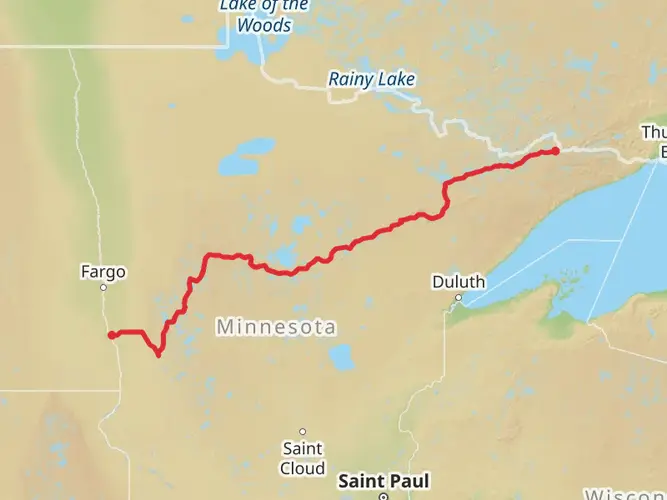
The Central Lakes State Trail offers a scenic journey through the heart of Minnesota's lake country, stretching approximately 90 kilometers (about 56 miles) with a minimal elevation gain of around 100 meters (328 feet), making it a relatively flat route. This point-to-point trail begins near Fergus Falls in Otter Tail County and extends to the city of Osakis, providing a medium difficulty level that caters to both casual and more serious hikers.
Getting to the Trailhead
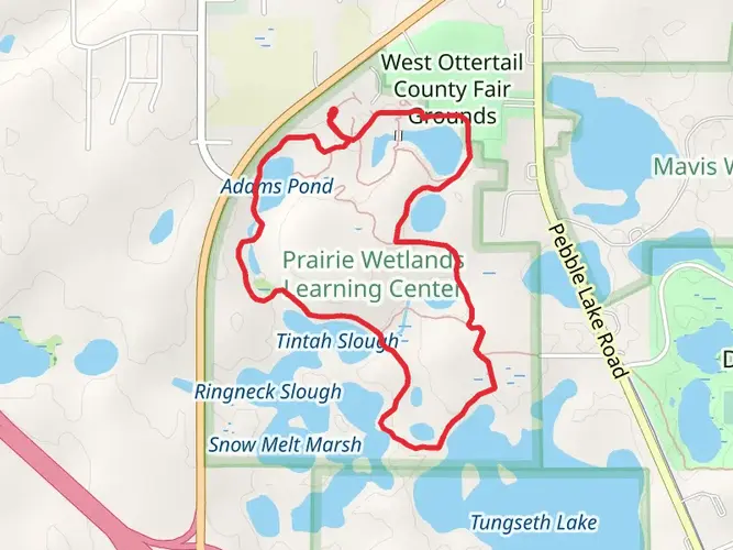
To reach the starting point of the Central Lakes State Trail, hikers can drive to Fergus Falls, which is accessible via Interstate 94. The trailhead is located near the intersection of Pebble Lake Road and West Lincoln Avenue. For those relying on public transportation, regional bus services may offer routes to Fergus Falls, but it's essential to check the latest schedules and routes.
Navigating the Trail
Hikers can utilize the HiiKER app to navigate the trail, ensuring they stay on the correct path and can identify upcoming landmarks and facilities. The app provides detailed maps and trail information, which is particularly useful for the Central Lakes State Trail, as it intersects with numerous local roads and other trails.
Landmarks and Nature
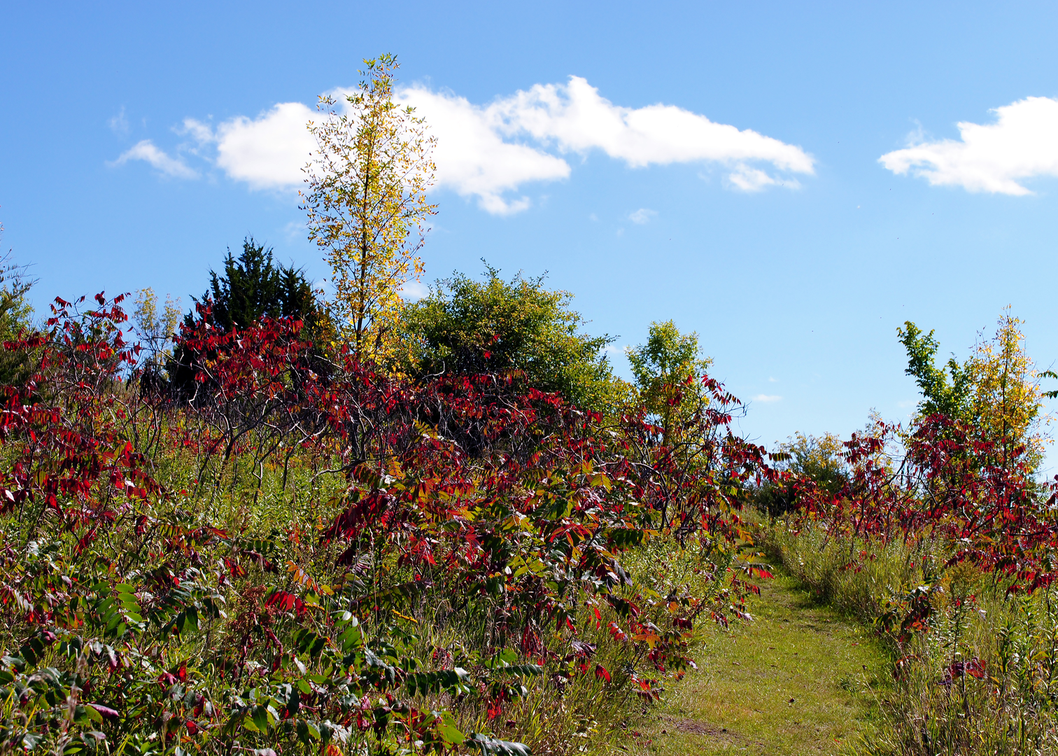
As you embark on the trail, you'll pass through a variety of landscapes, including woodlands, prairies, and wetlands. The trail is well-known for its picturesque views of the numerous lakes in the region, such as Lake Alice, Otter Tail Lake, and Lake Osakis. Approximately 30 kilometers (about 19 miles) into the hike, you'll reach Alexandria, a city known for its iconic Big Ole Viking statue and the Runestone Museum, which celebrates the region's Nordic heritage.
Wildlife and Flora
The Central Lakes State Trail is a haven for wildlife enthusiasts. The area is home to a diverse range of animals, including white-tailed deer, red foxes, and various bird species like the common loon, Minnesota's state bird. The trail also showcases an array of plant life, with wildflowers blooming in the spring and summer months, and the changing leaves offering a colorful display in the fall.
Historical Significance
The trail itself is built on a former railroad corridor, which has historical significance as part of the early transportation and economic development in the region. Along the route, hikers can find remnants of Minnesota's railroad era and learn about the early settlers and Native American tribes that once inhabited the area.
Facilities and Amenities
Throughout the trail, there are several towns and rest stops where hikers can find amenities such as restrooms, picnic areas, and water fountains. These towns also offer opportunities to explore local shops, restaurants, and cultural attractions, providing a nice break from the hike and a chance to experience the local hospitality.
Preparation and Planning
Before setting out on the Central Lakes State Trail, hikers should prepare for the changing weather conditions that can occur in Minnesota. It's advisable to bring layers of clothing, rain gear, and sun protection. Additionally, while the trail is relatively flat, it's essential to wear comfortable footwear suitable for long-distance walking. Always carry enough water and snacks, and consider the distance between towns when planning your rest stops and overnight accommodations if you're tackling the trail over multiple days.

What to expect?
Activity types
Frequently asked questions
How long is the Central Lakes State Trail and how many days does the Central Lakes State Trail take?
The Central Lakes State Trail is 90.24 kilometers, or about 56 miles, from Fergus Falls to Osakis. With only about 180 meters of climbing across the full route, strong walkers can cover it in two long days, while a more relaxed itinerary usually takes three to four days with overnight stops in trail towns such as Alexandria or Osakis.
Where does the Central Lakes State Trail start and end in Minnesota?
The Central Lakes State Trail runs point to point between Fergus Falls and Osakis in west-central Minnesota. The route follows a former railroad corridor through communities including Dalton, Ashby, Evansville, Brandon, Garfield, Alexandria, Nelson, and Osakis, and it connects at Osakis with the Lake Wobegon Trail for a longer paved trail journey.
Is the Central Lakes State Trail hard or mostly flat?
The Central Lakes State Trail is generally considered easy because it follows a former rail grade and climbs only about 180 meters over its full 90.24-kilometer length. That makes it one of the flatter long-distance routes in Minnesota, with gentle grades that suit beginners, casual walkers, and anyone looking for a low-strain multi-day trail.
Is the Central Lakes State Trail paved the whole way?
Yes. The Central Lakes State Trail is a paved state trail for its full 55-mile corridor between Fergus Falls and Osakis. Because it is built on an old railroad line, the surface is consistently smooth and the grades are nearly level, which helps make route-finding and daily mileage straightforward.
Where can you park for the Central Lakes State Trail in Fergus Falls or Osakis?
Parking is available at the Fergus Falls trailhead near Highway 210, and additional access is available at DeLagoon Park in Fergus Falls. On the east end, Osakis has trail parking near the connection with the Lake Wobegon Trail, and Minnesota DNR mapping also shows parking at places such as Lye Lake southeast of Fergus Falls.
What towns and landmarks do you pass on the Central Lakes State Trail?
The Central Lakes State Trail passes through 10 communities, including Fergus Falls, Dalton, Ashby, Evansville, Brandon, Garfield, Alexandria, Nelson, and Osakis. Alexandria is one of the biggest service hubs on the route, while the broader corridor is known for lake-country scenery, wetlands, prairie remnants, and views shaped by central Minnesota's glacial landscape.
Can you use the Central Lakes State Trail in winter?
Yes, but winter use changes. Minnesota DNR lists the entire Central Lakes State Trail as open to snowmobiles in season, so hikers should expect shared winter use and different surface conditions once snow arrives. In the warmer months, the paved corridor returns to its usual easy, nearly level character.
Comments and Reviews
User comments, reviews and discussions about the Central Lakes State Trail, Minnesota.
4.36
average rating out of 5
11 rating(s)