Download
3D Flyover
Add to list
More
118.1 km
~4 days
117 m
Multi-Day
“Embark on the Luce Line Trail for a scenic and historical trek from countryside serenity to urban buzz.”
Spanning approximately 73 miles (118 kilometers) with a minimal elevation gain of around 328 feet (100 meters), the Luce Line Trail offers a unique journey through the diverse landscapes of Minnesota. This point-to-point trail begins near Meeker County, just outside of the small town of Cosmos, and stretches all the way to the bustling outskirts of Minneapolis.
Getting to the Trailhead
To reach the starting point of the Luce Line Trail, hikers can drive to Cosmos, MN, where parking is available near the intersection of County Road 7 and Milky Way Street. For those relying on public transportation, options are limited due to the rural nature of the trailhead. However, hikers can travel to nearby larger cities and arrange for a taxi or rideshare service to the starting point.
Trail Experience
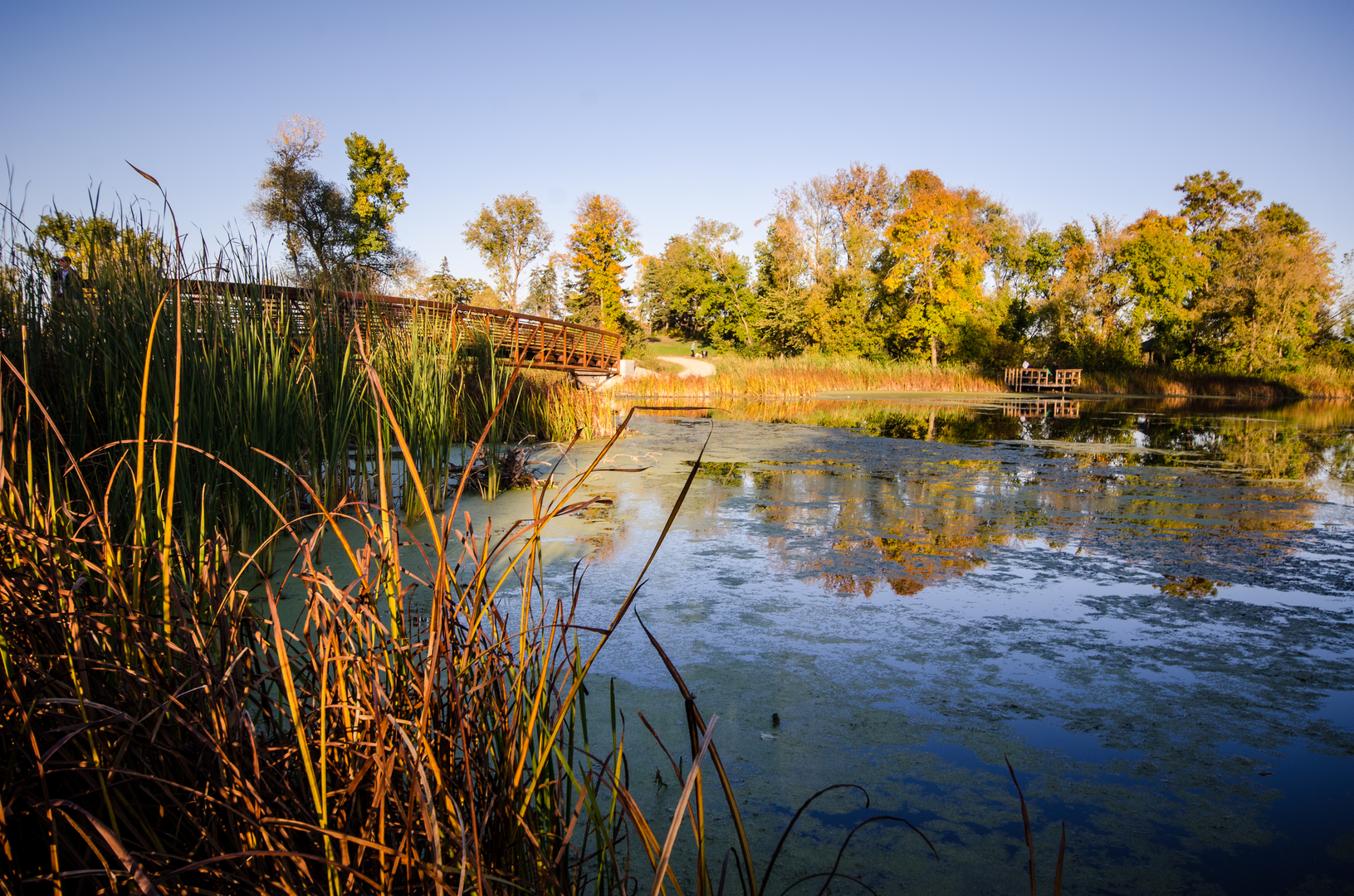
The trail kicks off on a tranquil note, meandering through the quiet countryside with vast farmlands stretching out on either side. The crushed limestone and natural surface make for a pleasant walking experience, suitable for both casual walkers and more serious hikers. As you progress, the trail transitions into a more wooded environment, offering shade and the chance to spot local wildlife such as white-tailed deer, foxes, and a variety of bird species.
Historical Significance
The Luce Line Trail is steeped in history, originally constructed as a railroad in the early 20th century. It was converted into a recreational trail in the 1990s, but as you hike, you'll notice remnants of its past, including old railroad bridges and the occasional railway tie. This historical context adds a layer of depth to the journey, inviting hikers to imagine the bustling rail activity that once took place along the same route.
Navigating the Trail
For navigation, hikers can rely on the HiiKER app, which provides detailed maps and waypoints to ensure you stay on the right path. The trail is well-marked, but having a digital tool can be invaluable, especially when traversing the more urban sections as you approach the Minneapolis suburbs.
Urban Transition and Amenities
As you approach the city, the trail surface changes to asphalt, making it more accessible for cyclists and inline skaters. This section offers a different vibe, with more people and amenities such as restrooms, water fountains, and places to rest. The trail eventually leads you into the heart of the Twin Cities metro area, where it connects with other trail systems, offering opportunities to explore further or conclude your journey.
Preparing for the Hike
Given the trail's length, it's important to plan accordingly. There are several towns along the route where you can resupply, but carrying enough water and snacks is essential. The trail is open year-round, but conditions can vary greatly with the seasons, so check the weather and prepare for anything from hot, sunny days to snow-covered paths, depending on the time of year.
Remember, the Luce Line Trail offers a unique cross-section of Minnesota's landscapes and history, from rural to urban, and is a journey well worth the trek for those looking to experience the heart of the Midwest.

What to expect?
Activity types
Frequently asked questions
How long is the Luce Line Trail and how many days does it take to hike end to end?
The Luce Line Trail is about 118.06 kilometers, or roughly 73 miles, point to point. With only about 117 meters of total elevation gain, it is more of a long-distance endurance walk than a climbing route. Most hikers break it into 3 to 5 days, depending on daily mileage, resupply plans, and whether they start near Cosmos or closer to the Minneapolis end.
What is the trail surface like on the Luce Line Trail in Minnesota?
The Luce Line Trail changes surface several times across its length. Minnesota DNR describes sections of crushed limestone, paved trail, crushed rock, and a natural mowed-grass segment, including a natural section between Cedar Mills and Cosmos. That mix makes footing generally easy, but the experience is different on the rural western stretches than on the paved eastern corridor near Plymouth.
Where can you park for the Luce Line Trail near Cosmos or other access points?
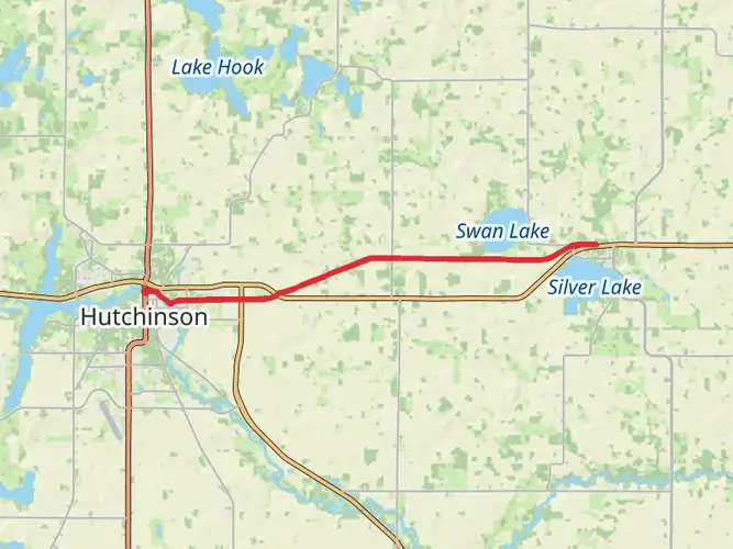
Parking is available in Cosmos, and Minnesota DNR also lists trail access parking farther east at places including Plymouth, Long Lake, Independence, Lyndale, and Carver County Road 127, along with parking in towns such as Watertown, Winsted, Silver Lake, and Cedar Mills. For a western start near Meeker County, Cosmos is one of the most practical access points.
Is the Luce Line Trail dog friendly for hiking?
Dogs are allowed on the Luce Line Trail, including the regional trail section managed by Three Rivers Park District, where dogs must stay on a six-foot non-retractable leash and owners must pick up after them. The trail's easy grades and long, non-technical stretches make it a practical option for leashed trail walks, especially on shorter out-and-back sections.
Is the Luce Line Trail good for beginners or kids?
Yes. The Luce Line Trail is generally well suited to beginners because it is rated easy and gains only about 117 meters over its full 118.06-kilometer length. Families usually choose shorter sections near towns such as Cosmos, Cedar Mills, Winsted, or Plymouth, where the gentle railroad grade and straightforward navigation are more manageable than attempting the full route.
What towns and landmarks does the Luce Line Trail pass through?
The Luce Line Trail links western and metro Minnesota, running from the Thompson Lake area west of Cosmos through towns and access communities including Cosmos, Cedar Mills, Silver Lake, Winsted, Watertown, Long Lake, and Plymouth. On the eastern end, the regional trail continues through Golden Valley and Theodore Wirth Park toward Minneapolis connections.
Can you ride horses on the Luce Line Trail?
Horseback riding is allowed on parts of the Luce Line Trail. Minnesota DNR notes a parallel horse trail on the eastern state trail segment and requires a Horse Pass for horseback riding or carriage driving. As of April 8, 2026, the bridge over the Crow River in Watertown remained closed to horses for safety reasons, so equestrian users need to account for that restriction.
Comments and Reviews
User comments, reviews and discussions about the Luce Line Trail, Minnesota.
4.6
average rating out of 5
15 rating(s)