Download
3D Preview
Add to list
More
58.2 km
~2 days
104 m
Multi-Day
“Embark on Michigan's historic Haywire Grade Trail for a scenic and wildlife-rich 58-kilometer adventure.”
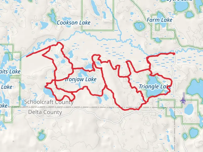
The Haywire Grade Trail, stretching approximately 58 kilometers (36 miles), offers a relatively flat journey with an elevation gain of around 100 meters (328 feet). This point-to-point trail is nestled in the heart of Michigan's Upper Peninsula, beginning near Schoolcraft County, and is considered to have a medium difficulty rating.
Getting to the Trailhead
To reach the starting point of the Haywire Grade Trail, hikers can navigate to the vicinity of Manistique, Michigan. For those driving, the trailhead is accessible via US Highway 2, turning onto M-94 and following the signs directing towards the trail. Public transportation options are limited in this rural area, so a personal vehicle or a rental car is recommended.
Trail Experience
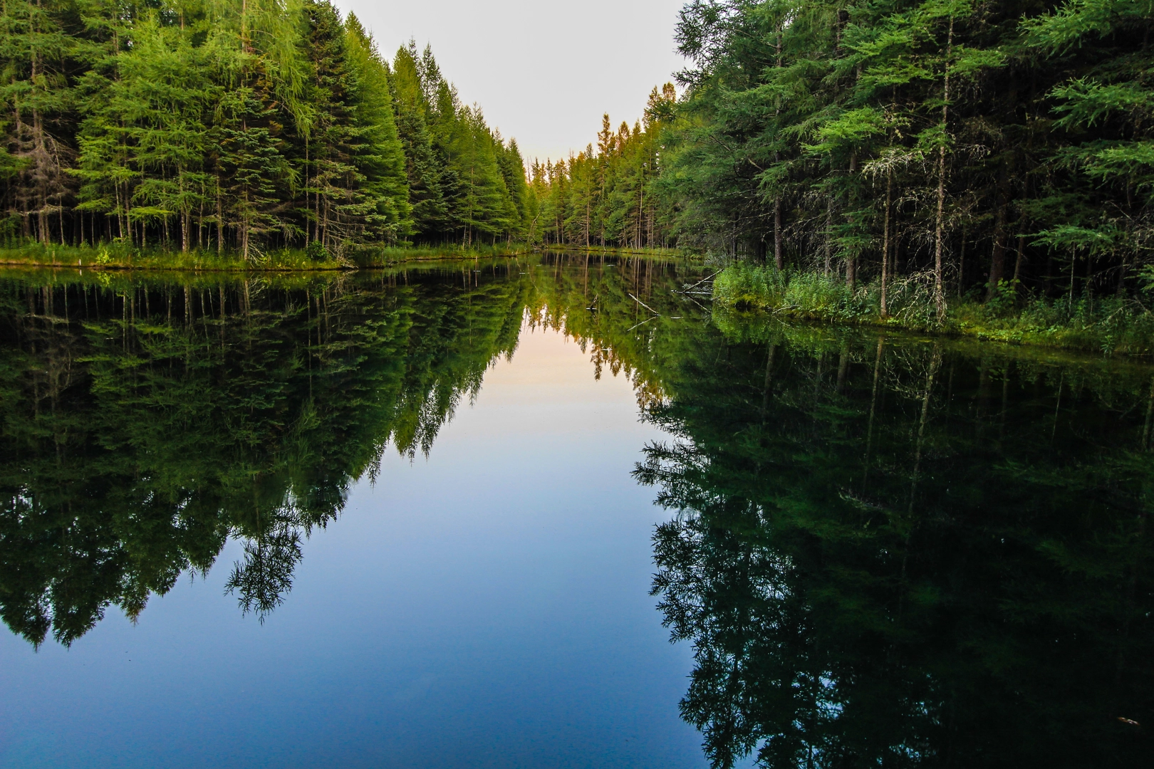
As you embark on the Haywire Grade Trail, you'll find yourself on a historic path that was once a railroad corridor. The trail is well-known for its crushed limestone and gravel surface, making it suitable for both hikers and mountain bikers. The journey begins with a gentle traverse through a mix of hardwood forests and conifer stands, providing a serene backdrop for your hike.
Wildlife and Nature
The trail offers an opportunity to witness the diverse wildlife of the region. Keep an eye out for white-tailed deer, black bears, and a variety of bird species, including the majestic bald eagle. The surrounding forests and wetlands are also home to beavers, otters, and an array of amphibians.
Landmarks and Historical Significance
Approximately 20 kilometers (12 miles) into the hike, you'll come across remnants of the area's logging history. The trail itself is a testament to the region's past, having been converted from the Manistique and Lake Superior Railroad into the recreational path you see today. This conversion is part of the nationwide Rails-to-Trails movement, preserving the historical significance of these corridors while providing a unique recreational experience.
Navigation and Planning
For navigation along the Haywire Grade Trail, HiiKER is an excellent tool to keep you on track. It's advisable to download the trail map onto your device before setting out, as cell service can be spotty in remote areas. Be sure to check the weather forecast and plan your trip accordingly, as the trail can become muddy after heavy rains.
Preparation and Safety
Due to the trail's length, it's important to carry sufficient water and food, as well as a basic first aid kit. Wear appropriate footwear for the gravel surface, and consider bringing insect repellent during the warmer months to ward off mosquitoes and ticks. Always let someone know your itinerary and expected return time before heading out on the trail.
The Haywire Grade Trail offers a unique blend of natural beauty, wildlife viewing, and historical intrigue. Whether you're looking for a long-distance hike or a leisurely walk through Michigan's Upper Peninsula, this trail provides a memorable outdoor experience.

What to expect?
Activity types
Frequently asked questions
How long does it take to hike the Haywire Grade Trail end to end?
The Haywire Grade Trail is about 58.16 km, or roughly 36 miles, from Manistique to Shingleton. Because the route is very flat with only about 104 m of elevation gain, strong hikers can cover it in a long day, but many split it into a multi-day outing because of the distance and the point-to-point logistics between Intake Park in Manistique and the M-94 trailhead near Shingleton.
Where are the main trailheads and parking areas for the Haywire Grade Trail?
The main southern access for the Haywire Grade Trail is at Intake Park in Manistique on the Indian River. On the north end, the trailhead is on the east side of M-94 just south of Shingleton, but there is no dedicated parking there; parking is available east of the Tanglewood Restaurant and Antique Shop on M-28 in Shingleton, less than a quarter mile from the trail. A third access point sits at Jack Pine Lodge on M-94 between Manistique and Shingleton.
What is the surface like on the Haywire Grade Trail for hiking?
The Haywire Grade Trail follows a former railroad corridor, so the grade stays gentle, but the tread is not a smooth crushed-stone path. Michigan DNR describes the surface as mixed sand, gravel, and coarse limestone, and other trail descriptions also note dirt and old rail ballast in places. That makes the route easy in terms of climbing, but some sections can feel rougher underfoot than a typical walking trail.
Is the Haywire Grade Trail actually easy, and is it suitable for beginners?
The Haywire Grade Trail is easy in terms of elevation, with only about 104 m of climbing over 58.16 km, so there are no major sustained ascents. The bigger challenge is endurance, since it is a long point-to-point route with a mixed surface and limited services along the corridor. Beginners often find shorter out-and-back sections from Manistique, Jack Pine, or Shingleton more manageable than attempting the full trail in one go.
What towns and landmarks does the Haywire Grade Trail connect?
The Haywire Grade Trail links Manistique and Shingleton across Schoolcraft County and follows the route of the former Manistique and Lake Superior Railroad. Notable points along the corridor include Intake Park on the Indian River in Manistique, the small historic hamlet of Steuben, and interpretive kiosks placed along the trail that highlight the area’s logging and railroad history.
Can you do the Haywire Grade Trail as a one-way hike?
Yes, the Haywire Grade Trail works well as a one-way hike because it has recognized access points at Intake Park in Manistique, Jack Pine Lodge, and the M-94 trailhead south of Shingleton. The route is linear rather than a loop, so a full end-to-end trip usually requires a vehicle shuttle or pickup plan. Without that, many hikers choose an out-and-back segment from one of the trailheads instead.
Comments and Reviews
User comments, reviews and discussions about the Haywire Grade Trail, Michigan.
4.5
average rating out of 5
10 rating(s)