Download
3D Preview
Add to list
More
61.9 km
~3 days
450 m
Multi-Day
“Embark on the Iron Ore Heritage Trail to traverse lush landscapes steeped in Michigan's robust mining lore.”
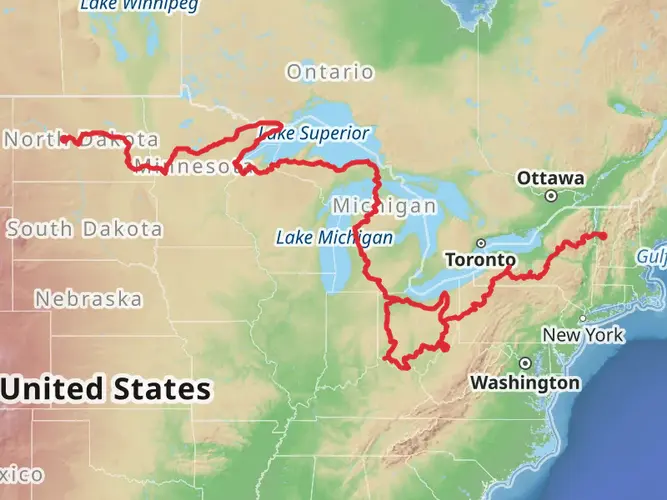
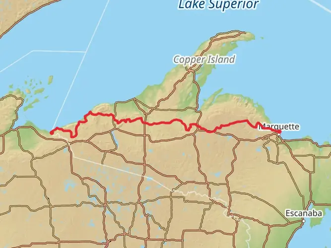
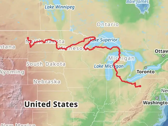
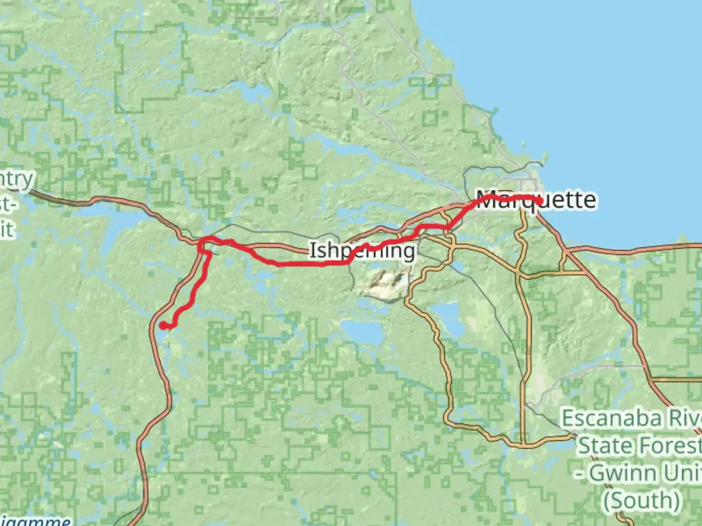
Spanning approximately 62 kilometers (about 38.5 miles) with an elevation gain of around 400 meters (roughly 1,300 feet), the Iron Ore Heritage Trail is a point-to-point path that traverses through the Marquette Iron Range in Michigan's Upper Peninsula. This trail, rated as medium difficulty, offers a unique blend of natural beauty and historical significance, making it a rewarding experience for both casual walkers and seasoned hikers.
Getting to the Trailhead
The trailhead is located near Marquette County, which is easily accessible by car. For those opting for public transportation, there are local bus services that can drop you close to the starting point, but it's essential to check the latest schedules and routes. If you're driving, you can park your vehicle at the designated parking area near the trailhead for convenience.
Historical Significance and Landmarks
As you embark on your journey along the Iron Ore Heritage Trail, you'll be following the same paths that the Marquette Iron Range miners once used to transport iron ore from the mines to the Great Lakes. The trail is a living museum, with interpretive signage and artifacts that tell the story of the region's mining history.
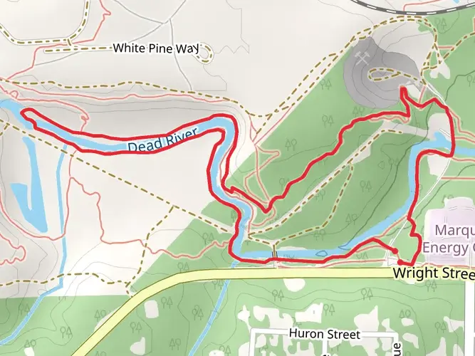
One of the significant landmarks you'll encounter is the Jackson Mine, which is one of the first iron mines in the United States. Approximately 10 kilometers (6 miles) into the trail, you'll find remnants of old mining operations, offering a glimpse into the past industrial might of the area.
Natural Beauty and Wildlife
The trail meanders through a diverse landscape of forests, wetlands, and rivers. As you hike, you'll be surrounded by the lush greenery of the Upper Peninsula, with opportunities to spot local wildlife such as white-tailed deer, beavers, and a variety of bird species. The trail also offers stunning views of the Lake Superior shoreline, providing picturesque spots for rest and reflection.
Trail Navigation and Preparation
Navigating the Iron Ore Heritage Trail is made easier with the use of the HiiKER app, which provides detailed maps and waypoints to ensure you stay on the right path. It's advisable to download the trail map on your device before setting out, as some sections may have limited cell service.
Preparation is key for a successful hike on this trail. Ensure you have enough water, as there are stretches without access to potable water. Dress in layers to adapt to the changing weather conditions typical of the region, and wear sturdy footwear suitable for the mixed-surface trail, which includes pavement, gravel, and natural terrain.
Conclusion
The Iron Ore Heritage Trail is not just a path through nature but a journey through the rich tapestry of Michigan's mining history. Whether you're looking to explore the region's past or simply enjoy the beauty of the Upper Peninsula, this trail offers a unique and fulfilling outdoor experience. Remember to respect the trail and its surroundings by following Leave No Trace principles, ensuring that this historical treasure can be enjoyed by future generations.

Frequently asked questions
How long is the Iron Ore Heritage Trail and how many days does it take to complete?
The Iron Ore Heritage Trail is 61.9 km, or about 38.5 miles, across Marquette County. Strong walkers can cover it in a long day, but many split it into two or three days because the route is point-to-point and passes through communities including Republic, Ishpeming, Negaunee, Marquette, and Chocolay Township.
Where can you park to access the Iron Ore Heritage Trail in Marquette County?
The Iron Ore Heritage Trail has multiple access points rather than a single trailhead. Common trailheads and parking areas include Republic Trailhead, Cliffs Shaft Mine Museum Trailhead, Jackson Mine Park Trailhead in Negaunee, Marquette Welcome Center Trailhead, Chocolay Lions Field Trailhead, and Chocolay Township Pocket Park Trailhead. Jackson Mine Park also has marked accessible parking and accessible restrooms.
Is the Iron Ore Heritage Trail paved or gravel?
The Iron Ore Heritage Trail is a mixed-surface route. Large sections are paved, especially near city centers, while rural stretches use crushed stone or crushed limestone, and some segments are more natural dirt. That surface mix is one reason the trail works well for easy walking, casual hiking, and long bike rides.
What towns and landmarks does the Iron Ore Heritage Trail pass through?
The Iron Ore Heritage Trail links several Marquette County communities and historic mining sites. Along the route are places such as Republic, Ishpeming, Negaunee, Marquette, and Chocolay Township, plus landmarks including Jackson Mine Park, the Cliffs Shaft Mine area, and the restored Carp River Furnace between the Marquette Commons and Marquette Welcome Center trailheads.
Is the Iron Ore Heritage Trail difficult for beginners or families?
The Iron Ore Heritage Trail is generally considered easy, with about 450 m of elevation gain spread over nearly 62 km. Because it is long but not especially steep, many beginners and families choose shorter out-and-back sections from trailheads in Negaunee, Marquette, or Chocolay Township instead of attempting the full point-to-point route.
Can you bike or use an e-bike on the Iron Ore Heritage Trail?
The Iron Ore Heritage Trail is a multi-use corridor used for walking, running, and biking, and its broad mixed-surface design makes it especially popular for cycling. Class 1 and 2 e-bikes are generally allowed under Michigan rules, but on city-owned segments in Marquette local rules are stricter, with only Class 1 e-bikes allowed there.
Comments and Reviews
User comments, reviews and discussions about the Iron Ore Heritage Trail, Michigan.
4.57
average rating out of 5
7 rating(s)