Download
Preview
Add to list
More
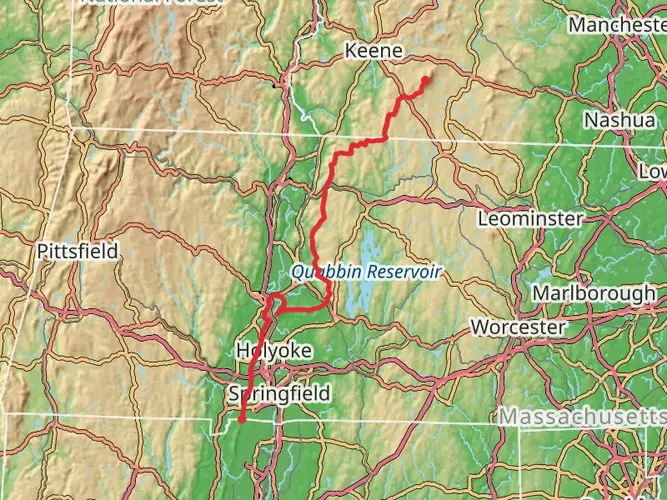
95.1 km
~4 days
1553 m
Multi-Day
“Embark on the scenic Metacomet Trail, a journey through history and nature's splendor in Southern New England.”
Spanning approximately 95 kilometers (59 miles) with an elevation gain of around 1500 meters (4921 feet), the Metacomet Trail offers a medium-difficulty hiking experience that traverses the picturesque ridgeline of the Metacomet Ridge in Southern New England. The trailhead is conveniently located near Hampden County, Massachusetts, marking the beginning of a point-to-point journey that will lead you through a diverse array of landscapes.
Getting to the Trailhead
To reach the starting point of the Metacomet Trail, hikers can drive to a location near Hampden County, where parking is available. For those relying on public transportation, the nearest bus or train stations may require a taxi or rideshare service to complete the journey to the trailhead.
Navigating the Trail
As you embark on the Metacomet Trail, it's essential to have a reliable navigation tool. HiiKER is an excellent resource for trail maps and navigation, ensuring you stay on the right path throughout your hike.
Landmarks and Scenery
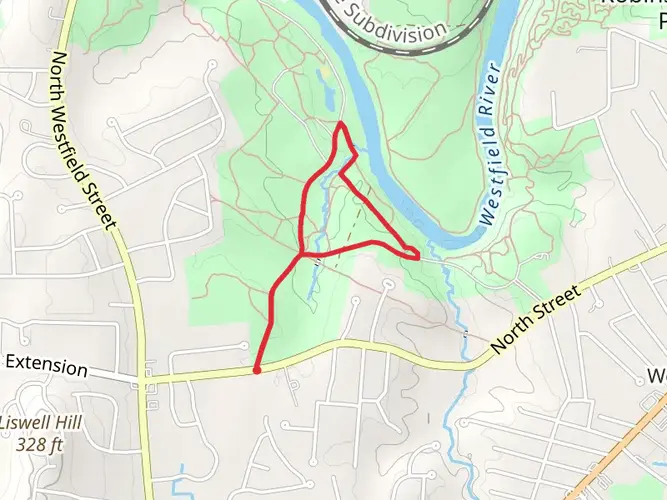
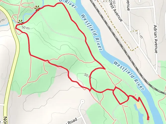
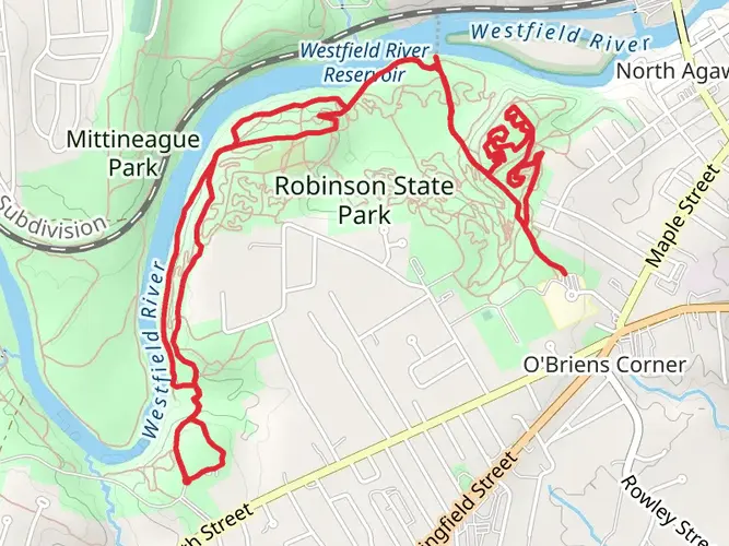
The trail will lead you through a variety of landscapes, including dense forests, open meadows, and rocky ledges that offer panoramic views of the surrounding area. Notable landmarks along the route include the dramatic cliff faces of Ragged Mountain and the basaltic outcrops of Castle Craig, which provide stunning vistas and photo opportunities.
Historical Significance
The region is steeped in history, with the Metacomet Trail itself named after Chief Metacomet of the Wampanoag tribe. As you hike, you'll be walking in the footsteps of indigenous peoples and early settlers who once traversed these ridges and valleys.
Flora and Fauna
The trail is home to a rich array of wildlife, including deer, foxes, and a variety of bird species. The changing seasons bring different experiences, from the vibrant fall foliage to the blooming mountain laurel and wildflowers in the spring and summer.
Preparation and Planning
Before setting out, ensure you have adequate water, food, and gear for the trail's duration. Weather can be unpredictable, so dress in layers and be prepared for changing conditions. It's also wise to inform someone of your hiking plans and expected return time.
Trail Etiquette and Conservation
As you enjoy the natural beauty of the Metacomet Trail, remember to practice Leave No Trace principles. Stay on marked paths, pack out all trash, and be considerate of other hikers and wildlife. By doing so, you'll help preserve the trail for future generations to enjoy.

Frequently asked questions
How long is the Metacomet Trail in Hampden County, Massachusetts?
The Metacomet Trail page for Hampden County covers 95.07 kilometers, or about 59.1 miles. With 1,553 meters of climbing across a point-to-point route, it is better suited to a full multi-day outing than a short day hike.
How hard is the Metacomet Trail and how much elevation does it gain?
This section of the Metacomet Trail is listed as easy overall, but it still includes 1,553 meters of total ascent over 95.07 kilometers. The route follows ridgeline terrain, so the effort comes more from the long distance and repeated ups and downs than from any single major climb.
What are the main landmarks on the Metacomet Trail near Hampden County?
Notable landmarks associated with the Metacomet Trail corridor include the traprock ridges of East Mountain and Mount Tom in Massachusetts, plus dramatic viewpoints farther south on the broader Metacomet route such as Ragged Mountain and Castle Craig in Connecticut. In the Hampden County area, the most recognizable scenery is the basalt ridge landscape and valley views around Mount Tom and nearby sections of the Metacomet Ridge.
Where can you park for the Metacomet Trail in the Hampden County area?
Parking for Metacomet Trail access in Hampden County is commonly tied to public lands along the ridge, especially Mount Tom State Reservation and Robinson State Park, both of which note trail access and parking through Massachusetts state park facilities. Because this is a point-to-point trail, parking logistics are usually easiest when arranged at both ends or combined with a shuttle.
Can you hike the Metacomet Trail as a day hike or is it better as a multi-day route?
The Metacomet Trail can be sampled in day-hike sections, but the full Hampden County route is 95.07 kilometers long, so it is best treated as a multi-day hike. Shorter outings are practical on ridge sections near places like Mount Tom, where road access and state reservation trailheads make section hiking more manageable.
What kind of terrain and views does the Metacomet Trail have?
The Metacomet Trail is known for traprock ridges, wooded stretches, rocky ledges, and repeated overlooks above the Connecticut River Valley. Around Hampden County, the route passes along the Metacomet Ridge near East Mountain and Mount Tom, where steep cliff bands and exposed viewpoints are part of the trail’s character.
Comments and Reviews
User comments, reviews and discussions about the Metacomet Trail, Massachusetts.
4.88
average rating out of 5
8 rating(s)