Download
3D Flyover
Add to list
More
40.4 km
~2 days
78 m
Multi-Day
“Experience the scenic Cape Cod Rail Trail, a flat, family-friendly path infused with history and nature.”
The Cape Cod Rail Trail offers an immersive journey through the natural beauty of Cape Cod, stretching approximately 25 miles (40 kilometers) with virtually no elevation gain, making it an accessible path for cyclists, runners, and hikers of all skill levels. This point-to-point trail is a converted railroad track that weaves through the diverse landscapes of Barnstable County, Massachusetts, from South Yarmouth to Wellfleet.
Getting to the Trailhead
To begin your adventure on the Cape Cod Rail Trail, you can arrive at the starting point near South Yarmouth by car or public transportation. If driving, you can park at the trailhead parking lot located on Station Avenue, just a short distance from Exit 8 off the Mid-Cape Highway (Route 6). For those opting for public transport, the Cape Cod Regional Transit Authority offers bus services that can get you close to the trailhead, where you can then bike or walk to the starting point.
Navigating the Trail
As you embark on the trail, you'll find that navigation is straightforward, thanks to the well-marked path and the availability of the HiiKER app, which provides detailed maps and waypoints to ensure you stay on course. The trail is predominantly flat and paved, making it an enjoyable experience for a leisurely hike or bike ride.
Landmarks and Historical Significance
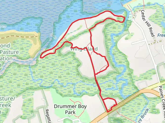
The Cape Cod Rail Trail passes through a variety of landscapes, including lush forests, freshwater ponds, and salt marshes. Notable landmarks along the way include Nickerson State Park, approximately 8 miles (13 kilometers) from the start, where you can take a detour to enjoy its clear kettle ponds and wooded trails.
Further along, at the halfway mark near Orleans, you'll cross the Jonathan Young Windmill, a historic structure dating back to the early 18th century. This area is a great spot to rest and enjoy some local history.
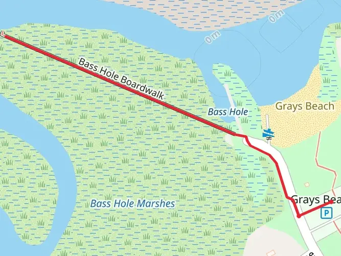
As you approach the trail's end in Wellfleet, you'll be greeted by the Cape Cod National Seashore. This federally protected area offers breathtaking views of the Atlantic Ocean and a chance to explore the region's maritime history.
Nature and Wildlife
Throughout your journey, keep an eye out for the diverse wildlife that inhabits the area. You may spot a variety of birds, including ospreys and herons, as well as other wildlife like turtles and deer. The trail's proximity to both woodland and coastal environments creates a unique opportunity for nature observation.
Preparation and Planning
Before setting out, ensure you have adequate water and snacks, as there are stretches of the trail with limited facilities. Sunscreen and insect repellent are also recommended, especially during the summer months. While the trail is open year-round, spring through fall offers the most comfortable weather for your trek.
Remember to check the HiiKER app for any updates on trail conditions or closures, and always respect the natural environment by staying on the designated path and practicing Leave No Trace principles.
Whether you're looking for a full-day excursion or a short outing, the Cape Cod Rail Trail provides a scenic and historically rich experience for visitors to this cherished region of Massachusetts.

What to expect?
Activity types
Frequently asked questions
How long is the Cape Cod Rail Trail and where does the Cape Cod Rail Trail start and end?
The Cape Cod Rail Trail is about 40.39 km, or roughly 25 to 26 miles, long. The route runs across Barnstable County from South Yarmouth and Dennis east through Harwich, Brewster, Orleans, and Eastham to Wellfleet, ending near Wellfleet Hollow State Campground.
Is the Cape Cod Rail Trail paved and easy for a full-day walk or multi-day hike?
The Cape Cod Rail Trail is a paved rail-trail with only about 78 m of total elevation gain, so it is widely considered an easy route. Its gentle grade makes it manageable for long walking days, but at just over 40 km end to end, many hikers split it into shorter sections or treat it as a relaxed multi-day outing.
Where can you park for the Cape Cod Rail Trail in South Yarmouth or Dennis?
One major access point for the Cape Cod Rail Trail is the Station Avenue trailhead in South Yarmouth, where the Town of Yarmouth lists a trailhead lot with 97 parking spaces east of Station Avenue. There is also trail access in South Dennis near Route 134, and Mass.gov notes that free parking is available for trail users at designated Cape Cod Rail Trail lots.
Is the Cape Cod Rail Trail good for families and beginner hikers?
The Cape Cod Rail Trail is one of the more beginner-friendly long trails on Cape Cod because it is paved, mostly flat, and rated easy. The route passes through several towns and crosses a mix of woods, ponds, marsh areas, and neighborhoods, so families often choose shorter out-and-back sections instead of walking the full 40.39 km.
Can dogs go on the Cape Cod Rail Trail?
Dogs are generally allowed on the Cape Cod Rail Trail when kept under control, but leash expectations can vary by managing agency and by adjoining protected land. Sections near Cape Cod National Seashore connections may have stricter seasonal or habitat-related rules, so the safest assumption is to keep dogs leashed and check posted signs at each trailhead.
What towns does the Cape Cod Rail Trail pass through on Cape Cod?
The Cape Cod Rail Trail passes through South Yarmouth and Dennis, then continues through Harwich, Brewster, Orleans, Eastham, and into Wellfleet. That town-to-town layout makes it easy to break the route into shorter segments with different trailheads, road crossings, and access points along the way.
Can you reach the Cape Cod Rail Trail by public transportation?
Public transit access is possible for parts of the Cape Cod Rail Trail through the Cape Cod Regional Transit Authority. CCRTA serves points of interest for the trail, and its fixed-route buses are equipped with bike racks, which can help with one-way trips or shorter section hikes without needing to return to the same parking lot.
Comments and Reviews
User comments, reviews and discussions about the Cape Cod Rail Trail, Massachusetts.
4.57
average rating out of 5
7 rating(s)