
Download
3D Flyover
Add to list
More
25.0 km
~5 hrs 12 min
123 m
Point to Point
“Glide along the hushed towpath to the cool, dripping darkness of Paw Paw Tunnel—if open.”
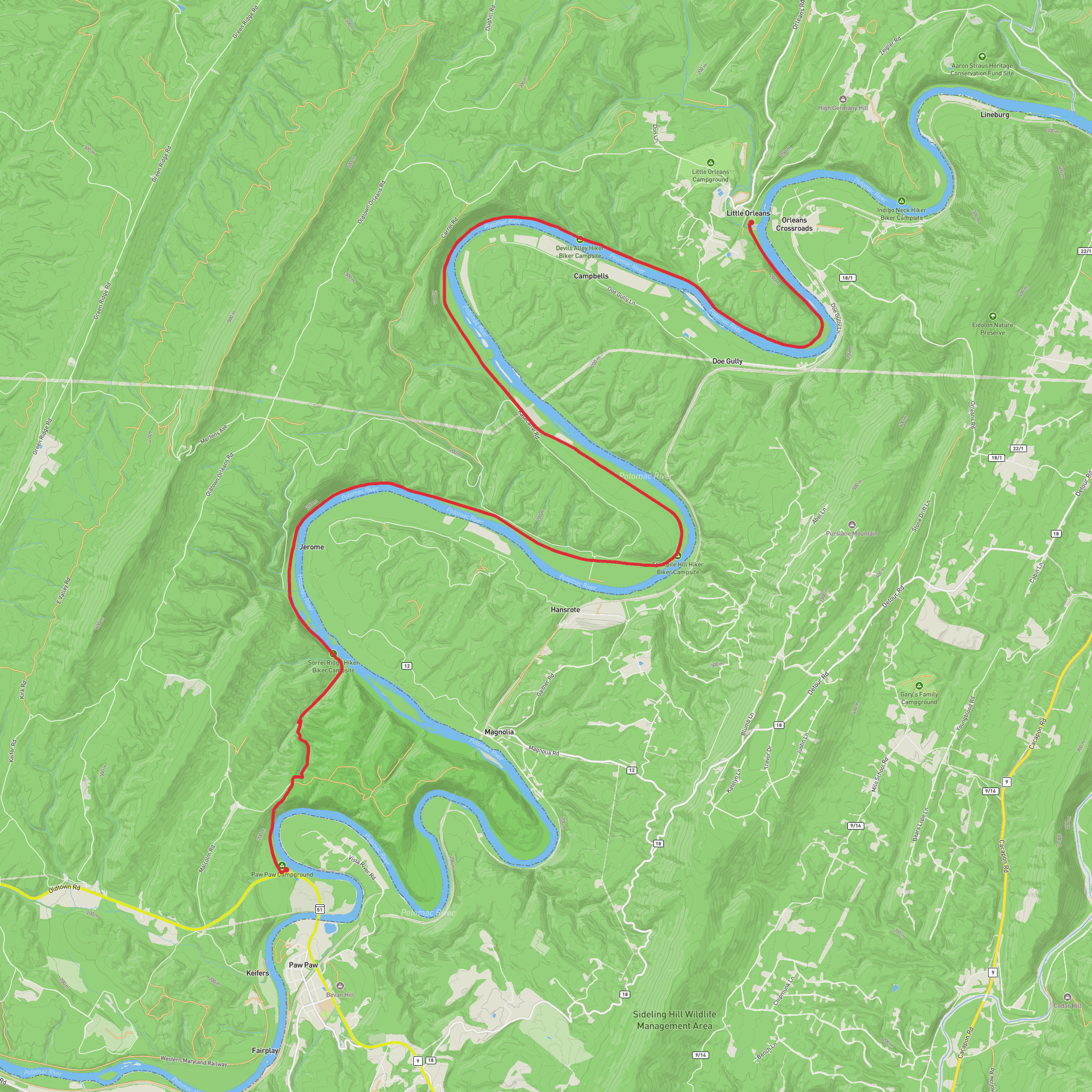
You’ll be walking a quiet, almost ruler-flat stretch of the Chesapeake & Ohio (C&O) Canal Towpath where the Potomac River loops so tightly around a ridge that 1800s engineers chose to punch straight through it—creating the Paw Paw Tunnel, the canal’s only tunnel and one of its signature landmarks. For an “easy” day at ~25 km / ~15.5 mi with ~100 m / ~330 ft of gain, this route is mostly smooth towpath cruising with one standout feature: the long, dark tunnel (and, depending on conditions/closures, a possible steep bypass over Tunnel Hill).
Where this hike starts (nearest landmark/address)
- The most common access is the Paw Paw Tunnel parking area near Oldtown, Maryland, signed for the C&O Canal. Many guides reference it as Paw Paw Tunnel, Chesapeake and Ohio Canal Towpath, Oldtown, MD 21555. (canaltrust.org)
- The C&O Canal Association lists the Paw Paw Tunnel access point at mile 156.2 with a parking lot. (candocanal.org)
- The National Park Service notes the tunnel has no street address and suggests searching for “Paw Paw Tunnel Campground” or following posted directions. (nps.gov)
Getting to the start
By car - Aim for the signed Paw Paw Tunnel access/parking area near Oldtown, MD. Cell service can be inconsistent in the river corridor, so download your route on HiiKER before you arrive.
By public transport - There isn’t practical, frequent public transit to the Paw Paw Tunnel area. The closest towns with limited regional connections still leave you with a long rideshare/taxi gap. If you must go car-free, the most realistic plan is: reach Cumberland, MD (regional rail/bus options vary), then arrange a pre-booked ride to the Paw Paw Tunnel area—confirming pickup reliability for the return.
What the route feels like underfoot
Most of the day is on the C&O towpath: a wide, mostly level corridor of packed dirt, fine gravel, and occasional muddy or rutted patches after rain. The elevation gain is low for the distance (about 100 m / 330 ft total), so the effort is more about time-on-feet than climbing.
Expect: - Long straightaways with a steady rhythm—great for consistent pacing. - Shaded sections under mixed hardwoods and riverbank vegetation. - Soft spots and puddles in low areas; after wet weather the towpath can hold water and become slick.
Key landmarks and the “must-see” section
Paw Paw Bends (the reason the tunnel exists)
The Potomac River here makes a series of tight meanders—so tight that canal planners decided it was more efficient to tunnel through the ridge than to build canal prism and towpath around the bends. NASA’s overview notes the tunnel bypass saved roughly 10 km / 6 mi of canal construction by avoiding multiple bends. (science.nasa.gov)
Paw Paw Tunnel (engineering centerpiece)
- Length: 3,118 ft / ~950 m. (nps.gov)
- It’s the only tunnel built on the C&O Canal, and it’s a standout piece of canal-era engineering. (nps.gov)
- The National Park Service recommends bringing a flashlight and looking for features like weep holes, rub rails, rope burns, and distance plates inside. (nps.gov)
Inside, it’s typically: - Cooler and damp, with water seeping in places. - Very dark—your light matters for footing and for being seen by cyclists. - Narrow-feeling, with sound carrying; be ready for oncoming traffic.
Tunnel bypass possibility (important planning note)
At times, work or rockfall mitigation has led to detours around the tunnel area. If you encounter a closure, the common alternate is the Tunnel Hill Trail over the ridge. One detour guide describes an elevation change around 350 ft / 107 m with several steep sections. (linkup.shaw-weil.com)
That’s still manageable for most hikers, but it changes the day from “flat and easy” to “short, steep climb + descent,” and it can be slippery
Surfaces
Dirt
Unpaved
Unknown
Wood
Comments and Reviews
User comments, reviews and discussions about the Paw Paw Bends and Tunnel via Chesapeake and Ohio Canal Trail, Maryland.
average rating out of 5
0 rating(s)



