Download
3D Flyover
Add to list
More
3.4 km
~46 min
64 m
Out and Back
“A gentle forest ramble reveals Orris Falls, mossy ledges, wetlands, and echoes of Maine’s past.”
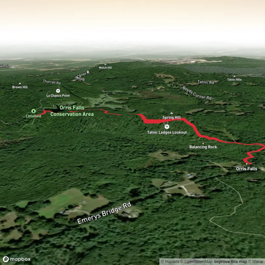
This easy woodland walk in South Berwick, Maine, is a good choice for families, casual hikers, and anyone looking for a short outing with a few standout natural features packed into a relatively small area. The route to Orris Falls is about 3 km / 1.9 miles round trip, with roughly 100 m / 330 ft of elevation gain if you include some of the rolling terrain and short side explorations; the gentlest out-and-back to the falls alone is shorter, while longer options in the preserve extend farther toward Balancing Rock and other features. The trail network is generally considered easy, with wide footpaths in many sections, but expect roots, uneven ground, damp patches, and some rocky footing near viewpoints and ledges. (mainetrailfinder.com)
The hike begins from the Thurrell Road trailhead near South Berwick, with the nearest clearly identified access point being the gated woods road on Thurrell Road in South Berwick, Maine. Parking at this main trailhead is very limited, with space for only about three cars, so arriving early is wise on weekends or during peak foliage season. There is also an alternate access area off Emerys Bridge Road with more parking, used by hikers linking into the same preserve trail system. (mainetrailfinder.com)
For drivers, the simplest approach is to navigate to Thurrell Road, South Berwick, Maine, and look for the signed gated woods road leading into the conservation area. From central South Berwick, the usual approach is via ME Route 4, Agamenticus Road, Knights Pond Road, Hooper Sands Road, Great Hill Road, and then Thurrell Road. From North Berwick, the approach is via Lower Main Street/Boyd’s Corner Road to Thurrell Road. Public transport is limited in this rural part of York County, and there does not appear to be regular service directly to the trailhead, so most hikers should plan on arriving by car or arranging a drop-off. (mainetrailfinder.com)
What the trail is like
Right from the start, the route follows an old woods road through mixed forest, making for a gentle and approachable beginning. The grade is mostly mild, which suits the easy rating, but the trail is not completely flat. Small rises and dips add interest, and after rain the ground can be muddy in places, especially around wetland sections and low spots. The path is usually easy to follow, though some side trails and junctions in the preserve can create minor confusion, so carrying the route in HiiKER is a smart idea if you plan to explore beyond the main falls walk. (mainetrailfinder.com)
Within roughly 0.8 to 1.6 km / 0.5 to 1 mile, hikers reach the area around Orris Falls, one of the preserve’s signature landmarks. The falls drop through a dramatic gorge reported at about 90 ft / 27 m deep, giving this short hike a surprisingly rugged focal point. Water levels can vary a lot depending on season and recent rainfall, so the falls may be much more impressive in spring or after wet weather than during dry periods. Near the falls, footing can become slick on rock, leaf litter, and damp soil, so extra care is needed even on an otherwise easy route. (mainetrailfinder.com)
Landmarks, nature, and wildlife
One of the strengths of this hike is how much variety it offers for such a short distance. The conservation area includes vernal pools, wetlands, ledges, beaver habitat, and large glacially deposited boulders. If you continue farther into the network, you may encounter features such as Balancing Rock and the Big Bump, along with occasional views toward Mount Agamenticus when leaves are down. Even hikers sticking to the shorter Orris Falls outing will pass through a landscape shaped by both water and ice, with rocky outcrops and marshy sections giving the walk a distinctly southern Maine character. (mainetrailfinder.com)
Wildlife sightings can include songbirds, amphibians around the wet areas, and signs of beaver activity near the marshes and ponds. In warmer months, insects can be intense, especially around wetlands and during peak bug season, so repellent and lightweight long sleeves are worth considering. In cooler months, the preserve can feel quieter and more open, and in winter the frozen marsh area may attract snowshoers when conditions are suitable. (mainetrailfinder.com)
Historical significance
This is not just a nature walk; it also passes through a landscape with traces of earlier settlement. Parts of the trail follow what was once an old colonial road, and the preserve contains stone foundations associated with the home and barn of Orris and Mercy Littlefield, who lived there in the late 1800s. Those remnants add context to the hike, showing

Surfaces
Dirt
Unknown
Comments and Reviews
User comments, reviews and discussions about the Orris Falls Trail, Maine.
average rating out of 5
0 rating(s)