
Tumbledown Dick Falls and Leavitt Pond via Tumbledown Dick Trail
Download
3D Flyover
Add to list
More
12.1 km
~2 hrs 42 min
178 m
Out and Back
“A gentle-feeling forest ramble leads past lonely ponds to a dramatic waterfall on rugged tread.”
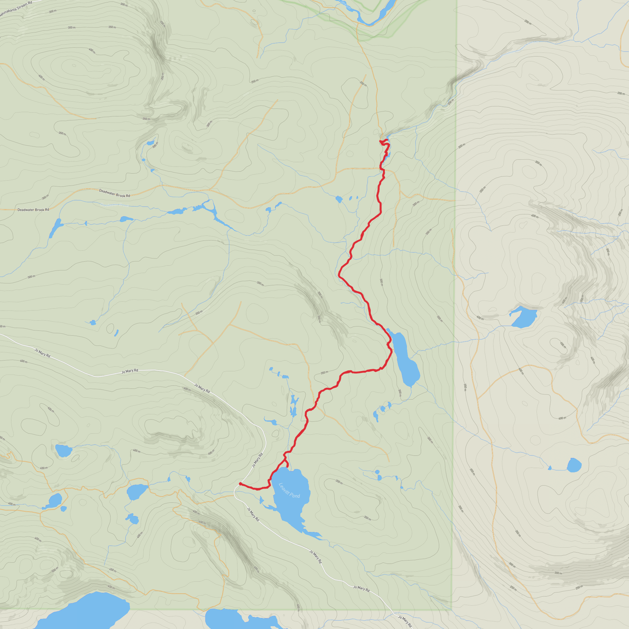
This easy, mostly low-gradient walk in Maine’s Nahmakanta Public Reserved Land leads through quiet forest to two remote ponds and a striking waterfall, covering about 12 km / 7.5 miles round trip with roughly 200 m / 650 ft of cumulative elevation gain. The tread is generally gentle rather than steep, so the challenge comes less from climbing and more from the trail’s primitive character: expect roots, rocks, wet patches, occasional blowdown, and stretches where the footpath is less distinct than a typical front-country hike. The route is blue-blazed and relatively flat overall, with only minor ups and downs along the way. (mainetrailfinder.com)
The hike begins from the southern Jo-Mary Road access for the Tumbledown Dick Trail in the southeastern corner of Nahmakanta Public Lands, a little over 1.5 miles north of the Henderson Checkpoint on Jo-Mary Road. The nearest practical landmark is the Henderson Checkpoint on Jo-Mary Road, near the Nahmakanta Public Reserved Land access roads in Piscataquis County, Maine; from there, the trailhead is a short drive farther north on the same road. Maine Trail Finder notes that the start is marked with double blue blazes and sits about 150 yards north of the Turtle Ridge Loop East Trailhead. (mainetrailfinder.com)
By car, most hikers approach via ME Route 11 and then the private Jo-Mary Road, passing through the Jo-Mary gate system used for access into this part of the North Maine Woods. Anyone entering via Jo-Mary to reach Nahmakanta is charged a day-use fee during the operating season, and the roads are gravel logging roads where slow driving, yielding to trucks, and carrying a spare tire are all wise precautions. Cell service can be weak to nonexistent in the area. Public transport is effectively not available to the trailhead, so this is a drive-in hike rather than one you can realistically reach by bus or rail alone. (northmainewoods.org)
What the route is like
From the southern trailhead, Leavitt Pond arrives quickly—within about 0.4 km / 0.25 mile—making it an early landmark and a good place to settle into the rhythm of the walk. A side trail near the north shore leads to a primitive campsite. Beyond Leavitt Pond, the trail continues through forest with a mix of older woods and regenerating areas that were previously harvested, then passes Tumbledown Dick Pond before following Tumbledown Dick Stream toward the falls. (mainetrailfinder.com)
Approximate waypoints from the southern trailhead are: - Leavitt Pond: 0.4 km / 0.25 mile - Tumbledown Dick Falls: about 4.8 km / 3 miles one way - Round trip to the falls and back: about 9.6 km / 6 miles - Extending the outing to include more wandering around Leavitt Pond, pond-side spurs, or a fuller out-and-back toward the northern end can bring the day closer to the stated 12 km / 7.5 miles. (mainetrailfinder.com)
The waterfall is the standout feature. Tumbledown Dick Falls is described as a narrow chute dropping into a pool, with short side paths leading to viewpoints above and below the cascade. One source describes it as roughly 70 feet / 21 m high, which helps explain why it feels like a major destination despite the otherwise mellow terrain. Near the falls, the trail briefly follows an old road and crosses a newer forest management road before the final approach. (mainetrailfinder.com)
Terrain, timing, and navigation
Although the route is rated easy, it is not manicured. The trail tread can be faint in places, and the footing is often uneven. That means sturdy footwear is still useful even on a low-elevation day. After rain, roots and rocks can be slick, and low spots may hold water. Because the route is remote and lightly developed, hikers should not expect frequent signage or quick assistance if something goes wrong. Using HiiKER before setting out is a smart way to confirm the route line, trail junctions, and distances. (mainetrailfinder.com)
A
Surfaces
Dirt
Unknown
Comments and Reviews
User comments, reviews and discussions about the Tumbledown Dick Falls and Leavitt Pond via Tumbledown Dick Trail, Maine.
average rating out of 5
0 rating(s)
