Download
3D Flyover
Add to list
More
1.5 km
~23 min
58 m
Out and Back
“A brief forest stroll drops into a rugged ravine, where lively falls surge through sculpted stone.”
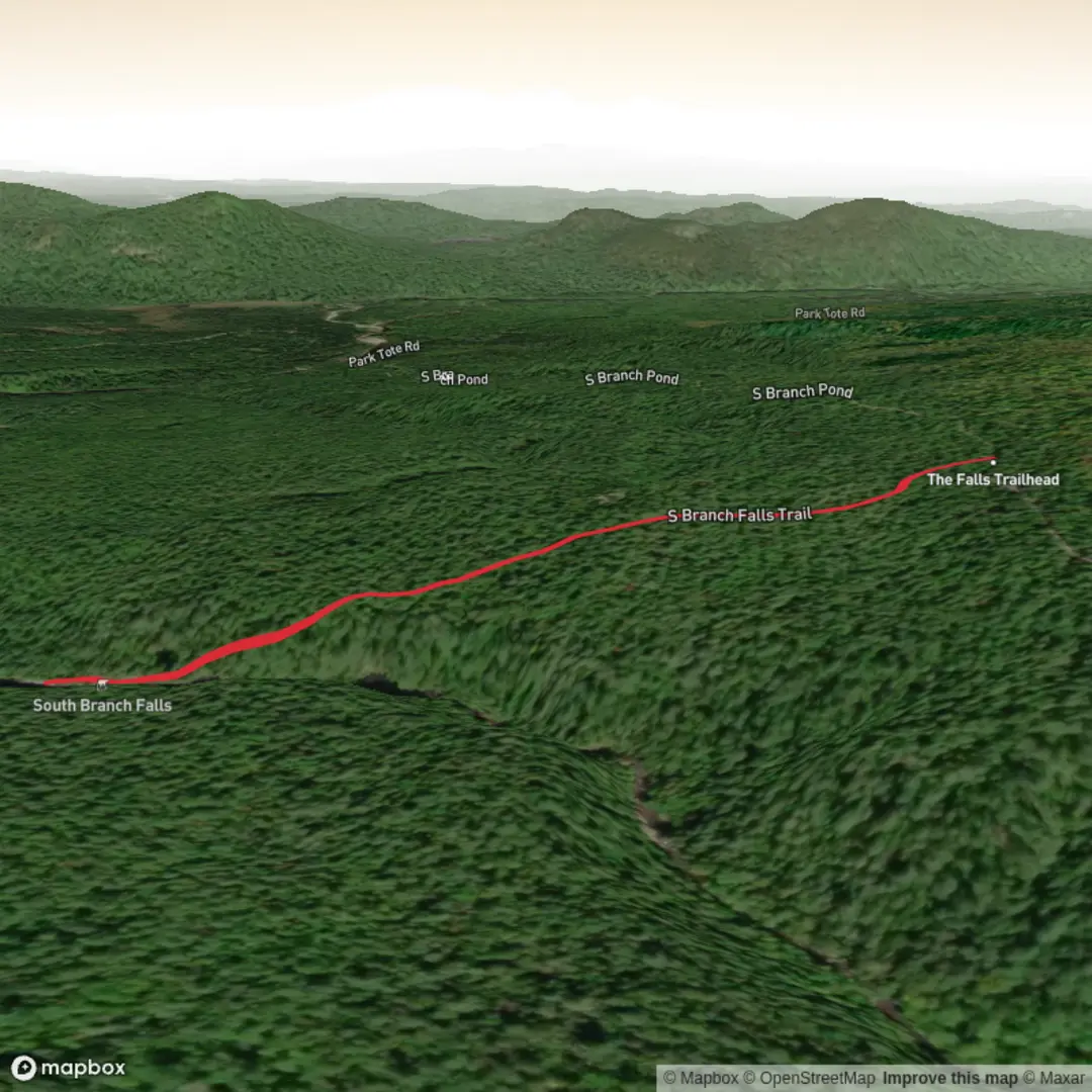
This short waterfall walk in Baxter State Park packs a lot into a small distance. Expect roughly 1 km / 0.6 miles round trip with about 100 metres / 330 feet of elevation change overall, though the steepest part is concentrated near the brook and can feel more demanding than the numbers suggest. The route is generally rated medium because the approach is brief but uneven, with a noticeable descent into a ravine and slick rock near the falls. Maine Trail Finder describes it as a short hike to a set of falls on South Branch Pond Brook, while recent trail listings place it at about 0.9 to 1.0 miles round trip with 177 feet / 54 metres of elevation gain depending on how the route is measured. (mainetrailfinder.com)
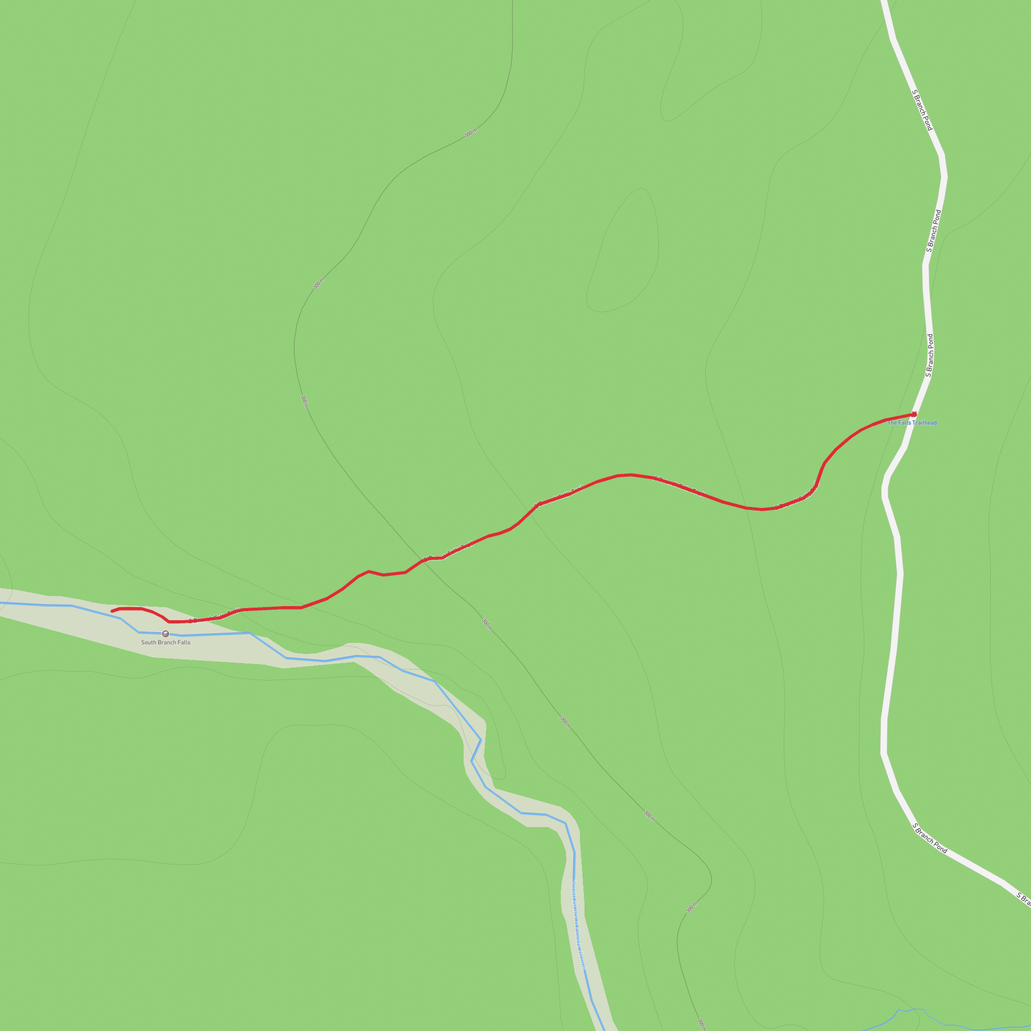
The trailhead is in the South Branch Pond area of Baxter State Park, at a small parking area on the west side of South Branch Pond Road, about 1.3 miles / 2.1 km south of the Park Tote Road junction and about 1 mile / 1.6 km north of South Branch Pond Campground. The nearest significant landmark is South Branch Pond Campground, in the park’s remote north end near the Matagamon Gate. One parking reference published for the falls is approximately 46.11860, -68.91380, which corresponds to the roadside parking area near South Branch Pond Road, Baxter State Park, near South Branch Pond Campground, T5 R9 WELS, Maine. (mainetrailfinder.com)
Getting there is straightforward by car but remote. From Patten, Maine, drivers typically head west toward Baxter State Park’s Matagamon Gate, then continue on the park road system toward South Branch Pond. Baxter State Park notes that Patten is about 24 miles from Matagamon Gate, and that it takes about 45 minutes to reach Matagamon Gate from Patten, then about 30 more minutes to drive from the gate to the South Branch Campground road area, passing the South Branch Falls parking area on the way. Roads in this part of the park are long, rural, and subject to seasonal conditions, so checking current park access before departure is important. Public transport to the trailhead is effectively not available; most hikers will need a private vehicle and should plan for limited services once inside the park. (baxterstatepark.org)
What the walk is like
From the parking area, the trail starts gently enough, moving through a forest of poplar and birch before reaching the edge of a deep ravine cut by South Branch Pond Brook. That easy opening can be misleading: once the trail tips into the ravine, the footing becomes steeper and more irregular. Maine Trail Finder notes that the route drops sharply to a series of ledges, and that the falls are formed where water shoots through several clefts in the bedrock. This is the defining feature of the hike: not a huge, open curtain waterfall, but a compact, forceful cascade shaped by rock, channeling water through narrow stone slots and polished ledges. (mainetrailfinder.com)
Because the trail is short, many hikers reach the main viewpoint quickly, often in well under an hour round trip even with time spent at the falls. The challenge comes from terrain rather than endurance. Expect roots, rock, and potentially wet surfaces, especially after rain or during spring runoff. The ledges near the brook deserve extra care; they can be smooth, slanted, and slippery even when they look dry. If traveling with children, this is a hike where close supervision matters most at the bottom near the water and exposed rock.
Landmarks, scenery, and seasonal character
The main landmark is the waterfall itself, where the brook narrows and accelerates through bedrock chutes. The rock formations are part of what makes this stop memorable: the stream has carved a confined passage through resistant stone, creating a rugged set of cascades and pools rather than one single vertical drop. In higher water, especially in spring and early summer, the falls are much more dramatic; in mid- to late summer and into autumn, flow may be lower and the scene quieter, though the exposed ledges and ravine remain attractive. (mainetrailfinder.com)
The surrounding forest is typical of Baxter’s north woods, with mixed hardwoods near the trail and broader boreal character across the region. Hikers should watch for songbirds, red squirrels, chipmunks, and signs of larger mammals such as moose in the wider South Branch Pond area. Wildlife encounters are never guaranteed, but this part of Baxter is known for its relatively wild, lightly developed setting. In
Surfaces
Unknown
Unpaved
Comments and Reviews
User comments, reviews and discussions about the South Branch Falls Trail, Maine.
average rating out of 5
0 rating(s)
