Download
Preview
Add to list
More
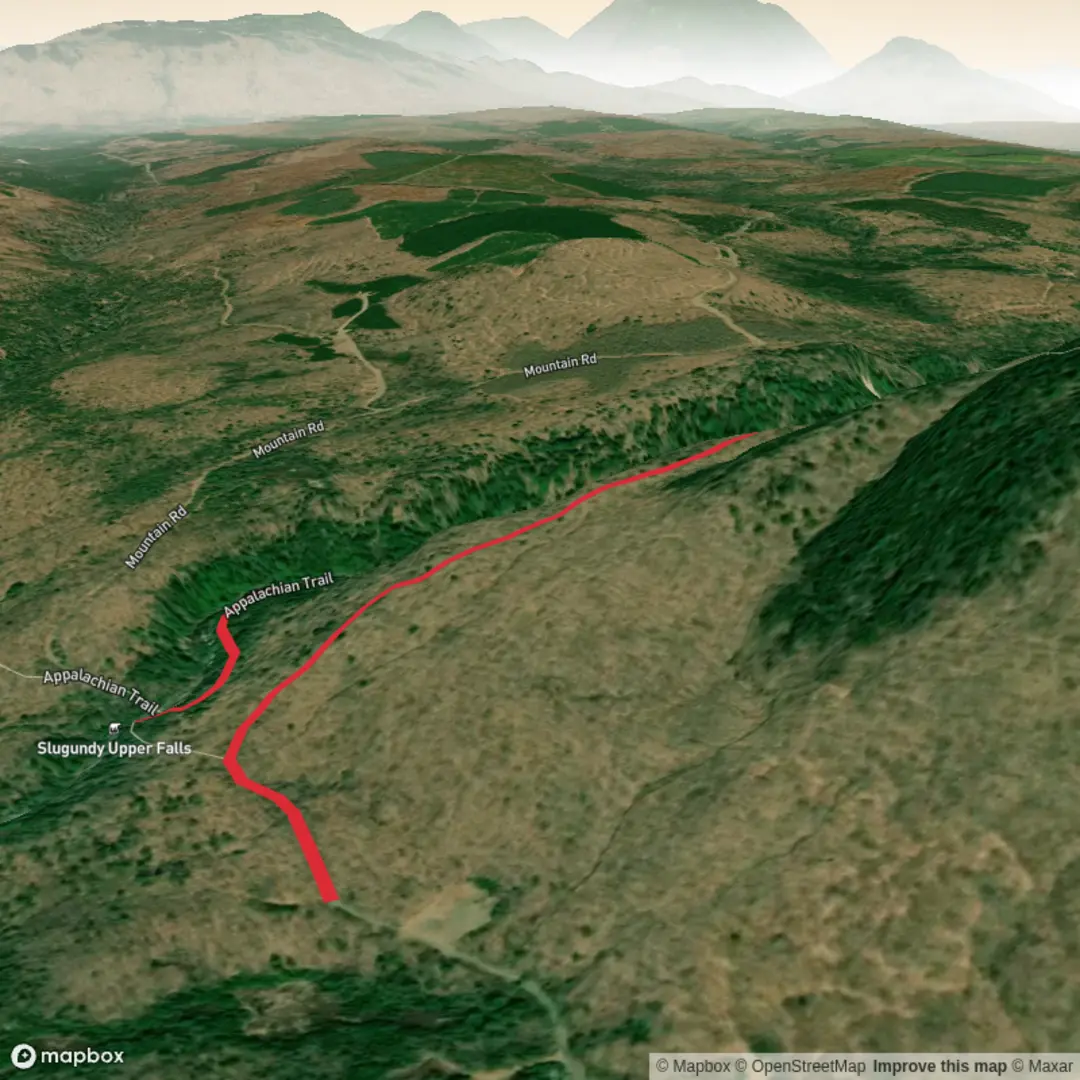
5.1 km
~1 hrs 23 min
227 m
Out and Back
“A quiet Appalachian Trail ramble through deep Maine forest leads to wild, rewarding cascades.”
This is a short but rewarding waterfall hike in the Maine Highlands, following a section of the Appalachian Trail through deep forest to the Slugundy Falls area in Piscataquis County. Although you’ve listed it at around 5 km (3.1 miles) with roughly 200 m (656 ft) of climbing, hikers should be aware that some online route listings for “Slugundy Upper Falls via Appalachian Trail” show a longer outing depending on exactly where you begin and whether you continue past the falls. The destination itself is in the Long Pond Stream / Barren Mountain area, with Slugundy Upper Falls located near Long Pond Stream Lean-to and close to Vaughn Stream Falls and Slugundy Lower Falls. (gaiagps.com)
The setting is notably remote. Slugundy Upper Falls sits in the Appalachian Trail corridor in the Katahdin Iron Works region of central Maine, an area known for rugged woods roads, stream valleys, and classic backcountry terrain rather than front-country trail infrastructure. Expect a quieter, more isolated feel than on Maine’s better-known roadside waterfall walks. (waterfallhikes.com)
Getting to the start
The nearest useful landmark for the falls is Long Pond Stream Lean-to, near the Appalachian Trail in Elliotsville Township, Piscataquis County, Maine, with Slugundy Upper Falls about 0.9 km / 0.6 miles southwest of the shelter. The broader access area is generally approached from the Katahdin Iron Works / Brownville–Greenville region via logging and gravel roads. (mapcarta.com)
By car, most hikers approach from the Greenville or Brownville side and use the Katahdin Iron Works road network to reach an Appalachian Trail access point in the Long Pond Stream area. Road conditions can vary with weather, grading, and logging activity, so a high-clearance vehicle is helpful even when a standard car may be able to get in during dry conditions. This is the kind of trailhead approach where fuel, paper backup directions, and offline navigation matter. For route planning and on-trail positioning, use HiiKER. Some nearby hiking access in the Katahdin Iron Works area is also on privately managed land where fees or checkpoint procedures may apply depending on the exact road and destination. (alltrails.com)
Public transport is effectively not a practical option for the final approach. Greenville is the nearest service hub of note, but there is no regular transit that will take you directly to this remote Appalachian Trail access. Most hikers should plan on driving or arranging a private shuttle. This is an inference based on the remoteness of the area and the nature of the access roads rather than a published transit schedule for the falls themselves. (www11.maine.gov)
What the hike is like
The route trends through classic Maine forest: mixed woods, damp ground in places, roots, rocks, and short uneven pitches rather than smooth path throughout. A medium rating fits well for hikers who are comfortable on natural trail surfaces, but the difficulty can feel higher after rain because wet rock, mud, and slick roots are common on Appalachian Trail terrain in this region. (gaiagps.com)
If your outing is the shorter version of about 5 km (3.1 miles), expect a steady woodland approach with moderate climbing spread across the route rather than one single sustained ascent. Around 200 m (656 ft) of elevation gain is enough to make the hike feel active without turning it into a major mountain day. The trail is best suited to hikers with sturdy footwear and comfort on uneven ground. (waterfallhikes.com)
The main attraction is the falls corridor itself. Slugundy Upper Falls is part of a cluster of scenic water features that includes Vaughn Stream Falls and Slugundy Lower Falls, so the walk has more visual interest than a single out-and-back to one viewpoint. Water levels will strongly affect the character of the hike: after rain or during spring runoff, the cascades are louder and more dramatic, while late summer can bring lower flow and more exposed rock. (gaiagps.com

Surfaces
Ground
Unknown
Comments and Reviews
User comments, reviews and discussions about the Slugundy Upper Falls via Appalachian Trail, Maine.
average rating out of 5
0 rating(s)