Download
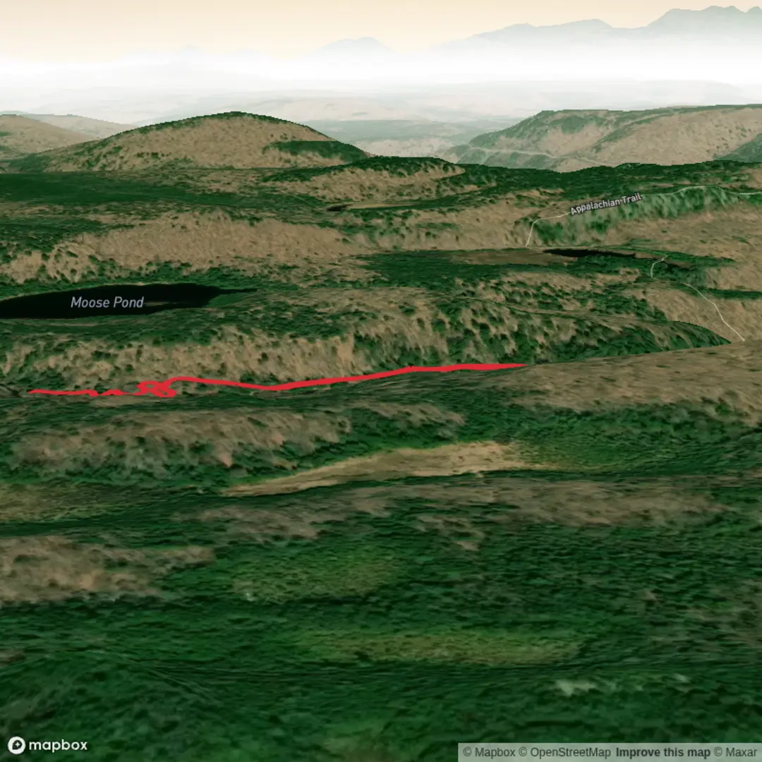
3D Flyover
Add to list
More
1.7 km
~20 min
0 m
Out and Back
“A gentle forest wander leads to a roaring gorge waterfall, where beauty meets Maine’s wild edge.”
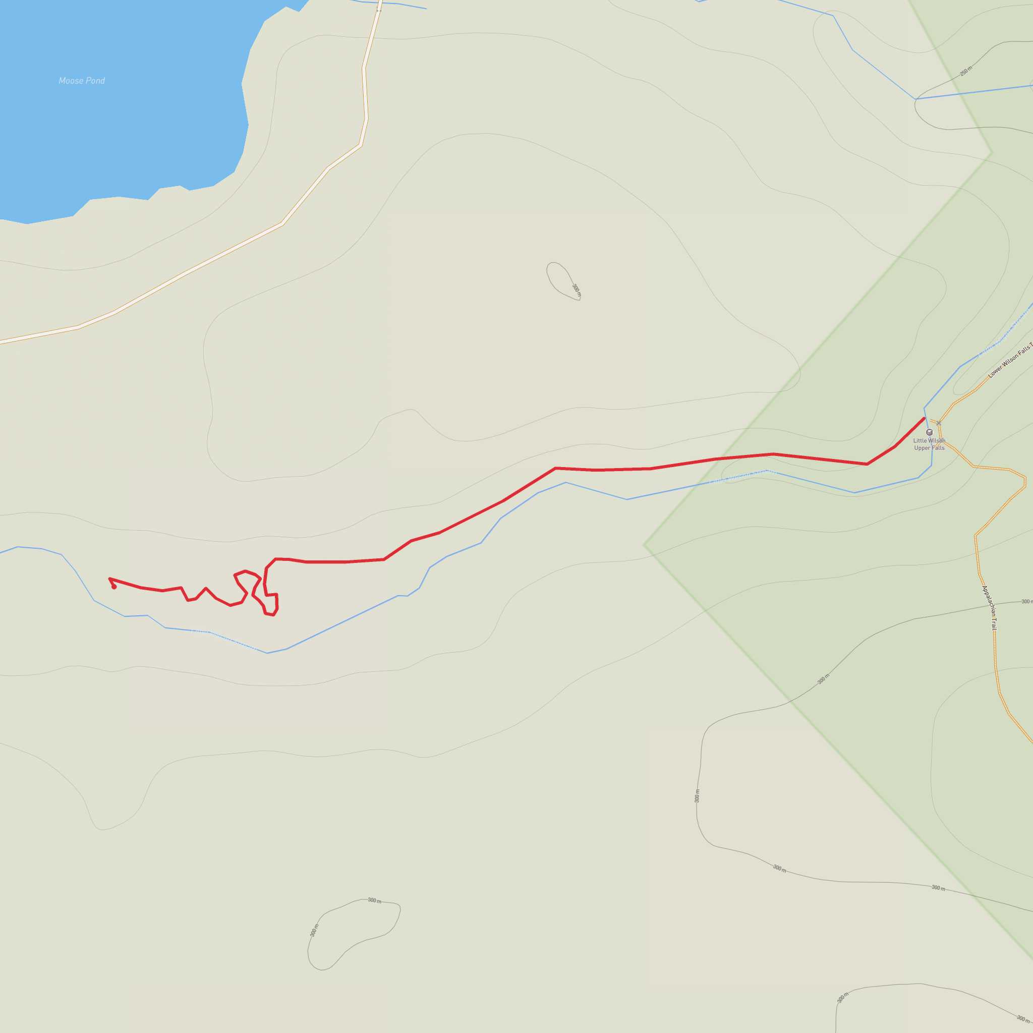
This is a short, easy out-and-back to one of the prettiest waterfalls in Maine’s 100-Mile Wilderness region, with roughly 2 km (1.2 miles) of walking and very little overall elevation gain. The route is well suited to families, casual walkers, and anyone looking for a quick scenic stop, but the terrain around the falls can still be slippery and uneven, especially after rain or during spring runoff.
The walk begins near Little Wilson Stream Road / Elliotsville Road in the Brownville–Elliottsville area, near Gulf Hagas and KI Road access points, which is the most useful landmark for planning arrival. This is a remote part of Piscataquis County, west of Brownville Junction and north of the Appalachian Trail corridor, so even though the hike itself is short, the approach feels much more backcountry than the mileage suggests. Expect a forested setting, gravel-road access, and limited services once you leave the nearest towns.
Getting to the trailhead
By car, most hikers approach from Brownville, Maine, then follow local roads toward the Gulf Hagas / KI Jo-Mary Forest access area. The final approach is typically on unpaved forest roads, so road conditions can vary with weather, washouts, logging activity, and seasonal maintenance. A standard vehicle is often enough in dry conditions, but drivers should still expect potholes, loose gravel, and occasional rough patches. Fuel up beforehand and download navigation in advance; for on-trail guidance, use HiiKER.
Public transport is very limited. There is no practical direct transit to the trailhead, and most visitors will need a car. The nearest communities with basic services are generally Brownville and Monson, but this is still a remote outing by Maine standards. If you are relying on a drop-off, arrange it carefully and confirm pickup timing, since cell service can be unreliable.
What the hike is like
The route is short and generally gentle, making it feel more like a scenic woodland walk than a strenuous hike. Over 2 km (1.2 miles), the path usually trends through mixed forest with only minor undulations, so the total ascent is close to 0 m (0 ft) in practical terms, though there may be small rises, roots, and uneven footing along the way.
The trail surface can include packed earth, leaf litter, exposed roots, and damp sections. In wet weather, mud is common, and the rock near the waterfall can become slick. Because the hike is brief, many people underestimate it and arrive in casual shoes; sturdy footwear with grip is still the better choice, especially if you plan to explore viewpoints near the water.
The main attraction is Upper Little Wilson Falls, where Little Wilson Stream drops through a rocky gorge in a dramatic cascade. Depending on water levels, the falls can range from pleasantly photogenic to loud and forceful. Spring snowmelt and periods after heavy rain usually bring the most impressive flow, while late summer may reveal more of the rock structure around the stream.
Landmarks, scenery, and what to watch for
The forest around the trail is typical of inland Maine: a mix of conifers and northern hardwoods, with mossy ground, ferns, and a cool, shaded feel for much of the walk. The sound of moving water often builds gradually as you approach the falls, which adds to the sense of arrival.
At the waterfall itself, expect ledges, boulders, and viewpoints that invite lingering. The gorge is the standout feature, and the contrast between dark rock, white water, and dense green forest gives the area a distinctly wild character despite the short distance. If water levels are high, keep well back from edges and avoid stepping onto wet rock shelves.
Wildlife in the broader region can include white-tailed deer, moose, red squirrels, snowshoe hare, and a variety of songbirds and woodpeckers. Black bears also inhabit this part of Maine, though sightings on a short daytime hike are uncommon. In warmer months, insects can be a major factor—mosquitoes and black flies are often the biggest comfort issue, particularly in late spring and early summer. Long sleeves, repellent, and a little patience can make a big difference.
Difficulty and preparation
Although rated Easy, this hike is best thought of as easy in distance rather than completely hazard-free. The biggest risks are usually environmental: slick rock, wet roots, children getting too close to the water, and underestimating how remote the access roads are. If traveling with kids, keep a close eye on them near the falls.
Bring water even for a short outing, and pack a light rain layer because weather can shift quickly in the Maine woods. Footwear with traction is more important than hiking fitness here. If visiting in shoulder seasons, expect colder spray and potentially icy patches. In summer, bug protection matters almost as much as boots.
Historical significance of the area
This hike sits within a landscape strongly associated with Maine’s North Woods, a region shaped by logging, river travel, and long-standing use of forest corridors for work and access. The surrounding area near Gulf Hagas, the West Branch Pleasant River region, and the broader 100-Mile Wilderness reflects that history: old timber routes, remote roads, and river systems that were once central to moving logs and supporting camps deep in the forest.
The region also lies within lands historically connected to Wabanaki peoples, whose presence across Maine long predates modern recreation and road networks. Today, many hikers know the area for its rugged scenery, waterfalls, and proximity to major backcountry routes, but its deeper story is one of waterways, forest use, and enduring cultural significance tied to the landscape itself.
For planning, the short mileage makes
Comments and Reviews
User comments, reviews and discussions about the Little Wilson Upper Falls, Maine.
average rating out of 5
0 rating(s)
