
Download
3D Flyover
Add to list
More
4.1 km
~1 hrs 5 min
165 m
Out and Back
“A mossy climb beside rushing water leads to Katahdin Falls, where Maine wilderness feels gloriously close.”
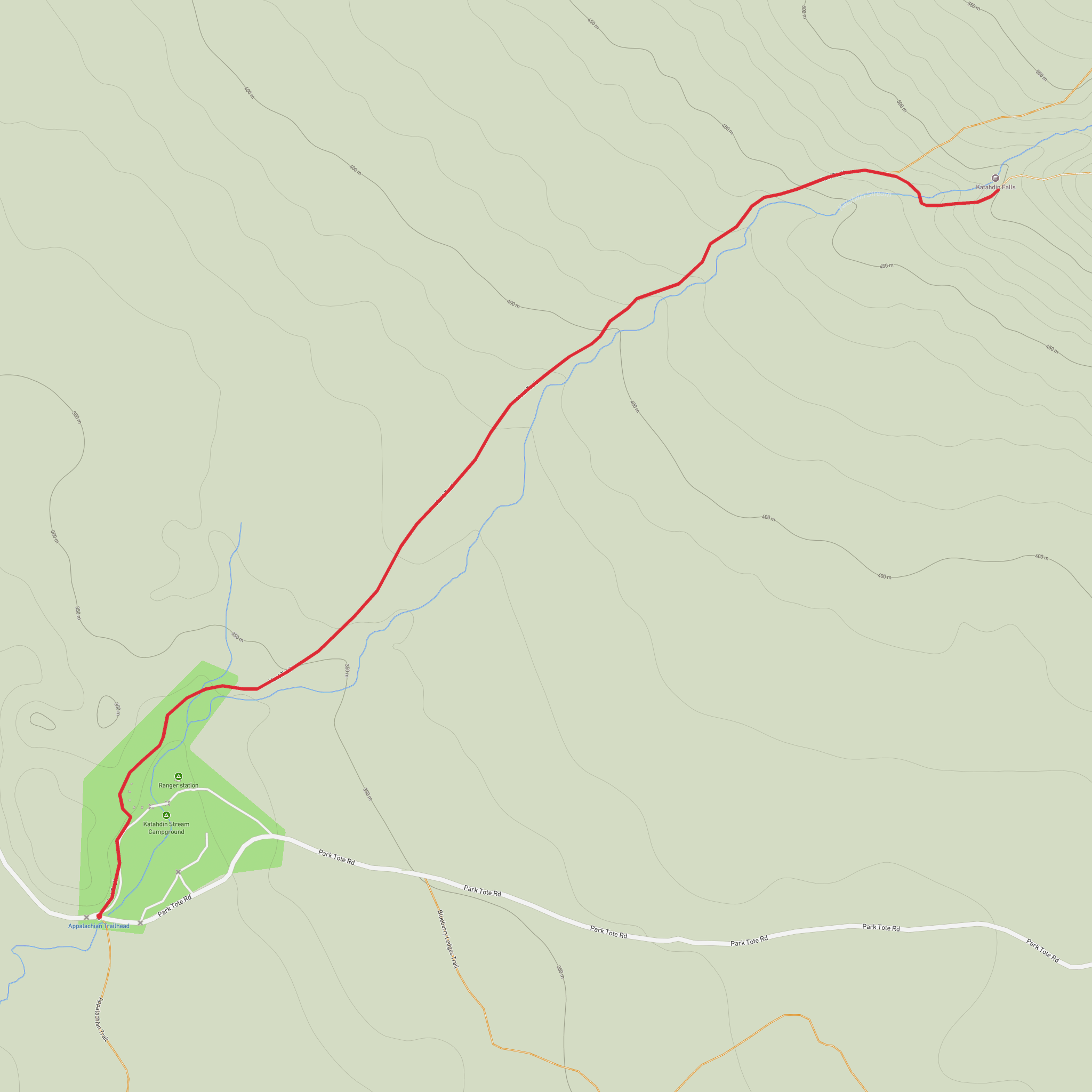
This short out-and-back to Katahdin Falls packs a lot into roughly 4 km / 2.5 miles, climbing about 200 m / 544 ft on the lower section of the Hunt Trail from Katahdin Stream Campground in Baxter State Park near Millinocket, Maine. The route begins at the Katahdin Stream area, the main access point for the Hunt Trail, which is also the Appalachian Trail on its final approach to Mount Katahdin. The nearest significant landmark for the start is Katahdin Stream Campground, about 8 miles / 13 km beyond Togue Pond Gatehouse on the Park Tote Road, and about 26 miles / 42 km from Millinocket. (baxterstatepark.org)
The walking starts gently enough through northern forest, but it is not a flat stroll. Expect a steady uphill grade over roots, rocks, and often damp ground, with the footing becoming rougher as you near the falls. For a hike rated medium, this one feels approachable for many hikers with decent fitness, but the terrain demands attention. After rain, the rocks around the stream and viewpoints can be slick, and spring runoff can make the area especially wet and noisy. The trail is popular, so even on a relatively short outing you may encounter day hikers, Appalachian Trail visitors, and people using this as a warm-up before bigger Katahdin objectives. (alltrails.com)
What the route is like
From Katahdin Stream Campground, the path follows white blazes through mixed forest, gradually gaining elevation beside the stream corridor. The lower section is shaded and enclosed, with the sound of moving water building as you climb. This is one of those hikes where the destination announces itself before it fully appears. The falls are reached in about 2 km / 1.25 miles, and the return follows the same route back. (alltrails.com)
Katahdin Falls is widely described as the tallest waterfall in Maine, and the setting feels dramatic because the stream drops through a steep, rocky channel below the massive slopes of Katahdin. There is a bridge at the foot of the falls and additional viewpoints slightly uphill, giving different angles on the cascade and the gorge-like rock walls around it. Mist, spray, and polished stone are common near the best viewing spots, so shoes with solid grip are important even on a short hike. (alltrails.com)
Although the mileage is modest, this is still a mountain trail in Baxter State Park rather than a groomed path. Hikers should be ready for uneven tread, exposed roots, stone steps, and short steeper pitches. Trekking poles can help on the descent, especially if the trail is wet. If using digital navigation, carry the route in HiiKER and do not rely on cell service, which can be limited in and around the park.
Landmarks, nature, and wildlife
The main landmark is, of course, the falls, but the approach is part of the appeal. The stream itself is a constant companion, and the forest around Katahdin Stream is typical of Baxter’s lower elevations: cool, shaded, and rich with moss, ferns, and conifers mixed with northern hardwoods. In warmer months, the damp ravine environment can feel lush compared with the exposed alpine terrain higher on Katahdin. (baxterstatepark.org)
Wildlife sightings are always possible in Baxter State Park, where protected habitat supports species such as moose and a wide range of birds. The broader park is well known for frequent wildlife viewing, particularly because it is managed with a strong conservation focus. Smaller animals, amphibians, and songbirds are often more likely than large mammals on this particular trail, but early morning and evening can increase your chances of seeing larger wildlife near roadsides and wet areas. Give all animals plenty of space and be especially alert when driving in and out of the park. (maine.gov)
Historical significance
This hike also carries real historical weight. The Hunt Trail is the northern terminus section of the Appalachian Trail, and Baxter Peak on Katahdin marks the end point for northbound thru-hikers coming all the way from Georgia. Even if you are only walking to the falls, you are sharing a famous stretch of one of the best-known long-distance footpaths in the world. Baxter State Park notes that the park contains the northernmost miles of the Appalachian Trail, terminating on Katahdin’s summit.
Comments and Reviews
User comments, reviews and discussions about the Katahdin Falls via Hunt Trail, Maine.
average rating out of 5
0 rating(s)
