Download
Preview
Add to list
More
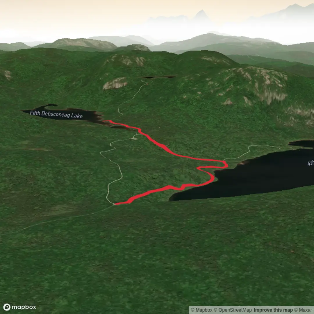
4.8 km
~1 hrs 5 min
76 m
Out and Back
“A gentle forest ramble leads to Debsconeag Falls, where wild water enlivens Maine’s deep green hush.”
This easy outing to Debsconeag Falls is a short, rewarding walk in the Millinocket area of Maine, best suited to hikers looking for a scenic waterfall without a long day on the trail. Expect roughly 5 km / 3.1 miles round trip with about 100 m / 330 ft of elevation gain overall, though the exact total can vary a little depending on where you park and how far you explore around the falls. The route is generally gentle, with the main effort coming from uneven footing, short rocky rises, and the usual roots and wet patches common on forest trails in northern Maine.
The hike sits in the broader Debsconeag and West Branch Penobscot region, northwest of Millinocket and close to the Golden Road corridor near Abol Bridge, a well-known landmark for reaching Baxter State Park and the Debsconeag Lakes Wilderness Area. The Debsconeag Lakes Wilderness Area begins just west of Abol Bridge on the Golden Road, placing the falls in a landscape of large conserved forest, lakes, streams, and old logging roads. (nature.org)
What the walk is like
The approach is typically through dense mixed forest, where the trail or path feels more like a woods route than a built park walkway. Underfoot, expect packed earth, exposed roots, stones, and muddy sections after rain. Because the hike is rated easy, most walkers with basic fitness should find it manageable, but sturdy footwear is still a good idea because slick rock and damp soil can make the final approach to the falls more awkward than the mileage suggests.
As you get closer, the sound of moving water usually becomes the first sign that the main attraction is near. Debsconeag Falls is part of the West Branch Penobscot system, and this stretch of river has long been known for a mix of rapids, falls, and calmer reaches farther downstream. Maine’s public lands material notes that beyond Debsconeag Falls, the river becomes calmer and opens into scenic beach areas such as Omaha Beach. (maine.gov)
At the falls themselves, expect a rugged river setting rather than a manicured overlook. Water levels can change the character of the scene significantly. After rain or during spring runoff, the falls can feel louder, broader, and more forceful; in drier periods, more rock may be exposed. The rocks near the water can be slippery, and the banks may be uneven, so extra care is needed if you move around for different viewing angles.
Landmarks, scenery, and natural features
This part of northern Maine is defined by big forest, glacially shaped terrain, and cold, clean water. The surrounding Debsconeag landscape includes granite boulders, ponds, old-growth stands, and remote lakes, with some nearby trails passing through terrain shaped by Ice Age glacial activity. The wider wilderness area is also noted for mature forest, including sections with little sign of past logging and trees reaching exceptional age in remote pockets. (nature.org)
Wildlife is one of the major draws of the region. The Nature Conservancy notes that the Debsconeag Lakes Wilderness Area supports moose, bobcat, black bear, pine marten, spruce grouse, and boreal chickadees, while bald eagles are commonly seen along the West Branch Penobscot shoreline. The lakes in the area also support trout, Arctic char, and rare freshwater mussels. Even on a short waterfall hike, it is worth scanning open water, listening for birds, and watching muddy edges for tracks. (nature.org)
In warmer months, insects are a real factor. Regional Maine public lands guidance notes that mosquitoes and black flies are thickest from late May through July. In autumn, hikers should also be aware that hunting activity occurs in the broader region, including bear season in September, moose hunting from late September into mid-October, and deer season in November. Wearing bright colors during fall is a sensible precaution. (maine.gov)
Getting to the start
By car, the usual access is from Millinocket. The standard approach into the Debsconeag area is to leave I-95 at the Millinocket–Medway exit, follow Route 157/Route 11 into Millinocket, then continue toward Baxter State Park before turning onto the Golden Road at Ambajejus Lake. From there, Abol Bridge is a key landmark, and Debsconeag-related access points lie west of the bridge along the Golden Road corridor. A Golden Road map published by Chewonki places the Debsconeag Falls turnoff about

Comments and Reviews
User comments, reviews and discussions about the Debsconeag Falls, Maine.
average rating out of 5
0 rating(s)