Download
3D Flyover
Add to list
More
9.4 km
~2 hrs 4 min
113 m
Loop
“A gentle forest loop reveals marshy hush, Katahdin glimpses, and Blueberry Ledges’ shimmering rock-slide charm.”
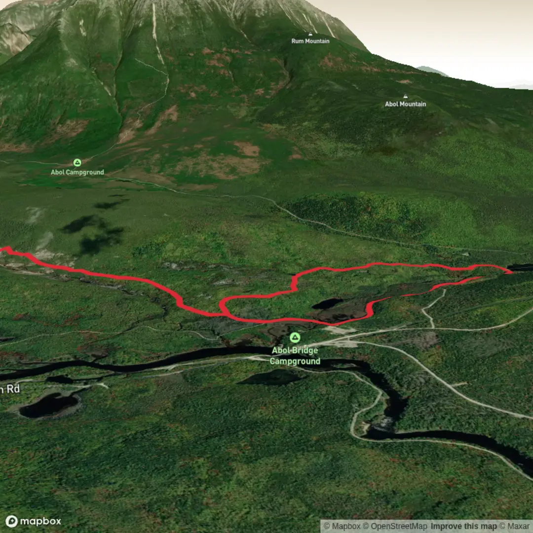
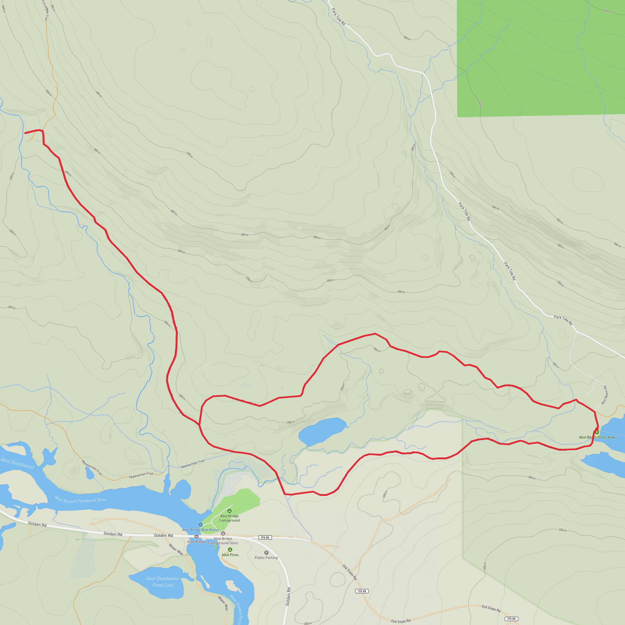
This easy loop of about 9 km / 5.6 miles with roughly 100 m / 330 ft of elevation gain explores the quieter south side of Baxter State Park, linking the Abol Stream Trail and Abol Pond Trail to reach Blueberry Ledges. The route is more about scenery than exertion: broad forest paths, wetland edges, occasional views toward Katahdin, and the distinctive open ledges where water slides across smooth rock. Sources describing this area place the start at the Abol Beach picnic area on Abol Beach Road in Baxter State Park, near Abol Pond and a short drive inside the Togue Pond Gate. (waze.com)
The nearest practical landmark for the hike start is Baxter State Park – Abol Beach, Abol Beach Road, Northeast Piscataquis, Maine, at the Abol Beach picnic area beside Abol Pond. Hikers arriving by car typically enter through the Togue Pond Gate and follow the Park Tote Road to Abol Beach Road. Baxter notes that non-Katahdin trailheads are generally first-come, first-served, while only the major Katahdin trailheads require a Katahdin Trailhead Pass reservation. The park is open for day use from 6:00 a.m. to 10:00 p.m. (baxterstatepark.org)
Public transport is very limited. Millinocket is the nearest service town for most visitors, but there is no routine public transit that drops hikers directly at Abol Beach inside Baxter State Park, so most people will need a private vehicle, taxi, or pre-arranged shuttle from the Millinocket area. Because travel inside the park is slow and distances are longer than they appear on a map, it is wise to allow extra driving time from the gate to the trailhead. (baxterstatepark.org)
What the route is like
From Abol Beach, the trail begins gently through mixed forest on a wide, easy-going tread. Early on, the walking is mostly level, with only small undulations, making this a good choice for hikers who want a relaxed outing rather than a sustained climb. Reports on the Abol Stream Trail describe a broad wooded corridor, marshy openings, and several excellent sightlines toward Katahdin at around 1.1 to 1.8 km / 0.7 to 1.1 miles from the start. (hikinginmaine.blog)
As the route follows the Abol Stream side of the loop, expect a pleasant combination of forest shade and water-adjacent terrain. One short spur leads to a beaver dam roughly 0.4 km / 0.25 miles in, and the main trail continues along an esker-like rise above the stream in places. This section is usually straightforward to follow, but wet roots, muddy patches, and insects can be notable in warm weather or after rain. Using HiiKER before setting out is helpful for confirming the loop shape and junctions. (hikinginmaine.blog)
Blueberry Ledges itself is the standout landmark. Rather than a cliff-edge viewpoint in the usual sense, it is known for a broad expanse of open ledge with water flowing over the rock, creating a ledge-slide or fan-like cascade. The feature is unusual for the region and is the main reason many hikers choose this route. Depending on recent rainfall, the water display can range from a gentle sheet to a more lively rush, so conditions can change noticeably from one visit to the next. (mainebyfoot.com)
Terrain, footing, and things to watch for
Although the hike is rated easy overall, it is not a paved or manicured walk. Expect roots, stones, damp ground, and occasional muddy or slick sections, especially near water and after wet weather. Some descriptions of Blueberry Ledges mention water crossings or wetter footing on parts of the trail network, so waterproof footwear or at least shoes that handle mud well are a sensible choice. Bugs can also be intense in late spring and summer, particularly in the marshy
Comments and Reviews
User comments, reviews and discussions about the Blueberry Ledges via Abol Stream Trail and Abol Pond Trail, Maine.
average rating out of 5
0 rating(s)
