Download
3D Flyover
Add to list
More
9.3 km
~1 hrs 55 min
32 m
Out and Back
“A gentle old logging road leads through deep North Woods to Orin Falls’ boulder-churned sparkle.”
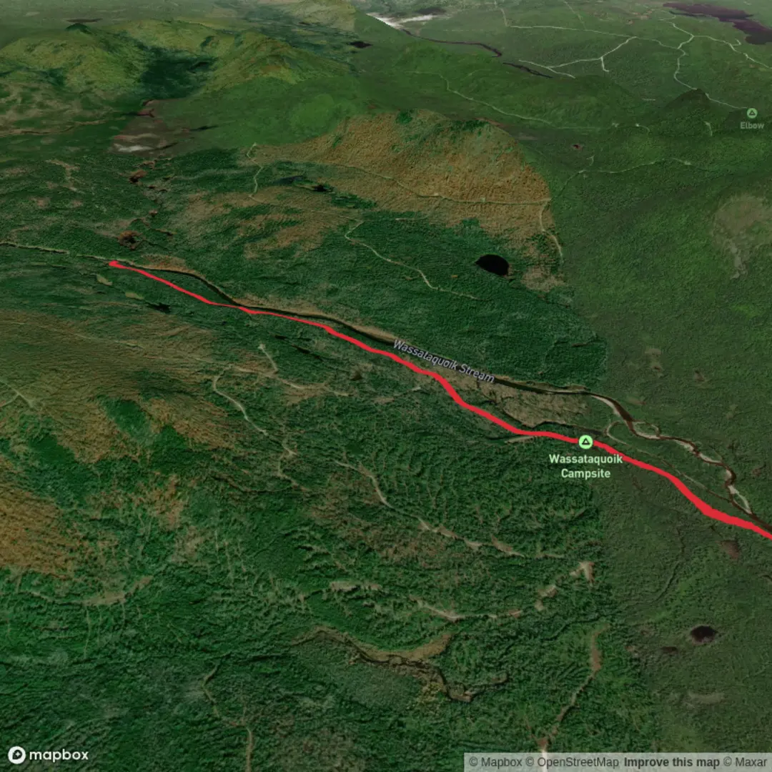
This easy out-and-back follows an old logging road through the south section of Katahdin Woods and Waters National Monument to a broad, boulder-strewn cascade on Wassataquoik Stream. The full walk is about 9.7 km / 6 miles round trip, with only about 26 m / 87 ft of elevation gain, so it suits hikers looking for a gentle day hike with a strong scenic payoff rather than a strenuous climb. The route begins at the Wassataquoik Gate parking area, the recognized trailhead for Orin Falls, near Patten in northern Maine. (home.nps.gov)
The setting is remote and distinctly North Woods: long stretches of gravel and dirt track, dense mixed forest, streamside views, and a final narrower footpath leading to the falls. Because the grade stays mild and most of the route is on a former roadbed, footing is generally straightforward, though hikers should still expect uneven gravel, muddy patches, and some slick wooden surfaces near the end. The trail is commonly rated easy, but the remoteness means it still deserves proper planning, especially since there is no potable water available at the trailhead or along the route. (home.nps.gov)
Getting to the start
The nearest significant access point is Wassataquoik Gate Parking Lot, Katahdin Woods and Waters National Monument, near Patten, Maine. The National Park Service identifies this parking area as the start for Orin Falls, and local trail listings place the hike in the Patten area. For drivers, the practical approach is to head for Patten first and then continue into the monument on monument access roads to the end of Wassataquoik Road at the gate parking area. Parking and a vault toilet are available there. (nps.gov)
Public transport is very limited in this part of northern Maine. There is no regular transit service directly to the trailhead, so most hikers will need a private vehicle or a pre-arranged shuttle from the broader Katahdin region. If arriving without a car, the realistic option is to reach the Katahdin area first and then arrange a local shuttle rather than expect direct service to the monument entrance. (appalachiantrailhostel.com)
What the route is like
From the parking area, the trail heads northwest on a former gravel logging road. Early on, the walking is wide and easy to follow, making this a good route for hikers who prefer simple navigation and steady terrain. At roughly 0.6 km / 0.4 miles, the trail crosses Katahdin Brook on a footbridge and passes the Wassataquoik Campsite and lean-to. This is one of the main landmarks near the start and a useful point for gauging progress. (home.nps.gov)
About 1.6 km / 1 mile from the start, you reach a junction where the shared corridor with the International Appalachian Trail continues onward; staying on the Orin Falls route means continuing northwest rather than turning off toward Barnard Mountain. From there, the trail remains mostly gentle for another 2.4 km / 1.5 miles before a signed right turn onto the narrower final approach to the falls. That last section is shorter, wetter, and more enclosed, with boardwalk-style planks and a small footbridge intended to keep hikers above mud and seepage. These surfaces can be slippery, especially after rain. (home.nps.gov)
At the turnaround point, Orin Falls is less a single vertical plunge than a lively series of rapids and cascades tumbling through large glacial boulders. The falls area is known as a scenic viewpoint and picnic spot, and anglers are also drawn here by access to Wassataquoik Stream. Expect rock, sand, and uneven footing around the viewing area, so extra care is needed if approaching the water’s edge. (nps.gov)
Landmarks, nature, and wildlife
The most memorable natural feature is the falls themselves, where the stream churns through tiered rock and glacially scattered boulders. The geology here reflects the region’s glacial past, and that shows up clearly in the oversized rocks and sculpted stream corridor around the cascade. Along the way, the trail passes through dense forest and small openings that create a varied but consistently wild-feeling landscape. (home.nps.gov)
Wildlife viewing can be rewarding, though sightings are never guaranteed. The monument’s forests and waterways support the kind of fauna hikers typically associate with

Surfaces
Unknown
Unpaved
Comments and Reviews
User comments, reviews and discussions about the Orin Falls Trail, Maine.
average rating out of 5
0 rating(s)