Bickford Slides via Bickford Brook Trail and Bickford Slides Trail
Download
Preview
Add to list
More
3.5 km
~1 hrs 1 min
194 m
Loop
“A gentle forest approach gives way to gleaming cascades and slick ledges at beautiful Bickford Slides.”
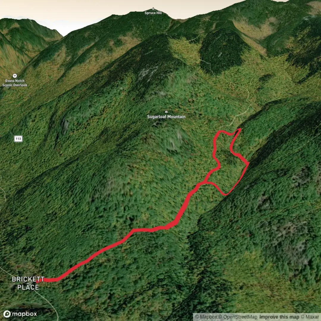
This short outing to Bickford Slides packs a lot into roughly 4 km / 2.5 miles, with about 200 m / 650 ft of elevation gain if you keep the trip focused on the slides rather than continuing higher on the longer mountain routes. It starts from Brickett Place in Evans Notch, a historic 1830 brick farmhouse on the east side of Maine Route 113 in Stow, Maine, just east of the New Hampshire border. The Bickford Brook Trail leaves directly from the parking area, which also has toilets, and the site sits within the White Mountain National Forest near the Caribou-Speckled Mountain Wilderness. Route 113 through this section is typically closed in winter, and a White Mountain National Forest recreation pass or day-use fee is generally required at Brickett Place. (fs.usda.gov)
For drivers, the simplest approach is to navigate to Brickett Place Interpretive Site on Maine State Route 113, Stow, Maine. If you are coming from Gilead on US 2, the trailhead is about 10 miles / 16 km south on Route 113; from Fryeburg on US 302, it is about 19 miles / 31 km north on Route 113. Public transport is very limited in Evans Notch, and there is no practical regular service to the trailhead itself, so most hikers should plan on arriving by car or arranging a private drop-off from the Fryeburg, Bethel, or North Conway area. (mainetrailfinder.com)
The opening section is gentle and easy to follow, making for a friendly start before the terrain becomes rougher near the brook. For the first 0.25 mile / 0.4 km, the trail passes old stone walls left from the Brickett family farm, a reminder that this quiet forest was once cleared and worked agricultural land. The farmhouse itself is one of the oldest surviving structures associated with the Forest Service in the region, and the surrounding land became part of the White Mountain National Forest in 1918, during the early era of federal land protection that followed the Weeks Act. (maine.gov)
What the hike feels like
Early on, the route moves through northern hardwood forest with paper birch, American beech, yellow birch, and sugar maple, then gradually trends upward on what was once an old jeep road used for fire tower access farther up the mountain. Even on a short out-and-back to the slides, that old roadbed often makes the walking feel steadier than many steeper White Mountain footpaths, though roots, wet patches, and uneven footing still show up. Around the first junctions, pay attention to signs and keep track of your route with HiiKER, especially if you are visiting in shoulder season when leaves, mud, or washouts can make side paths less obvious. (maine.gov)
The real character of the hike changes as you near Bickford Brook. The brook cuts through a ravine and forms a series of cascades, flumes, and slides, including the better-known lower and upper slide sections. The slides themselves are the highlight: broad, sloping rock with fast-moving water, polished surfaces, and attractive pools. The lower tier is about 50 ft / 15 m high and the upper tier about 40 ft / 12 m high. Expect the final approach to feel more rugged than the mileage suggests, with short steep bits, slick rock, and the kind of footing that demands care even in dry weather. (mainetrailfinder.com)
Landmarks, terrain, and hazards
The most significant landmark is Brickett Place at the start, followed by the old stone walls and then the brook corridor itself. Once you reach the slides, the terrain becomes the main challenge. Smooth ledge beside moving water can be extremely slippery, and after rain the hazard level rises quickly. This is not

Comments and Reviews
User comments, reviews and discussions about the Bickford Slides via Bickford Brook Trail and Bickford Slides Trail, Maine.
average rating out of 5
0 rating(s)