Download
3D Flyover
Add to list
More
7.1 km
~1 hrs 29 min
46 m
Loop
“A gentle forest loop reveals mossy ledges, birdsong, and two lovely waterfalls with only brief steeper footing.”
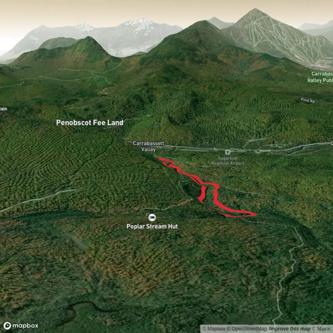
This easy loop to Poplar Stream Falls and South Brook Falls is one of the more approachable waterfall walks in the Carrabassett Valley area, following a gentle circuit on the Maine Huts & Trails network near Sugarloaf. Expect roughly 7 km / 4.3 miles overall, with very modest climbing—about 90 m / 300 ft at most depending on the exact line you take—spread across rolling forest trail rather than any sustained ascent. The route begins from the Airport Trailhead at 1240 Carrabassett Drive, Carrabassett Valley, Maine, beside the western end of the Carrabassett Valley airport runway and behind the Sugar Bowl bowling alley. (mainehuts.org)
From the parking area, the trail heads diagonally across open ground before entering woods on the Maine Hut Trail. Early on, the walking is straightforward and mostly level, with a broad, well-used tread that makes this a good choice for families, casual hikers, and anyone looking for a scenic half-day outing rather than a summit effort. After about 2.1 km / 1.3 miles, the route reaches Carriage Road and the junction area for the waterfall loop. (mainetrailfinder.com)
What the route is like
A common and very logical way to hike this loop is to go out on Warren’s Trail and return on Larry’s Trail. Warren’s Trail runs along the west side of Poplar Stream through older forest and is known for its quiet, winding character and good wildlife-watching potential. It is a narrower, more backcountry-feeling path than the approach trail, but still manageable for most hikers in dry conditions. (mainehuts.org)
If you take Warren’s Trail first, you’ll usually reach Poplar Stream Falls at around 3.2 km / 2 miles from the trailhead. This lower waterfall drops about 7 m / 24 ft through a narrow, V-shaped rock channel, and short side paths lead down to viewpoints. Not long after, at roughly 3.6 km / 2.25 miles, you come to South Brook Falls, the taller of the two main cascades at about 15.5 m / 51 ft. Access here involves a notably steep stone staircase, which is one of the few places on the hike where footing deserves extra attention. (mainebyfoot.com)
Larry’s Trail forms the return leg on the east side of the stream. It passes through mixed forest, crosses a native cedar bridge over the South Branch of Poplar Stream, and offers another close look at the water. The terrain remains mostly easy, though there are a few short rises and dips that keep the walk from feeling completely flat. Stone steps reconnect the trail with the upper junctions near the falls area. (mainehuts.org)
Landmarks, scenery, and wildlife
The main draw is, of course, the pair of waterfalls, but the setting adds a lot to the experience. The trail travels through a cool northern forest landscape with streamside ledges, mossy ground, and sections of older tree growth. In warmer months, hikers may notice wildflowers along the route, including lady’s slippers in season, and the stream pools can be strikingly clear. (mainehuts.org)
Birdlife is often part of the experience here, and the Maine Huts & Trails materials specifically note bird watching and wildlife viewing as highlights on Warren’s Trail. As with much of western Maine, larger wildlife such as deer, moose, foxes, and black bears are possible in the broader area, though most hikers are more likely to notice tracks, birdsong, and movement in the understory than large animals themselves. (mainehuts.org)
The waterfalls also create natural rest spots. South Brook Falls is especially known for its pool, and some hikers use it as a place to cool off in warm weather. Even so, rocks near both falls can be slick, especially after rain, during spring runoff, or when leaf litter covers roots and stone. (mainehuts.org

Surfaces
Unknown
Unpaved
Comments and Reviews
User comments, reviews and discussions about the Poplar Stream Falls via Larry's Trail and Warren's Trail, Maine.
average rating out of 5
0 rating(s)