
Download
3D Flyover
Add to list
More
5.7 km
~1 hrs 38 min
299 m
Loop
“Embark on a rewarding 6 km hike through Muir Valley and Middle Fork Lower Devil Creek's stunning landscapes.”
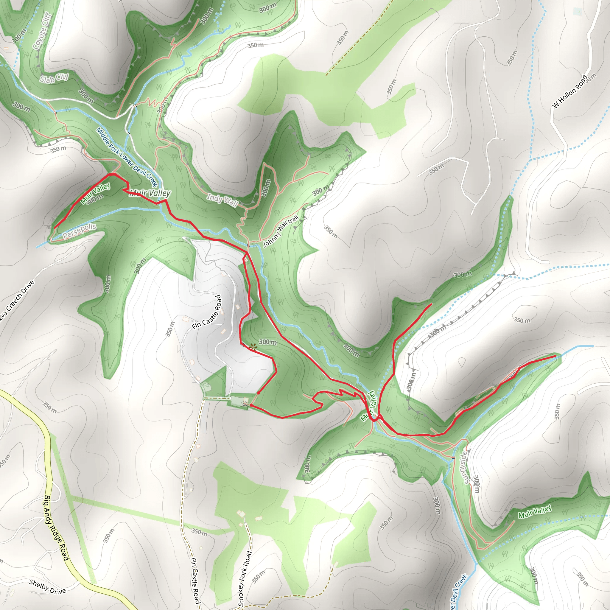
Starting your adventure near Wolfe County, Kentucky, the Muir Valley and Middle Fork Lower Devil Creek Walk is a captivating loop trail that spans approximately 6 km (3.7 miles) with an elevation gain of around 200 meters (656 feet). This medium-difficulty trail offers a blend of natural beauty, historical significance, and diverse wildlife, making it a rewarding experience for hikers.
Getting There
To reach the trailhead, you can drive or use public transport. If you're driving, head towards the vicinity of Wolfe County, Kentucky. The nearest significant landmark is the Natural Bridge State Resort Park, which is well-signposted and easy to find. From there, follow local roads to the trailhead. For those using public transport, the closest major city is Lexington, Kentucky. From Lexington, you can take a bus or shuttle service to the Natural Bridge State Resort Park and then arrange for a local taxi or rideshare to the trailhead.
Trail Navigation
For navigation, it's highly recommended to use the HiiKER app, which provides detailed maps and real-time updates to ensure you stay on track throughout your hike.
Trail Highlights
Muir Valley
As you begin your hike, you'll enter Muir Valley, a privately-owned nature preserve known for its stunning rock formations and lush forests. The valley is a haven for rock climbers, so don't be surprised to see climbers scaling the cliffs. The trail here is well-marked and winds through dense woodland, offering plenty of shade and a cool, refreshing atmosphere.
Middle Fork Lower Devil Creek
Continuing on, you'll reach the Middle Fork Lower Devil Creek section. This part of the trail is particularly scenic, with the creek meandering alongside the path. The sound of flowing water adds a serene backdrop to your hike. Keep an eye out for various species of birds and small mammals that inhabit the area. The trail crosses the creek at several points, so be prepared for some minor water crossings.
Flora and Fauna
The trail is rich in biodiversity. You'll encounter a variety of plant species, including oak, maple, and pine trees. In spring and summer, wildflowers such as trillium and columbine add splashes of color to the landscape. Wildlife is abundant, with white-tailed deer, raccoons, and even the occasional black bear making appearances. Birdwatchers will enjoy spotting species like the red-tailed hawk, eastern bluebird, and pileated woodpecker.
Historical Significance
The region around Wolfe County has a rich history, with Native American tribes such as the Shawnee and Cherokee having once inhabited the area. The trail itself passes through land that was historically used for hunting and gathering. In the 19th century, European settlers arrived, and remnants of old homesteads and farming equipment can still be found along the trail, offering a glimpse into the past.
Practical Tips
- Footwear: Sturdy hiking boots are recommended due to the uneven terrain and potential water crossings.
- Water: Carry enough water, especially during the warmer months, as there are limited places to refill along the trail.
- Weather: Check the weather forecast before you go. The trail can become slippery and challenging in wet conditions.
- Wildlife: Be aware of your surroundings and keep a safe distance from any wildlife you encounter. Carrying bear spray is advisable in this region.
By following these guidelines and using the HiiKER app for navigation, you'll be well-prepared to enjoy the Muir Valley and Middle Fork Lower Devil Creek Walk.
What to expect?
Activity types
Comments and Reviews
User comments, reviews and discussions about the Muir Valley and Middle Fork Lower Devil Creek Walk, Kentucky.
4.52
average rating out of 5
69 rating(s)
