Download
3D Flyover
Add to list
More
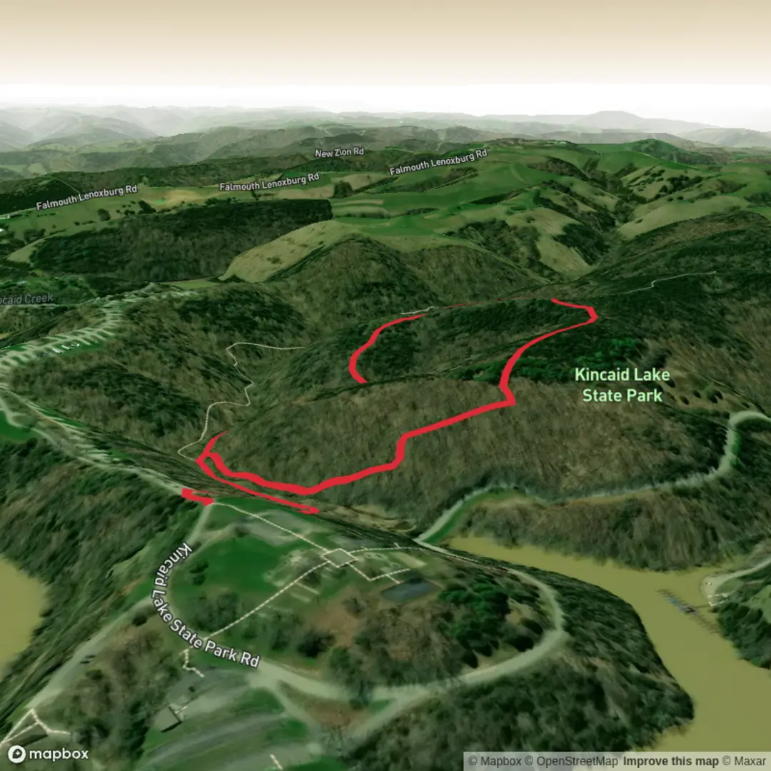
2.3 km
~34 min
72 m
Loop
“Share the trailhead details, and I’ll paint a vivid, grounded hike guide with local texture.”
I’m missing a few key pieces of information needed to write an accurate, location-specific hike description (and to convert the start point to a nearby address/landmark).
Please send one of the following so I can proceed: 1) The GPS coordinates (lat, lon) for the trailhead (or a HiiKER link), or 2) The park/region + nearest town/state/country (e.g., “Spicebush Loop in Patapsco Valley State Park, MD”).
Also, if you know them, please fill in: - Hike head (near): (it’s currently blank) - Hike type: loop / out-and-back / point-to-point (you can just say “loop” if that’s correct)
Once I have the location, I’ll include: - Turn-by-turn style expectations with approx. distances in km + miles and elevation in m + ft (2 km / 1.2 mi; 100 m / 328 ft total gain) - What to watch for on a “Medium” 2 km loop (surface, steep bits, mud/roots, seasonal hazards) - Notable landmarks, flora/fauna (including spicebush ecology where relevant), and any local historical context - How to reach the trailhead by car and public transport - The nearest known address or significant landmark to the provided coordinates - Navigation notes referencing HiiKER only

Surfaces
Unpaved
Asphalt
Unknown
Comments and Reviews
User comments, reviews and discussions about the Spicebush Loop Trail, Kentucky.
average rating out of 5
0 rating(s)