
Download
3D Flyover
Add to list
More
926.6 km
45 days
10108 m
Multi Day
“From St Peter’s to land’s end, this sun-washed pilgrimage threads ruins, vineyards, and enduring southern horizons.”
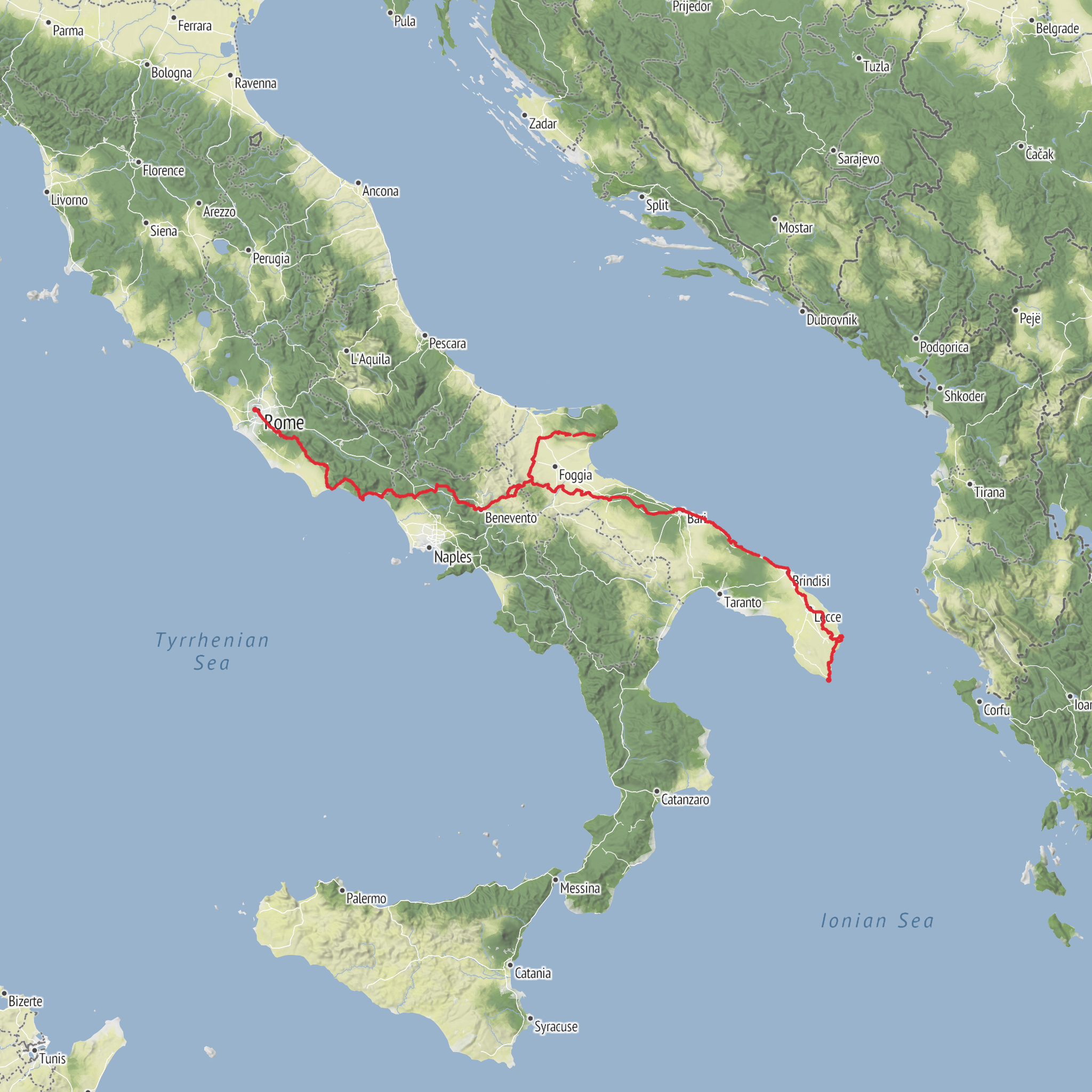
This long southbound pilgrimage continues beyond Rome toward the heel of Italy, linking the Vatican with the far-southern sanctuary at Santa Maria di Leuca. The full route is about 926 km / 575 miles with roughly 10,300 m / 33,800 ft of ascent, and despite the modest overall difficulty rating, it is best understood as an endurance walk: gradients are often manageable, but the cumulative distance, repeated road walking, summer heat, and long exposed sections can make it more demanding than “easy” suggests. The southern continuation of the Via Francigena is widely described as running from St. Peter’s Basilica in Rome to Santa Maria di Leuca, traditionally the Basilica-Santuario di Santa Maria de Finibus Terrae in Piazza Giovanni XXIII, 73040 Santa Maria di Leuca, in the municipality of Castrignano del Capo. (visitlazio.com)
The start is best understood as the area around St. Peter’s Basilica, Vatican City/Rome, rather than an isolated trailhead. From central Rome, public transport is straightforward, with metro, regional rail, and city buses serving the Vatican area; by car, access is easy in theory but parking and traffic restrictions in Rome make it far less convenient than arriving on foot or by transit. At the far end, Santa Maria di Leuca is reached by road from Lecce and the Salento peninsula; hikers finishing there typically connect onward by bus or regional transport via Lecce, while drivers can retrieve vehicles through a shuttle or staged transfer plan. Rome-to-Leuca transport links are well established, but the finish is much more remote than the start, so end-of-walk logistics deserve advance planning. (rome2rio.com)
Early on, the route leaves the monumental heart of Rome and heads onto one of the most historically resonant walking corridors in Europe. South of the city it follows long stretches associated with the Via Appia Antica, then crosses the Castelli Romani and continues through southern Lazio toward the Campania border near Sessa Aurunca. This opening section is rich in Roman archaeology, old paving, aqueduct landscapes, volcanic hills, vineyards, olive groves, and towns layered with medieval and ecclesiastical history. It is a route where the cultural density is often as memorable as the walking itself. (visitlazio.com)
Terrain, pacing, and what the walking feels like
Most hikers should expect a mix of farm tracks, secondary roads, old paved lanes, urban approaches, and occasional rougher rural stretches rather than a single continuous mountain trail. The route crosses Lazio, Campania, Basilicata, and Puglia, and the character changes repeatedly: volcanic and archaeological landscapes near Rome, agricultural plains and low hills in Campania, more rugged inland sections through parts of the southern Apennine zone, then broad open country and olive-covered terrain as the route trends toward Apulia and the Salento. (terre.it)
Daily stages vary, but many walkers plan around 20 to 30 km / 12 to 19 miles per day. On paper, the elevation gain is moderate for such a long route, yet the challenge comes from repetition: many days include rolling ascents rather than one dramatic climb, and several sections are exposed to sun and wind with limited shade. Spring and autumn are usually the most forgiving seasons. In summer, heat management becomes one of the main hazards, especially in southern inland sections and across open agricultural country. Water planning matters every day, and lightweight sun protection is as important as rain gear. Because the route includes paved and hard-packed surfaces for long periods, footwear that handles road impact well is often more useful than aggressive mountain-trail shoes. These route characteristics are consistent with the official and regional descriptions of the southern Francigena as a long interregional walking route rather than a wilderness path. (visitlazio.com)
Navigation is usually more about consistency than technical difficulty. Waymarking exists, but it can vary by region and municipality, especially where the route passes through towns, road junctions, or agricultural land. Hikers should prepare stage-by-stage and keep the route loaded in HiiKER before setting out each morning.
Historical landscape and major landmarks
Historically, this is one of Europe’s great pilgrimage continuations. The Via Francigena connected northwestern Europe with Rome, and the southern extension carried pilgrims onward toward the ports of Apulia, where they could continue toward the Holy Land. The route’s importance is tied not only to medieval devotion but also to older Roman infrastructure
AI Planner
Days planned around your pace, with somewhere to stay each night.
Surfaces
Unknown
Asphalt
Dirt
Unpaved
Gravel
Ground
Cobblestone
Sand
Paved
Grass
Concrete
Wood
Comments and Reviews
User comments, reviews and discussions about the Via Francigena Sud, Italy.
average rating out of 5
0 rating(s)



